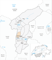
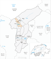
Category:Maps of municipalities in the district of Westlich Raron to 2008
Jump to navigation
Jump to search
Media in category "Maps of municipalities in the district of Westlich Raron to 2008"
The following 12 files are in this category, out of 12 total.
-
 Karte Gemeinde Ausserberg 2007.png 1,181 × 1,363; 334 KB
-
 Karte Gemeinde Blatten 2007.png 1,181 × 1,363; 334 KB
-
 Karte Gemeinde Bürchen 2007.png 1,181 × 1,363; 334 KB
-
 Karte Gemeinde Eischoll 2007.png 1,181 × 1,363; 334 KB
-
 Karte Gemeinde Ferden 2007.png 1,181 × 1,363; 334 KB
-
 Karte Gemeinde Hohtenn 2007.png 1,181 × 1,363; 334 KB
-
 Karte Gemeinde Kippel 2007.png 1,181 × 1,363; 334 KB
-
 Karte Gemeinde Niedergesteln 2007.png 1,181 × 1,363; 335 KB
-
 Karte Gemeinde Raron 2007.png 1,181 × 1,363; 335 KB
-
 Karte Gemeinde Steg 2007.png 1,181 × 1,363; 334 KB
-
 Karte Gemeinde Unterbäch 2007.png 1,181 × 1,363; 334 KB
-
 Karte Gemeinde Wiler Lötschen 2007.png 1,181 × 1,363; 334 KB


