Category:Maps of municipalities in the district of Winterthur
Jump to navigation
Jump to search
Subcategories
This category has the following 7 subcategories, out of 7 total.
Media in category "Maps of municipalities in the district of Winterthur"
The following 20 files are in this category, out of 20 total.
-
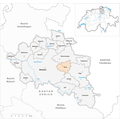
 Karte Gemeinden des Bezirks Winterthur 2018.png 1,476 × 1,468; 429 KB
-
 Karte Gemeinde Altikon 2018.png 1,476 × 1,468; 429 KB
-
 Karte Gemeinde Brütten 2018.png 1,476 × 1,468; 429 KB
-
 Karte Gemeinde Dinhard 2018.png 1,476 × 1,468; 429 KB
-
 Karte Gemeinde Dägerlen 2018.png 1,476 × 1,468; 429 KB
-
 Karte Gemeinde Dättlikon 2018.png 1,476 × 1,468; 429 KB
-
 Karte Gemeinde Elgg 2018.png 1,476 × 1,468; 429 KB
-
 Karte Gemeinde Ellikon an der Thur 2018.png 1,476 × 1,468; 429 KB
-
 Karte Gemeinde Elsau 2018.png 1,476 × 1,468; 429 KB
-
 Karte Gemeinde Hagenbuch 2018.png 1,476 × 1,468; 429 KB
-
 Karte Gemeinde Hettlingen 2018.png 1,476 × 1,468; 429 KB
-
 Karte Gemeinde Neftenbach 2018.png 1,476 × 1,468; 429 KB
-
 Karte Gemeinde Pfungen 2018.png 1,476 × 1,468; 429 KB
-
 Karte Gemeinde Rickenbach ZH 2018.png 1,476 × 1,468; 429 KB
-
 Karte Gemeinde Schlatt ZH 2018.png 1,476 × 1,468; 429 KB
-
 Karte Gemeinde Seuzach 2018.png 1,476 × 1,468; 429 KB
-
 Karte Gemeinde Turbenthal 2018.png 1,476 × 1,468; 429 KB
-
 Karte Gemeinde Wiesendangen 2018.png 1,476 × 1,468; 430 KB
-
 Karte Gemeinde Winterthur 2018.png 1,476 × 1,468; 431 KB
-
 Karte Gemeinde Zell ZH 2018.png 1,476 × 1,468; 429 KB


