Category:Maps of municipalities of the canton of Graubünden
Jump to navigation
Jump to search
Cantons of Switzerland: Aargau (AG) · Appenzell Ausserrhoden (AR) · Appenzell Innerrhoden (AI) · Basel-Stadt (BS) · Basel-Landschaft (BL) · Bern (BE) · Fribourg (FR) · Geneva (GE) · Glarus (GL) · Jura (JU) · Luzern (LU) · Neuchâtel (NE) · Nidwalden (NW) · Obwalden (OW) · Schaffhausen (SH) · Schwyz (SZ) · Solothurn (SO) · Thurgau (TG) · Ticino (TI) · Uri (UR) · Valais (VS) · Vaud (VD) · Zug (ZG) · Zürich (ZH)
Subcategories
This category has the following 27 subcategories, out of 27 total.
2
A
B
I
L
M
P
S
V
Media in category "Maps of municipalities of the canton of Graubünden"
The following 22 files are in this category, out of 22 total.
-
 Karte Region Albula 2018 blank.png 2,066 × 1,454; 429 KB
-
 Karte Region Albula 2018.png 2,066 × 1,454; 531 KB
-
 Karte Region Bernina 2016 blank.png 2,066 × 1,455; 411 KB
-
 Karte Region Bernina 2016.png 2,066 × 1,455; 512 KB
-
 Karte Region Engiadina Bassa Val Müstair 2016 blank.png 2,066 × 1,410; 491 KB
-
 Karte Region Engiadina Bassa Val Müstair 2016.png 2,066 × 1,410; 627 KB
-
 Karte Region Imboden 2016 blank.png 2,066 × 1,223; 408 KB
-
 Karte Region Imboden 2016.png 2,066 × 1,223; 531 KB
-
 Karte Region Landquart 2016 blank.png 2,066 × 1,583; 493 KB
-
 Karte Region Landquart 2016.png 2,066 × 1,583; 652 KB
-
 Karte Region Maloja 2018 blank.png 2,066 × 1,345; 425 KB
-
 Karte Region Maloja 2020.png 2,066 × 1,345; 571 KB
-
 Karte Region Moesa 2018 blank.png 2,066 × 1,615; 426 KB
-
 Karte Region Moesa 2018.png 2,066 × 1,615; 549 KB
-
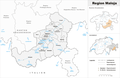
 Karte Region Plessur 2021 blank.png 2,066 × 1,268; 334 KB
-
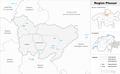 Karte Region Plessur 2021.png 2,066 × 1,268; 428 KB
-
 Karte Region Prättigau-Davos 2016 blank.png 2,066 × 1,424; 537 KB
-
 Karte Region Prättigau-Davos 2021.png 1,476 × 1,017; 350 KB
-
 Karte Region Surselva 2018 blank.png 2,066 × 1,308; 452 KB
-
 Karte Region Surselva 2018.png 2,066 × 1,308; 580 KB
-
 Karte Region Viamala 2021 blank.png 2,066 × 1,427; 467 KB
-
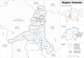 Karte Region Viamala 2021.png 2,066 × 1,427; 597 KB


