Category:Maps of rivers of Hungary
Jump to navigation
Jump to search
Subcategories
This category has the following 5 subcategories, out of 5 total.
Media in category "Maps of rivers of Hungary"
The following 7 files are in this category, out of 7 total.
-
 Karte Leitha-Cisleithanien-Transleithanien.svg 1,182 × 962; 106 KB
-
 Leitha OSM.png 880 × 458; 367 KB
-
 Mining area around Schemnitz in Danubius Pannonico-Mysicus 1726 by Marsigli.jpg 1,032 × 759; 150 KB
-
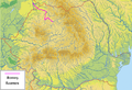 Raul Somes.png 800 × 547; 766 KB
-
 Szentgotthárdi csata (csapatok felállása).PNG 846 × 483; 475 KB
-
 Brook Tapolca.png 290 × 335; 22 KB
-
 Thiz river.jpg 593 × 399; 102 KB


.PNG)

