Category:Maps of states of Sudan (1956-2011)
Jump to navigation
Jump to search
Subcategories
This category has only the following subcategory.
M
Media in category "Maps of states of Sudan (1956-2011)"
The following 13 files are in this category, out of 13 total.
-
 Southern Sudanese independence referendum, 2011.jpg 637 × 825; 83 KB
-
 Sudan political map 1994.jpg 501 × 600; 324 KB
-
 Sudan political map 2000.jpg 487 × 599; 342 KB
-
 Sudan politisch 1956.png 539 × 652; 219 KB
-
 Sudan politisch 1974.png 539 × 652; 236 KB
-
 Sudan politisch 1976.png 539 × 652; 247 KB
-
 Sudan states numbered.svg 1,654 × 1,956; 80 KB
-
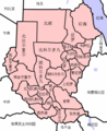 Sudan states zh.png 491 × 600; 132 KB
-
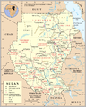
 Sudan-adm-ru 1.png 1,171 × 1,355; 446 KB
-
 Sudan-adm-ru.png 1,657 × 1,969; 80 KB
-
 Sudan-karte-politisch.png 539 × 652; 260 KB
-
 Sudansur.png 491 × 600; 122 KB
-
 Un-sudan.png 2,646 × 3,321; 1.97 MB


