Category:Maps of the 2004 European Parliament election
Jump to navigation
Jump to search
Subcategories
This category has only the following subcategory.
Media in category "Maps of the 2004 European Parliament election"
The following 12 files are in this category, out of 12 total.
-
-
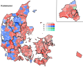 Europa-Parlamentsvalg 2004 - Kommuner.svg 510 × 412; 6.62 MB
-
 Europa-Parlamentsvalg 2004 - Opstillingskredse.svg 510 × 412; 2.89 MB
-
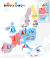
 European Parliament election, 2004.png 1,270 × 1,345; 99 KB
-
 Europeias 2004.png 1,162 × 1,477; 86 KB
-
 FrEuro04.png 582 × 552; 36 KB
-
 Irish EU Parliament election 2004.png 763 × 980; 51 KB
-
 PE 2004 Barry Kent.png 902 × 865; 103 KB
-
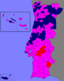
 PO PE 2004.png 902 × 849; 96 KB
-
 SpainProvinceMapEuropean2004.png 1,705 × 1,185; 37 KB
-
 SpainProvinceMapEuropeanA2004.png 1,705 × 1,185; 36 KB
-
 SpainRegionMapEuropean2004.png 1,705 × 1,185; 29 KB


