Category:Maps of the Alaouite Sultanate
Jump to navigation
Jump to search
Media in category "Maps of the Alaouite Sultanate"
The following 9 files are in this category, out of 9 total.
-
 Alaouites apogée 1700.jpg 870 × 863; 127 KB
-
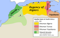 Alawids and Ottoman regencies in 17th-19th centuries.png 2,996 × 1,910; 1,022 KB
-
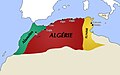
 Dynastie Alaouite en 1824.png 376 × 375; 61 KB
-
 Dynastie Alaouite.jpg 1,680 × 1,055; 147 KB
-
 Empire alaouite - XVIIIe s-es.svg 385 × 408; 870 KB
-
 Empire alaouite - XVIIIe s-pt.svg 353 × 396; 870 KB
-
 Empire alaouite - XVIIIe s.PNG 604 × 643; 18 KB
-
 Empire Alaouite XVIIIe siècle.jpg 1,498 × 955; 170 KB
-
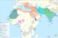 Map of the MENA region in 1798.svg 1,543 × 1,006; 528 KB


