Category:Maps of the Borough of Wyre
Jump to navigation
Jump to search
Media in category "Maps of the Borough of Wyre"
The following 14 files are in this category, out of 14 total.
-
 Borough of Wyre parishes map.svg 1,425 × 981; 2.98 MB
-
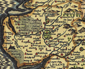
 Garstang & Catterall, West Kirby Nantybwch, Rhymney, Rhymney Bridge RJD 110.jpg 2,697 × 1,697; 588 KB
-
 Hundred of Amounderness.png 588 × 478; 702 KB
-
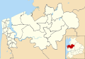
 LancashireWyre.png 200 × 250; 19 KB
-
 Location map United Kingdom Borough of Wyre.svg 1,425 × 981; 4.23 MB
-
 Location map United Kingdom Fleetwood.svg 1,266 × 1,686; 3.62 MB
-
 Parlick Grid.gif 1,000 × 1,000; 87 KB
-
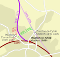 Railways in Poulton-le-Fylde.svg 744 × 700; 26 KB
-
 Thornton Cleveleys and Poulton unparished area UK locator map.svg 1,425 × 981; 557 KB
-
 Wyre UK local election 2007 map.svg 1,425 × 981; 525 KB
-
 Wyre UK local election 2011 map.svg 1,425 × 981; 525 KB
-
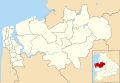
 Wyre UK locator map.svg 1,116 × 1,305; 1.25 MB
-
 Wyre UK ward map 2010 (blank).svg 1,425 × 981; 524 KB
-
 Wyre UK ward map 2015 (blank).svg 1,425 × 981; 559 KB


.svg)
.svg)