Category:Maps of the Boston and Worcester Street Railway
Jump to navigation
Jump to search
Media in category "Maps of the Boston and Worcester Street Railway"
The following 8 files are in this category, out of 8 total.
-
 1904 Boston and Worcester Street Railway bird's eye view map.jpg 18,385 × 4,894; 36.46 MB
-
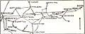 1908 map of streetcar lines between Boston and Worcester.jpg 901 × 364; 101 KB
-
 1908 map of the Boston and Worcester Street Railway and connections.jpg 1,943 × 1,709; 844 KB
-
 1908 map of the Boston and Worcester Street Railway.jpg 1,378 × 867; 246 KB
-
 1912 Boston and Worcester Street Railway track map - left.png 3,866 × 2,500; 9.84 MB
-
 1912 Boston and Worcester Street Railway track map - right.png 3,852 × 2,500; 12.9 MB
-
 Boston and Worcester.png 3,085 × 848; 101 KB
-
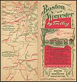 Cover of Boston and Worcester Street Railway brochure.jpg 4,639 × 4,944; 6.95 MB


