Category:Maps of the Chagos Archipelago
Jump to navigation
Jump to search
Media in category "Maps of the Chagos Archipelago"
The following 25 files are in this category, out of 25 total.
-
 Admiralty Chart No 2899 Chagos Archipelago to Madagascar, Published 1963, Large Corrections 1965.jpg 16,238 × 11,073; 34.8 MB
-
 Admiralty Chart No 2900 Ceylon to Madagascar, Published 1963, Large Corrections 1965.jpg 16,303 × 11,096; 38.58 MB
-
 Admiralty Chart No 3 Chagos Archipelago, Published 1839.jpg 11,300 × 16,314; 22.15 MB
-
 Admiralty Chart No 4 Principal groups of the Chagos Archipelago, Published 1839.jpg 12,148 × 8,698; 22.34 MB
-
 Atoll research bulletin (1971) (20336900672).jpg 2,992 × 2,014; 2.17 MB
-
 B.I.O.T location map.svg 1,581 × 1,768; 57 KB
-
 Benares Shoals Sat.png 996 × 557; 1.59 MB
-
 Biot-map.PNG 328 × 353; 7 KB
-
 British indian ocean map.png 325 × 351; 5 KB
-
 Chagos large.png 1,311 × 1,947; 1.28 MB
-
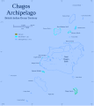 Chagos map 2.svg 1,581 × 1,768; 144 KB
-
 Chagos map.PNG 1,581 × 1,768; 111 KB
-
 Chagos map.svg 1,581 × 1,768; 145 KB
-
 Chagos map2y.PNG 1,581 × 1,768; 107 KB
-
 Deliniantur in hac tabula - Henricus F.ab Langren Sculpsit.png 858 × 507; 592 KB
-
 Diego Garica from entrance to East Point.jpg 837 × 1,046; 268 KB
-
 Isles de Peros Banhos... - btv1b531431597.jpg 2,938 × 4,546; 1.02 MB
-
 PIan des isles de Chagos... - btv1b531428744.jpg 2,470 × 1,878; 326 KB
-
 PIan des isles de Chagos... - btv1b53143160m.jpg 2,480 × 3,840; 626 KB
-
 PIan des isles de Peros Banhos - btv1b53143162h.jpg 1,094 × 6,138; 453 KB
-

-

-
 Plan of the Harbour at the Island Chagos or Diego Garcia.jpg 837 × 1,164; 229 KB
-
 Salomon Islands (1907).jpg 837 × 612; 206 KB
-
 Карта на Чагос.svg 1,581 × 1,768; 457 KB


_(20336900672).jpg)


.jpg)
te_par_la_tartane_l%27%C3%89lizabeth_-_Capitaine_Lazare_Picault_-_btv1b53142661m.jpg)

.jpg)
