Category:Maps of the General Government
Jump to navigation
Jump to search
Media in category "Maps of the General Government"
The following 25 files are in this category, out of 25 total.
-
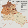 General Government camps of Lublin Reservation.png 2,299 × 2,280; 636 KB
-
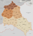
 General Government for the occupied Polish territories (1941).png 2,299 × 2,280; 543 KB
-
 General Government for the occupied Polish territories.png 1,610 × 1,735; 521 KB
-
 28 Nazi Germany 1940.jpg 2,301 × 1,956; 2.73 MB
-
 AGAD Mapa generalnego gubernatorstwa z 39.png 3,610 × 4,774; 27.5 MB
-
 Dystrykt krakowski 1.png 2,026 × 2,596; 2.1 MB
-
 Dystrykt warszawski.jpg 3,000 × 2,052; 1.17 MB
-
 General Government (1942).svg 450 × 456; 500 KB
-
 General.governement.map.1943.jpg 690 × 709; 771 KB
-
 Generalgouvernement fur die besetzten polnischen gebiete.png 1,610 × 1,735; 523 KB
-
-
 Generalgouvernement.png 2,092 × 2,505; 2.71 MB
-
 GeneralgouvernementKarte1940.png 1,295 × 1,385; 404 KB
-
 GeneralGovernement.1940.jpg 583 × 656; 442 KB
-
 GeneralGovernment1940Map.png 2,594 × 2,770; 899 KB
-
 Generalne gubernatorstwo 1942.png 2,086 × 2,480; 1.53 MB
-
 Generalne gubernatorstwo 1945-es.svg 629 × 705; 772 KB
-
 Generalne gubernatorstwo 1945.png 2,092 × 2,505; 1.95 MB
-
 Generalne Gubernatorstwo.jpg 730 × 711; 79 KB
-
 Gengub admin.png 2,122 × 2,428; 1.66 MB
-
 Germany1941.png 698 × 600; 240 KB
-
 NaziGaue.png 1,224 × 1,052; 431 KB
-
 Reichsgau Wartheland (Karte).png 2,092 × 2,505; 2.81 MB
-
 Territoriale Veränderungen nach dem Polenfeldzug 1939.png 2,092 × 2,505; 2.42 MB
-
 מפת הגנרלגוברנמן.png 1,055 × 1,138; 305 KB

.png)


.svg)


.png)

