Category:Maps of the Lower Silesian Voivodeship
Jump to navigation
Jump to search
Voivodeships of Poland: Greater Poland · Kuyavian-Pomeranian · Lesser Poland · Łódź · Lower Silesian · Lublin · Lubusz · Masovian · Opole · Podlaskie · Pomeranian · Silesian · Subcarpathian · Świętokrzyskie · Warmian-Masurian · West Pomeranian ·
Subcategories
This category has the following 21 subcategories, out of 21 total.
Media in category "Maps of the Lower Silesian Voivodeship"
The following 85 files are in this category, out of 85 total.
-
 "Ducatus Silesiae Laureani delineatio - Auctore Friderico Kuhnovio..." (22258644655).jpg 3,723 × 3,026; 2.48 MB
-
 "Ducatus Silesiae Ligniciensis - Auctore Iona Sculteto Sprotta Silesio" (22070695180).jpg 3,820 × 3,024; 2.69 MB
-

-
 "Ducatus Silesiae Wolanus - Authore Iona Sculteto Sprotta Silesio" (22245893322).jpg 3,838 × 3,068; 2.69 MB
-
 AgloWro.png 2,513 × 2,299; 53 KB
-
 AI dolnośląskie.png 2,390 × 2,196; 125 KB
-
 Bahnstrecke Kamienna Gora-Kralowec Karte.jpg 499 × 600; 279 KB
-
 Bahnstrecke Kamienna Gora-Okrzeszyn Karte.jpg 499 × 600; 275 KB
-
 Bahnstrecke Lubań Śląski - Leśna Karte.jpg 1,384 × 1,035; 813 KB
-
 Bahnstrecke Sedzislaw–Kamienna Gora Karte.jpg 499 × 600; 279 KB
-
 Barkowo Lageplan.svg 567 × 680; 444 KB
-
 Bielany-Wr-08021053m.jpg 1,885 × 1,985; 787 KB
-
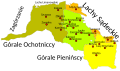
 Black Gorals map.svg 1,346 × 1,281; 66 KB
-
 Bogactwa nat DŚL.png 2,411 × 2,179; 119 KB
-
 Districts Barkowo Zmigrod.svg 794 × 765; 206 KB
-
 Dolnoslaskie location map.PNG 2,000 × 1,863; 205 KB
-
 Dolnoslaskie mapa administracyjna.png 2,507 × 2,275; 796 KB
-
 Dolnoslaskie mapa fizyczna.png 2,508 × 2,275; 718 KB
-
 Dolnoslaskie powiaty.png 1,056 × 816; 49 KB
-
 Dolnoslaskie region map EN.png 1,600 × 1,467; 2.15 MB
-
 Dolnoslaskie topo.png 2,942 × 2,254; 8.74 MB
-
 Dolnośląskie topo.png 4,789 × 4,984; 4.93 MB
-
 Dolnośląskie-miasta.png 3,094 × 2,812; 348 KB
-
 DSna49.png 2,479 × 2,333; 135 KB
-
 DSW-powierzchnia.tif 878 × 516; 1.3 MB
-
 Elektrifizierte Bahnlinien in Schlesien bis 1939.png 1,500 × 1,327; 557 KB
-
 European Parliament constituencies Poland (12).png 902 × 849; 42 KB
-
 Gmina-Kobierzyce-08021054.JPG 2,112 × 2,816; 1.44 MB
-
 Góry Kamienne.jpg 1,420 × 963; 282 KB
-
 Góry Sowie.jpg 1,420 × 963; 280 KB
-
 Góry Walbrzyskie.jpg 1,420 × 963; 282 KB
-
 Jaszkow okolice.jpg 764 × 490; 272 KB
-
 Jelenia Gora mapka 2.png 491 × 454; 298 KB
-
 Landkreese - Woiwodschoaft Niederschläsing.png 1,129 × 1,024; 283 KB
-
 Lipiec dolnośląskie.png 2,391 × 2,196; 178 KB
-
 Lower Silesian in Poland (+rivers).svg 861 × 837; 856 KB
-
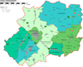
 Lower Silesian Voivodeship administrative map.svg 1,140 × 1,044; 4.16 MB
-
 M-33-070-D.jpg 2,362 × 2,776; 2.19 MB
-
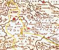
 Map of Silesia in 1791 by Reilly 107.jpg 1,151 × 932; 480 KB
-
 Map of the Jelenia Góra valley, Lower Silesia, Poland - 20081010.jpg 1,752 × 987; 452 KB
-
 Mapa części Niziny Śląsko Łużyckiej i Wału Trzebnickiego.png 3,665 × 2,206; 1.69 MB
-
 Mapa części Niziny Śląsko Łużyckiej i Wału Trzebnickiego.svg 942 × 567; 782 KB
-
 Mapa ks2009-ok.png 726 × 650; 219 KB
-
 Mapa powiatów województwa dolnośląskiego.png 6,435 × 5,850; 950 KB
-
 Mapa, Dolnoslezské vojvodství západ.png 1,207 × 634; 695 KB
-
 Masyw Sleza.jpg 1,420 × 963; 282 KB
-
 Miasta województwa dolnośląskie.png 3,094 × 2,812; 350 KB
-
 MOs810, WG 2014 39, Milicz Ponds Jaskolcze ponds in Ruda Milicka (3).JPG 1,535 × 1,259; 294 KB
-
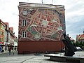 Mural and monument JPII in Dzierzoniow.jpg 3,648 × 2,736; 2.02 MB
-
 Niederschlesisch-Märkische Eisenbahn.jpg 800 × 492; 296 KB
-
 OkoliceRoztoki.dawniej.jpg 590 × 497; 118 KB
-
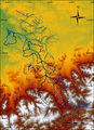 Olza (rzeka).png 4,825 × 6,678; 7.19 MB
-
 Opad dolnośląskie.png 2,391 × 2,196; 123 KB
-
 Opad lip dolnośląskie.png 2,390 × 2,195; 122 KB
-
 Opad sty dolnośląskie.png 2,391 × 2,196; 114 KB
-
 Osola (4).jpg 3,968 × 2,976; 3.37 MB
-
 Osola (5).jpg 3,968 × 2,976; 3.8 MB
-
 Parszowice (1) tablica plan wsi.jpg 3,131 × 1,990; 1.23 MB
-
 Piława G Kalinów.png 400 × 260; 12 KB
-
 Piława G Kopanica.png 400 × 260; 12 KB
-
 Piława G Kośmin.png 400 × 260; 12 KB
-
 POL Gmina Długołęka map.svg 627 × 607; 269 KB
-
 POLSKA woj pow gminy dolnośląskie.PNG 697 × 660; 167 KB
-
 Powiat dzierżoniowski.png 1,800 × 1,453; 409 KB
-
 Przedgórze Sudeckie relief.png 4,170 × 3,173; 10.21 MB
-
 Riesengebirgsbahn.jpg 1,216 × 1,268; 1.07 MB
-
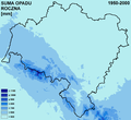
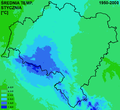
 Roczna dolnośląskie.png 2,391 × 2,196; 161 KB
-
 Rudawy Janowickie.jpg 1,420 × 963; 282 KB
-
 Rzeki DŚL.png 1,025 × 928; 841 KB
-
 Skały powierzchniowe DŚL.png 2,390 × 2,199; 363 KB
-
 Styczeń dolnośląskie.png 2,390 × 2,196; 147 KB
-
 Bahnstrecke Sedzislaw–Lubawka Karte.jpg 1,120 × 1,349; 976 KB
-
 Torfowisko Borowki (3).jpg 2,824 × 1,884; 1.11 MB
-
 Verlaufskarte Bahnstrecke Walbrzych–Mezimestí.png 830 × 1,136; 854 KB
-
 Verlaufskarte Schlesische Gebirgsbahn.jpg 2,000 × 1,209; 1.71 MB
-
 Verlaufskarte Zackenbahn.png 1,325 × 851; 983 KB
-
 White Gorals map.svg 1,219 × 714; 145 KB
-
 Wikiexpedition Lower Silesia, day 5.png 667 × 577; 468 KB
-
 Woiwodschoaft Niederschläsing.png 1,600 × 1,467; 2.23 MB
-
 Woj dolnoslaskie adm.svg 740 × 688; 89 KB
-
 Województwo dolnośląskie powiaty.png 999 × 907; 309 KB
-
 Województwo dolnośląskie powiaty.svg 301 × 273; 68 KB
-
 Zagórzanie map.svg 647 × 892; 6.99 MB
-
 Zgorzelec Miasto railway stop (5).jpg 4,608 × 3,456; 3.9 MB
-
 Bahnstrecke Görlitz–Seidenberg Karte.jpg 1,384 × 1,035; 860 KB
.jpg)
.jpg)
.jpg)
.jpg)


.png)


.svg)


.JPG)


.png)


.jpg)
.jpg)
_tablica_plan_wsi.jpg)


.jpg)


.jpg)
