Category:Maps of the Metropolitan Borough of Bolton
Jump to navigation
Jump to search
Media in category "Maps of the Metropolitan Borough of Bolton"
The following 18 files are in this category, out of 18 total.
-
 Bolton UK locator map.svg 1,425 × 993; 860 KB
-
 Bolton UK ward map 2010 (blank).svg 1,425 × 1,102; 336 KB
-
 Bolton unparished area UK locator map.svg 1,425 × 1,102; 225 KB
-
 BoltonNorthEast2007Constituency.svg 322 × 242; 305 KB
-
 BoltonNorthEastConstituency.svg 329 × 242; 76 KB
-
 BoltonSouthEast2007Constituency.svg 322 × 242; 305 KB
-
 BoltonSouthEastConstituency.svg 329 × 242; 76 KB
-
 BoltonWest2007Constituency.svg 322 × 242; 305 KB
-
 BoltonWestConstituency.svg 329 × 242; 76 KB
-
 EnglandBolton.png 200 × 247; 27 KB
-
 GManc-Bolton.png 200 × 151; 15 KB
-
 GreaterManchesterBolton.png 200 × 151; 16 KB
-
 Manchester Transport Museum SELNEC Futuroute sign.jpg 2,048 × 1,536; 910 KB
-
 Map of the Manchester Bolton and Bury Canal with east lancs line.gif 1,515 × 1,656; 92 KB
-
 Map of the Manchester Bolton and Bury Canal.gif 1,515 × 1,656; 85 KB
-
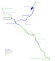
 Map of the Manchester Bolton and Bury Canal.svg 1,100 × 1,293; 59 KB
-
 MBB canal map.gif 588 × 838; 24 KB
-
 Mbb canal map.svg 724 × 1,024; 28 KB


.svg)