Category:Maps of the New York, New Haven and Hartford Railroad
Jump to navigation
Jump to search
Subcategories
This category has the following 2 subcategories, out of 2 total.
M
- Maps of the Old Colony Railroad (16 F)
Media in category "Maps of the New York, New Haven and Hartford Railroad"
The following 43 files are in this category, out of 43 total.
-
 1828 Boston and Providence Railroad survey.jpg 12,928 × 2,416; 7.44 MB
-
 1845 NY&NH.jpg 29,026 × 4,718; 16.14 MB
-
 1849 Railroad Map of New England & Eastern New York.jpg 7,882 × 9,884; 19.41 MB
-
 1854 Telegraph and Rail Road Map of the New England States.jpg 8,192 × 7,841; 20.52 MB
-
 1855 Telegraph and Rail Road Map of the New England States.jpg 10,147 × 9,760; 21.05 MB
-
 1860 Shore Line.jpg 11,328 × 9,184; 20.38 MB
-
 1867 New Haven, Middletown and Boston Railroad map.jpg 8,479 × 7,920; 16.44 MB
-
 1871 Connecticut & Western.jpg 8,432 × 4,258; 8.36 MB
-
 1871 New England railroad map.jpg 4,772 × 6,252; 6.68 MB
-
 1888 Old Colony Railroad Cape Cod map.png 3,500 × 2,436; 18.69 MB
-
 1893 New Haven east.jpg 5,747 × 5,719; 5.05 MB
-
 1893 Sectional Map of New York, New Haven and Hartford Railroad, Eastern District, Cape Cod.jpg 4,670 × 3,036; 17.25 MB
-
 1894 New York, New Haven and Hartford Railroad map.jpg 5,761 × 4,560; 3.01 MB
-
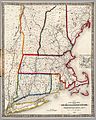
 1899 Massachusetts railroads map.jpg 9,384 × 7,128; 19.48 MB
-
 1906 New York, New Haven and Hartford Railroad map.png 2,048 × 1,342; 3.75 MB
-
 1909 New York, New Haven and Hartford Railroad map.png 3,000 × 1,610; 5.29 MB
-
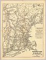
 Sectional map of N. Y. N. H. & H. R.R. Berkshire Hills Route.jpg 1,746 × 3,666; 1.23 MB
-
 1911 map of proposed tunnel to East Boston.png 5,000 × 792; 6.22 MB
-
 Sectional map of the N.Y. N.H. and H. Berkshire Hills Route.png 1,808 × 4,528; 3.1 MB
-
 1912 New Haven Railroad system map.png 4,367 × 2,290; 10.33 MB
-
 1915 New Haven Railroad system map.png 4,772 × 2,576; 10.83 MB
-
 1923 New York, New Haven and Hartford Railroad map.png 1,500 × 913; 1.22 MB
-
 1924 New Haven Railroad system map.jpg 4,810 × 2,536; 2.5 MB
-
 1927 New York, New Haven and Hartford Railroad promotional calendar.png 8,422 × 8,137; 127.27 MB
-
 New Haven Railroad 1940 system map.jpg 3,107 × 1,752; 1.07 MB
-
 1955 New Haven Railroad system map.png 4,576 × 2,556; 14.05 MB
-
 1956 New Haven railroad MA RI track map.jpg 1,422 × 1,600; 1.2 MB
-
 1970 NYNH&H map.png 6,772 × 5,508; 1.84 MB
-
 Alphabet Route map.svg 5,024 × 1,600; 102 KB
-
 Cedar Hill Yard 1917 Railway Review.png 305 × 819; 147 KB
-
 Claremont Park 1912 Map.jpg 2,468 × 3,165; 3.25 MB
-
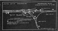 Framingham Center interlocking diagram, August 1908.jpg 3,180 × 1,710; 1.05 MB
-
 Map of Cedar Hill Yard (1918).png 5,483 × 2,346; 1.56 MB
-
 NEC map.png 1,676 × 1,286; 392 KB
-
 NEC map.svg 1,676 × 1,286; 264 KB
-
 New Haven electric railway subsidiaries.svg 1,400 × 800; 2.29 MB
-
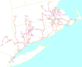
 New Haven Map.png 2,439 × 1,466; 1.16 MB
-
 New Haven Map1.png 2,439 × 1,466; 1.14 MB
-
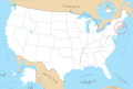
 NYNH&H on US map cropped.png 445 × 367; 26 KB
-
 NYNH&H on US map.png 5,912 × 4,003; 1.87 MB
-
 Railway Age Northup Yard Map.jpg 3,957 × 1,396; 433 KB
-

-
 Walpole interlocking diagram, January 1911.jpg 3,192 × 1,752; 1.36 MB


.png)


_(14573132588).jpg)
