Category:Maps of the Singapore Strait
Jump to navigation
Jump to search
Media in category "Maps of the Singapore Strait"
The following 18 files are in this category, out of 18 total.
-
 Singapore Strait 1906 map, from- Chinese South Sea (cropped).jpg 1,768 × 1,283; 863 KB
-

-
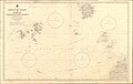 Admiralty Chart No 1311 Singapore Strait to Borneo Northern Sheet, Published 1959.jpg 17,573 × 11,178; 49.14 MB
-
 Admiralty Chart No 1312 Singapore Strait to Borneo (southern sheet), Published 1968.jpg 13,829 × 8,442; 24.33 MB
-

-
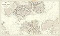 Admiralty Chart No 2403 Singapore Strait, Published 1936.jpg 27,521 × 16,456; 90.34 MB
-

-

-

-
 Admiralty Chart No 3833 Singapore Strait, Published 1930.jpg 23,445 × 11,282; 58.5 MB
-
 Admiralty Chart No 3834 China Sea Singapore Strait Eastern Portion, Published 1927.jpg 8,000 × 3,713; 6.3 MB
-
 Admiralty Chart No 3837 Western Approaches to Singapore, Published 1927.jpg 11,066 × 16,298; 40 MB
-

-

-
 Indo Malay border2.jpg 994 × 750; 227 KB
-
 Map of the Singapore Strait (Hebrew).png 800 × 734; 162 KB
-
 Map of the Singapore Strait (Spanish).png 2,790 × 2,508; 134 KB
-
 Map of the Singapore Strait.png 2,790 × 2,508; 124 KB
.jpg)
.jpg)

,_Published_1968.jpg)


.png)
.png)
