Category:Maps of the South Caucasus
Jump to navigation
Jump to search
Subcategories
This category has the following 5 subcategories, out of 5 total.
A
G
O
Media in category "Maps of the South Caucasus"
The following 39 files are in this category, out of 39 total.
-
 Armenian migration-Tsutsiev 2015.svg 1,328 × 897; 1.21 MB
-
 Armenian reform package in Ottoman Empire 1912-1914.png 1,822 × 1,123; 156 KB
-
 Armenianhighlandorg.png 700 × 472; 138 KB
-
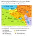 ATD of the regions of Turkey occupied by Russian troops during WW1.png 1,232 × 1,352; 191 KB
-
 Autonomus Armenian province project 1913.png 3,612 × 1,432; 773 KB
-
 AZ-qa-location-en.svg 443 × 300; 178 KB
-
 AZ-qa-location-mk.svg 443 × 300; 178 KB
-
 Base Map of the Southern Caucasus.png 2,913 × 2,166; 295 KB
-
 CampañaDelCaucaso1914-1916.svg 3,022 × 2,172; 535 KB
-
 Caucasus countries.png 512 × 352; 15 KB
-
 Caucasus envsec baseb.png 1,439 × 1,027; 706 KB
-
 Caucasus03-zh.jpg 874 × 645; 237 KB
-
 Caucasus03-zh.png 874 × 645; 43 KB
-
 Caucasus03.png 874 × 645; 40 KB
-
 Caucasus03.jpg 874 × 645; 54 KB
-
 Caucasus03 la.png 874 × 645; 44 KB
-
 Caucasus03-es.svg 2,466 × 1,754; 227 KB
-
 Caucasus03-sr.png 874 × 645; 41 KB
-
 Caucasus Megrelian.jpg 874 × 645; 74 KB
-
 Caucasus03 fr.png 874 × 645; 39 KB
-
 Caucasus03RO.JPG 874 × 645; 56 KB
-
 Armenia in 300 BC.png 850 × 607; 28 KB
-
 Ethnic population of the Caucasus according to the Russian census of 1897.JPG 2,328 × 1,098; 249 KB
-
 Historical provinces of Georgia.png 2,000 × 1,344; 300 KB
-
 IranAndNeighbours.png 538 × 316; 11 KB
-
 Karabakh map.png 1,358 × 1,341; 219 KB
-
 Kaukasien-politik.png 801 × 605; 36 KB
-
 Map of the Kars-Akhalkalaki-Tbilisi-Baku railway.png 1,742 × 1,076; 2.34 MB
-
 Map of the Yerewan Jolfa railway.jpg 1,406 × 816; 344 KB
-
 Projet de province arménienne - Empire ottoman (1913).png 1,764 × 1,328; 338 KB
-
 Projet de réformes en Arménie ottomane (1914).png 882 × 663; 64 KB
-
 Soviet territorial claims against Turkey 1945-1953.png 2,000 × 1,579; 395 KB
-
 Transcaucasia adm location map.svg 1,358 × 935; 224 KB
-
 Transcaucasia locator map.svg 1,768 × 1,171; 153 KB
-
 USSR territorial claims to Turkey.svg 736 × 581; 1.83 MB
-
 Vector-map of Caucasus.svg 9,000 × 5,904; 195 KB
-
 Закавказье.png 512 × 352; 43 KB
-
 Историко-географические провинции Грузии..png 2,000 × 1,382; 324 KB
-
 남캅카스의 국가들.png 512 × 352; 34 KB


.png)
.png)


