Category:Maps of the United States Environmental Protection Agency
Jump to navigation
Jump to search
Subcategories
This category has only the following subcategory.
M
Media in category "Maps of the United States Environmental Protection Agency"
The following 37 files are in this category, out of 37 total.
-
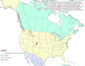
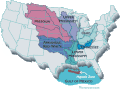
 Regions of the United States EPA.svg 959 × 593; 119 KB
-
 2002 303d reg.png 760 × 670; 196 KB
-
 2013 Greenhouse Gas Emissions data (15399939641).jpg 1,456 × 1,125; 397 KB
-
 Areas Covered by the BEACH Act of 2000.jpg 2,859 × 2,045; 1.02 MB
-
 Barnegat Bay No Discharge Zone.jpg 582 × 955; 161 KB
-
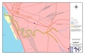 Buffalo River - final state approved.pdf 2,550 × 1,650; 545 KB
-

-
-
 CSO map EPA 2008.jpg 407 × 221; 27 KB
-
 Didymo distribution.png 1,097 × 847; 61 KB
-
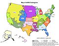 EGRID2012 eGRID subregions.jpg 6,600 × 5,100; 3.09 MB
-
 EGRID2012 NERC regions.jpg 3,300 × 2,550; 530 KB
-
 Energy Star Recommended Insulation map US EPA.jpg 700 × 379; 290 KB
-
 EPAmap.jpg 790 × 925; 90 KB
-
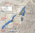 Extent of Seepage-Impacted Groundwater 2009 Church Rock uranium mill.png 1,572 × 1,515; 2.7 MB
-
 FlintRiverwatershed.gif 284 × 189; 3 KB
-
 FlintRwshedoverview.gif 284 × 189; 1 KB
-
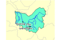
 Gulf-mexico-watershed.gif 350 × 261; 27 KB
-
 Hurricane Sandy Hazardous Waste Pickup Sites - Bronx County (8211192699).jpg 4,608 × 3,456; 7.47 MB
-
 Hurricane Sandy Hazardous Waste Pickup Sites - Kings County (8211192111).jpg 4,608 × 3,456; 8.35 MB
-
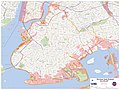
 Hurricane Sandy Hazardous Waste Pickup Sites - New York County (8212280944).jpg 4,608 × 3,456; 10 MB
-
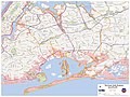 Hurricane Sandy Hazardous Waste Pickup Sites - Queens County (8211190719).jpg 4,608 × 3,456; 8.12 MB
-
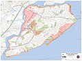 Hurricane Sandy Hazardous Waste Pickup Sites - Richmond County (8211190069).jpg 4,608 × 3,456; 5.9 MB
-
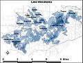
 Indianriverlagoon.GIF 592 × 832; 19 KB
-
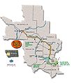
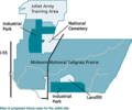 Joliet Arsenal proposed redevelopment map.png 400 × 334; 19 KB
-
 Lake of Egypt.PNG 398 × 298; 14 KB
-
 LakeMinnetonkaBlue.jpg 441 × 334; 34 KB
-
 Mississippi River basin.jpg 300 × 222; 9 KB
-
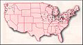
 NAAQS Non Attainment Counties 09302017.svg 698 × 744; 436 KB
-
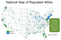 National Map of Regulated MS4s 2009.png 719 × 477; 62 KB
-
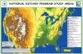 NEP Study Areas Map 2015.png 5,400 × 3,599; 12.75 MB
-
 NURP project map.jpg 1,040 × 664; 106 KB
-
 Superfund sites.svg 900 × 500; 2.33 MB
-
 TriWiki.png 1,089 × 871; 1.02 MB
-
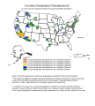
 US Counties Designated Non-attainment according to EPA NAAQS.jpg 699 × 715; 374 KB
-
 US Power Plants - EPA Toxics Rule Facilities - 2011.png 1,861 × 1,260; 337 KB
-
 Waterloo Creek Iowa.gif 600 × 450; 269 KB


.jpg)


.png)
.svg)


.jpg)
.jpg)
.jpg)
.jpg)
.jpg)


