Category:Maps of the canton of Graubünden to 2015
Jump to navigation
Jump to search
Media in category "Maps of the canton of Graubünden to 2015"
The following 33 files are in this category, out of 33 total.
-
 Karte Kanton Graubünden 2010.png 2,066 × 1,646; 991 KB
-
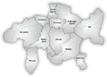
 Karte Kanton Graubünden Bezirke 2010.png 2,066 × 1,645; 955 KB
-
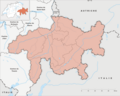
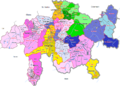
 Karte Kanton Graubünden Kreise 2015.png 2,066 × 1,645; 1.06 MB
-
 Karte Kanton Graubünden 2009.png 1,476 × 1,167; 381 KB
-
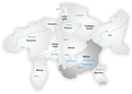
 Karte Kanton Graubünden.png 1,181 × 934; 220 KB
-
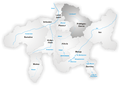
 Map of Canton Graubunden.png 1,003 × 716; 167 KB
-
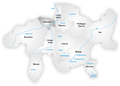
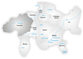
 Karte Kanton Graubünden Bezirke.png 1,181 × 934; 211 KB
-
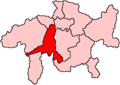
 Karte Bezirk Albula.png 1,181 × 843; 196 KB
-
 Karte Bezirk Bernina.png 1,181 × 843; 196 KB
-
 Districts of Canton Grisons.png 800 × 571; 202 KB
-
 Grisons districts blank.png 1,003 × 716; 24 KB
-
 Karte Bezirk Hinterrhein.png 1,181 × 843; 267 KB
-
 Karte Bezirke Imboden.png 1,181 × 843; 264 KB
-
 Karte Bezirk Inn.png 1,181 × 843; 269 KB
-
 Karte Kanton Graubünden Bezirke 2010 clair.png 2,066 × 1,645; 613 KB
-
 Karte Bezirk Landquart.png 1,181 × 843; 266 KB
-
 Karte Bezirk Maloja.png 1,181 × 843; 268 KB
-
 Mapo Grizono.png 1,026 × 733; 362 KB
-
 Karte Bezirk Moësa.png 1,181 × 843; 267 KB
-
 Karte Bezirk Plessur.png 1,181 × 843; 264 KB
-
 Karte Bezirk Prättigau-Davos.png 1,181 × 843; 269 KB
-
 Karte Bezirk Surselva.png 1,181 × 843; 270 KB
-
 Gr bez albula.png 240 × 170; 3 KB
-
 Gr bez bernina.png 240 × 170; 3 KB
-
 Gr bez hinterrhein.png 240 × 170; 3 KB
-
 Gr bez imboden.png 240 × 170; 3 KB
-
 Gr bez inn.png 240 × 170; 3 KB
-
 Gr bez landquart.png 240 × 170; 3 KB
-
 Gr bez maloja.png 240 × 170; 3 KB
-
 Gr bez moesa.png 240 × 170; 3 KB
-
 Gr bez plessur.png 240 × 170; 3 KB
-
 Gr bez praettigau.png 240 × 170; 3 KB
-
 Gr bez surselva.png 240 × 170; 3 KB


