Category:Maps of the history of Hungary (1526–1700)
Jump to navigation
Jump to search
Subcategories
This category has only the following subcategory.
Media in category "Maps of the history of Hungary (1526–1700)"
The following 44 files are in this category, out of 44 total.
-
 1570 borders of the Principality of Transylvania.svg 970 × 970; 42 KB
-
 1570 grenzen van Vorstendom Transsylvanië.svg 970 × 970; 42 KB
-

-
 AtlBalk1600.jpg 318 × 327; 171 KB
-
 Banlaky József történelmi térképe Magyarország 1527-1570.jpg 2,642 × 1,789; 832 KB
-
 Bethlen Gábor fejedelemsége.png 14,880 × 13,485; 18.02 MB
-
 Central europe 1572 hu.svg 922 × 880; 117 KB
-
 Central europe 1572.png 922 × 880; 120 KB
-
 Central Erope 1572 es.svg 1,122 × 883; 248 KB
-
 Central Erope 1572 HU.svg 1,122 × 883; 243 KB
-
 A' budai pasaság 1650-ben Hadzsi Chalfa szerint.png 1,246 × 1,520; 1.62 MB
-
 Budin Eyalet, Central europe 1683-ar.png 1,499 × 974; 796 KB
-
 Budin Eyalet, Central europe 1683.png 1,499 × 974; 789 KB
-
 Central europe 1683.png 1,280 × 971; 390 KB
-
 Egri Eyalet, Central europe 1683.png 1,499 × 974; 787 KB
-
 Vassal states of the Ottoman Empire in 1683 hu.svg 877 × 688; 397 KB
-
 Vassal states of the Ottoman Empire in 1683.svg 877 × 688; 278 KB
-
 Vassal states of the Ottoman Empire in 1683-es.svg 2,557 × 2,000; 1.11 MB
-
 Vassal states of the Ottoman Empire in 1683-pt.svg 2,557 × 2,000; 583 KB
-
 Temesvar Eyalet, Central europe 1683.png 1,499 × 974; 788 KB
-
 Kanije Eyalet, Central europe 1683.png 1,499 × 974; 848 KB
-
 Varat Eyalet, Central europe 1683.png 1,499 × 974; 785 KB
-
 Eastern-hungarian-kingdom1550-es.svg 3,561 × 2,489; 1.54 MB
-
 Eastern-hungarian-kingdom1550-hu.svg 3,561 × 2,489; 993 KB
-
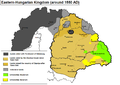
 Eastern-hungarian-kingdom1550.JPG 1,500 × 1,057; 576 KB
-
 Eastern-hungarian-kingdom1550.PNG 1,107 × 780; 83 KB
-
 HerrschaftPinkafeld.png 895 × 602; 69 KB
-
 Magyar- és Erdélyország 1629-ben (Pallas).jpg 2,280 × 1,800; 946 KB
-
 Magyarország 1606-ban a bécsi és zsitvatoroki béke korában Bánlaky.jpg 2,748 × 1,670; 2.66 MB
-
 Mapa Uhorska.jpg 574 × 517; 107 KB
-
 Ottomaanse Rijk in Centraal Europa in 1683 (NL).svg 877 × 605; 412 KB
-
 Panství habsburské v XVI. století.jpg 952 × 823; 191 KB
-
 Partition of Hungary-ar.png 389 × 328; 42 KB
-
 Partition of Hungary.png 389 × 328; 31 KB
-
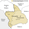
 Partium1570 hu.png 1,027 × 1,015; 202 KB
-
 Partium1570.PNG 1,027 × 1,015; 165 KB
-
 PNG Jagelon.png 1,268 × 1,054; 90 KB
-
 PodzialWegier hu.svg 840 × 602; 71 KB
-
 PodzialWegier.png 840 × 602; 37 KB
-
 Rákóczi estates.jpg 1,104 × 786; 211 KB
-
 Totius Regni Hungarie Tabula.jpg 1,500 × 820; 541 KB
-
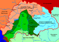
 TransilvaniaDeEspira1570 hu.svg 1,027 × 1,015; 69 KB
-
 TransilvaniaDeEspira1570.svg 1,027 × 1,015; 75 KB
-
 Zapolya.jpg 1,814 × 1,110; 1.22 MB
.jpg)


.jpg)


.svg)


