Category:Maps of the history of colonies of Belgium
Jump to navigation
Jump to search
Countries of Europe: Belgium · Denmark · France‡ · Germany · Italy · Netherlands‡ · Portugal‡ · Spain‡ · Sweden · United Kingdom
‡: partly located in Europe
‡: partly located in Europe
Subcategories
This category has the following 3 subcategories, out of 3 total.
B
- Maps of Belgian Congo (47 F)
C
- Maps of the Congo Free State (59 F)
R
- Maps of Ruanda-Urundi (29 F)
Media in category "Maps of the history of colonies of Belgium"
The following 16 files are in this category, out of 16 total.
-
 Carte du District de Santo-Thomas (Etat de Guatemala).jpg 2,560 × 1,677; 1.06 MB
-
 Carte de la Republique de L'Amerique Centrale.jpg 2,576 × 1,690; 1.46 MB
-
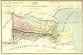
 Kolonie Belg-Honduras (Santo Tomás de Castilla).jpg 528 × 647; 262 KB
-
 Carte des estates de Nicaragua et Costarica.jpg 2,576 × 1,687; 1.2 MB
-
 Carte de la Mer des Antilles et du Golfe du Mexique.jpg 2,576 × 1,687; 1.21 MB
-
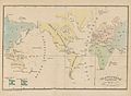 Planisphere terrestre.jpg 3,467 × 2,546; 1.49 MB
-
 1967 data of Benelux.jpg 4,294 × 2,864; 2.89 MB
-
 Belgian colonial empire.png 1,425 × 625; 38 KB
-
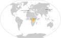 Belgian colonial empire.svg 1,503 × 923; 1.33 MB
-
 BelgianColonialEmpire(UPT).png 6,262 × 3,403; 1.43 MB
-
 BelgianColonialEmpire.png 6,262 × 3,403; 1.35 MB
-
 Italy, Netherlands and Belgium 1934, 30.jpg 5,519 × 2,651; 1.67 MB
-
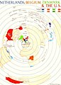 Netherlands, Belgium, Denmark & the U.S., 1954.jpg 1,016 × 1,414; 188 KB
-

-
 SantoTomasdeCastilla.jpg 863 × 866; 773 KB
-
 벨기에 식민 제국.png 1,425 × 620; 38 KB
.jpg)

.jpg)


.png)


