Category:Maps showing 1030
Jump to navigation
Jump to search
| 1030 1031 1037 → |
English: Maps showing the year 1030 (i.e. history maps)
See also category: 1030 maps. and 1030s maps for old maps created in this time.
See also category: 1030 maps. and 1030s maps for old maps created in this time.
Media in category "Maps showing 1030"
The following 14 files are in this category, out of 14 total.
-
 Comté de Toulouse 1030 ru.png 338 × 316; 82 KB
-
 Leon 1030.png 620 × 654; 786 KB
-
 Leon1030.jpg 1,149 × 870; 305 KB
-
 Map France 1030-br.svg 989 × 1,126; 741 KB
-
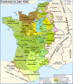 Map France 1030-de.svg 988 × 1,124; 1.49 MB
-
 Map France 1030-es.svg 1,053 × 1,199; 4.12 MB
-
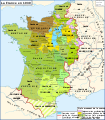 Map France 1030-fr.svg 989 × 1,126; 718 KB
-
 Map France 1030-ru.svg 988 × 1,124; 789 KB
-
 Map France 1030-uk.svg 988 × 1,124; 789 KB
-
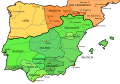
 Map Iberian Peninsula 1030-ast.svg 827 × 574; 260 KB
-
 Map Iberian Peninsula 1030-de.svg 827 × 574; 335 KB
-
 Map Iberian Peninsula 1030-es.svg 827 × 574; 280 KB
-
 Map Iberian Peninsula 1030-hu.svg 827 × 574; 265 KB
-
 Vasconie 1030 Shepherd.png 1,208 × 1,556; 255 KB


