Category:Maps showing 1942
Jump to navigation
Jump to search
| ← 1940 1941 1942 1943 1944 1945 1946 1947 1948 1949→ |
English: Maps showing the year 1942 (i.e. history maps)
See also category: 1942 maps. and 1940s maps for old maps created in this time.
See also category: 1942 maps. and 1940s maps for old maps created in this time.
Subcategories
This category has the following 3 subcategories, out of 3 total.
M
- Maps of the Battle of Stalingrad (141 F)
U
Media in category "Maps showing 1942"
The following 13 files are in this category, out of 13 total.
-
 BlankMap-World-1942.11.png 2,753 × 1,400; 199 KB
-
 BlankMap-World-WWII.PNG 1,500 × 740; 103 KB
-
 Bombay Presidency in the Indian Empire 1942.png 1,621 × 1,401; 392 KB
-
 Colombia (1942).svg 2,072 × 2,339; 2.02 MB
-
 Flag Map of Italy (November 1942).svg 512 × 779; 247 KB
-
 Japanese Empire - 1942.svg 1,100 × 837; 875 KB
-

-
 Map of Japanese Empire August 1942 - DPLA - 0a5010ede7fcba8bd85ef9771b44d17b.jpg 7,866 × 6,364; 9.53 MB
-
 Political Evolution of Central America and the Caribbean 1942 na.png 1,000 × 750; 123 KB
-
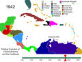 Political Evolution of Central America and the Caribbean 1942.png 1,000 × 750; 153 KB
-
 World map 1942 (SVG).svg 512 × 260; 4.85 MB
-
 Flag map of the world (1942).jpg 1,425 × 625; 493 KB
-
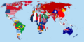 Flag-map of the world (1942).png 4,500 × 2,234; 602 KB

.svg)
.svg)


.svg)
.jpg)
.png)