Category:Maps showing the 1400s
Jump to navigation
Jump to search
| Maps showing the 15th century:
←1400s 1410s 1420s 1430s 1440s 1450s 1460s 1470s 1480s 1490s → |
Not to be confused with maps made in the 1400s.
Subcategories
This category has the following 5 subcategories, out of 5 total.
- Maps showing 1400 (15 F)
- Maps showing 1402 (7 F)
- Maps showing 1404 (3 F)
- Maps showing 1405 (4 F)
Media in category "Maps showing the 1400s"
The following 30 files are in this category, out of 30 total.
-
 Byzanc 1400.png 724 × 589; 355 KB
-
 Corona de Castilla 1400 ast.svg 738 × 542; 1 MB
-
 Corona de Castilla 1400 ca.svg 738 × 542; 813 KB
-
 Corona de Castilla 1400 eo.svg 738 × 542; 1 MB
-
 Corona de Castilla 1400 es.svg 738 × 542; 1.02 MB
-
 Corona de Castilla 1400 pt.svg 738 × 542; 1 MB
-
 Extent of the Hansa-optimiert.jpg 3,605 × 2,061; 11.37 MB
-
 Extent of the Hansa.png 1,250 × 695; 141 KB
-
 Heiliges Römisches Reich 1400.png 2,788 × 2,299; 2.47 MB
-
 Herrschaft Ruppin 1400.PNG 460 × 248; 86 KB
-
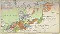
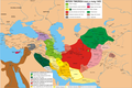
 Tamerla 1399-1401.png 2,500 × 1,675; 1.11 MB
-
 Tamerla 1401-1402.png 2,500 × 1,675; 1.16 MB
-
 Tamerla 1402-1403.png 2,500 × 1,675; 1.16 MB
-
 Tamerla 1402.png 2,500 × 1,675; 1.13 MB
-
 Tamerla 1403-1405.png 2,500 × 1,673; 1.24 MB
-
 Tamerla 1403.png 3,732 × 2,500; 1.99 MB
-
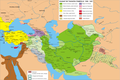
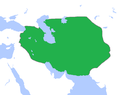 TimuridEmpire1400.png 756 × 600; 18 KB
-
 Xahrukh1405-1406.png 2,500 × 1,674; 988 KB
-
 Xahrukh1405.png 2,500 × 1,674; 1 MB
-
 Xahrukh1405a.png 2,500 × 1,674; 1.02 MB
-
 Xahrukh1405b.png 2,500 × 1,674; 997 KB
-
 Xahrukh1406-1407.png 2,500 × 1,676; 1.01 MB
-
 Xahrukh1406.png 2,500 × 1,676; 1,015 KB
-
 Xahrukh1406a.png 2,500 × 1,676; 1.02 MB
-
 Xahrukh1407-1408.png 2,500 × 1,676; 1.02 MB
-
 Xahrukh1407.png 2,500 × 1,676; 991 KB
-
 Xahrukh1408-1409.png 2,500 × 1,676; 989 KB
-
 Xahrukh1408.png 2,500 × 1,676; 1,006 KB
-
 Xahrukh1409-1410.png 2,500 × 1,676; 1.02 MB
-
 Xahrukh1409.png 2,500 × 1,677; 1,022 KB


