Category:Maps showing the 1720s
Jump to navigation
Jump to search
| Maps showing the 18th century:
←1700s 1710s 1720s 1730s 1740s 1750s 1760s 1770s 1780s 1790s → |
Not to be confused with maps made in the 1720s.
Media in category "Maps showing the 1720s"
The following 4 files are in this category, out of 4 total.
-

-
 Montigny map with locations.jpg 863 × 1,036; 454 KB
-
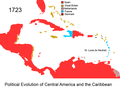 Political Evolution of Central America and the Caribbean 1723 na.png 1,000 × 750; 84 KB
-
 Treaty of Utrecht.jpg 3,446 × 2,643; 2.33 MB
.jpg)


