Category:Mariehällskyrkan
Jump to navigation
Jump to search
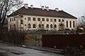
Svenska: Mariehällskyrkan tillhörde Bromma församling, Birka kontrakt, Stockholms stift / Diocese of Stockholm.
| Object location | | View all coordinates using: OpenStreetMap |
|---|
|
This is a category about an ecclesiastical monument in Sweden, number 21300000011353 (sub-number: 21400000295631) in the RAÄ buildings database.
|
building in Stockholm Municipality, Stockholm County, Sweden  | |||||
| Upload media | |||||
| Instance of | |||||
|---|---|---|---|---|---|
| Named after | |||||
| Location | Mariehäll, Stockholm Municipality, Stockholm County, Sweden | ||||
| Street address |
| ||||
| Diocese | |||||
| Architect | |||||
| Has use |
| ||||
| Heritage designation |
| ||||
| Inception |
| ||||
 | |||||
Media in category "Mariehällskyrkan"
The following 6 files are in this category, out of 6 total.
-
 Mariehälls församlingshus 2006-04-16.jpg 2,288 × 1,296; 584 KB
-
 Mariehälls kyrka från luften.jpg 4,256 × 2,832; 3.19 MB
-
 Mariehällskyrkan2001.jpg 5,184 × 3,456; 7.72 MB
-
 Mariehällskyrkan2002.jpg 5,184 × 3,456; 8.94 MB
-
 Mariehällskyrkan2003.jpg 5,184 × 3,456; 6.53 MB
-
 Mariehällskyrkan2004.jpg 5,184 × 3,456; 8.69 MB


