Category:Market Bosworth
Vai alla navigazione
Vai alla ricerca
village and market town in Leicestershire, England, UK  | |||||
| Carica un file multimediale | |||||
| Istanza di | |||||
|---|---|---|---|---|---|
| Luogo | Hinckley and Bosworth, Leicestershire, Midlands Orientali, Inghilterra | ||||
| Popolazione |
| ||||
| Considerato essere uguale a | Market Bosworth (pagina Wikimedia duplicata, parrocchia civile dell'Inghilterra) | ||||
 | |||||
Català: Market Bosworth és una gran població de Leicestershire a Anglaterra. El matemàtic Thomas Simpson va morir allà el 1761, (també hi havia nascut el 20 d'agost de 1710). (→Market Bosworth)
Cebuano: Market Bosworth maoy lungsod sa Hiniusang Gingharian. Ang Market Bosworth nahimutang sa kondado sa Leicestershire ug apil sa nasod sa Inglatera, sa habagatang bahin sa nasod, ka molupyo. (→Market Bosworth (lungsod))
Cymraeg: Tref fechan yn Swydd Gaerlŷr, Lloegr yw Market Bosworth. Fe'i lleolir yng ngorllewin Swydd Gaerlŷr tua hanner ffordd rhwng Tamworth a dinas Caerlŷr. Rhoddwyd siarter yn rhoi'r hawl i gynnal marchnad ynddi gan y brenin Edward I o Loegr yn 1285. (→Market Bosworth)
Deutsch: Market Bosworth ist ein Ort und eine civil parish in Leicestershire, England mit 2097 Einwohnern (2011). Es gibt Siedlungsspuren aus der Bronzezeit im Bereich der civil parish und auch die Überreste einer römischen Villa wurden entdeckt. (→Market Bosworth)
English: Market Bosworth is a market town and civil parish in Leicestershire, England. At the 2001 Census, it had a population of 1,906, increasing to 2,097 at the 2011 census. (→Market Bosworth)
فارسی: مارکت بازورث (به انگلیسی: Market Bosworth) یک شهرک در بریتانیا است که در انگلستان واقع شدهاست. (→مارکت بازورث)
Français : Market Bosworth est une ville et une paroisse civile du Leicestershire, en Angleterre. Au moment du recensement de 2001, elle comptait habitants. (→Market Bosworth)
Italiano: Market Bosworth è un paese della contea del Leicestershire, in Inghilterra. (→Market Bosworth)
Nederlands: Market Bosworth is een plaats en civil parish in het bestuurlijke gebied Hinckley and Bosworth, in het Engelse graafschap Leicestershire met 1.906 inwoners. (→Market Bosworth)
Norsk bokmål: Market Bosworth er en stor landsby i Leicestershire, England. Den er mest kjent for at slaget ved Bosworth, det siste slaget i rosekrigene, ble utkjempet like ved. (→Market Bosworth)
Polski: Market Bosworth – miasto w Anglii, w hrabstwie Leicestershire, w dystrykcie Hinckley and Bosworth. Leży 18 km na zachód od miasta Leicester i 152 km na północny zachód od Londynu. W 2001 miasto liczyło 1906 mieszkańców. (→Market Bosworth)
Svenska: Market Bosworth är en stad och en civil parish i Hinckley and Bosworth i Leicestershire i England. Orten har 2 097 invånare (2011). (→Market Bosworth)
Українська: (→Босвортський ринок)

Sottocategorie
Questa categoria contiene le 13 sottocategorie indicate di seguito, su un totale di 13.
B
D
- Dixie Grammar School (12 F)
F
- Far Coton (49 F)
M
- Market Bosworth Free Church (4 F)
- Market Bosworth Hall (21 F)
- Market Bosworth railway station (18 F)
- Market Bosworth War Memorial (11 F)
P
S
- Shops in Market Bosworth (11 F)
Y
File nella categoria "Market Bosworth"
Questa categoria contiene 200 file, indicati di seguito, su un totale di 830.
(pagina precedente) (pagina successiva)-
 'Face at The Window' - geograph.org.uk - 4631218.jpg 1 065 × 1 600; 346 KB
-
 1416 near Fox Bridge - geograph.org.uk - 4727106.jpg 640 × 426; 135 KB
-
 15, Park St - geograph.org.uk - 4754112.jpg 640 × 426; 80 KB
-
 19 - 20, Market Place - geograph.org.uk - 4757480.jpg 640 × 426; 70 KB
-
 23, Market Place - geograph.org.uk - 4757478.jpg 640 × 414; 64 KB
-
 25, Station Rd (Litchfield Cottage) - geograph.org.uk - 4746634.jpg 640 × 371; 58 KB
-
 26, Park St - geograph.org.uk - 4754115.jpg 640 × 426; 64 KB
-
 27, Station Rd (Nogg Cottage) - geograph.org.uk - 4746629.jpg 640 × 398; 51 KB
-
 28, Park St - geograph.org.uk - 4754116.jpg 640 × 426; 62 KB
-
 29 - 31, Main St - geograph.org.uk - 4746710.jpg 640 × 426; 76 KB
-
 30, Park St - geograph.org.uk - 4754117.jpg 640 × 426; 55 KB
-
 37, Main St - geograph.org.uk - 4746711.jpg 640 × 426; 82 KB
-
 4 - 6, Market Place - geograph.org.uk - 4757578.jpg 640 × 426; 74 KB
-
 5, Church St - geograph.org.uk - 4746720.jpg 640 × 426; 85 KB
-
 9, Sutton Lane - geograph.org.uk - 4754471.jpg 640 × 426; 64 KB
-
 A Leicestershire lane - geograph.org.uk - 4712067.jpg 640 × 426; 70 KB
-

-
 Ambion Rise - Heath Road - geograph.org.uk - 3135257.jpg 640 × 480; 59 KB
-
 Approaching a bend in Tinsel Lane - geograph.org.uk - 4495387.jpg 640 × 480; 101 KB
-
 Approaching Coton Bridge - geograph.org.uk - 4738239.jpg 640 × 426; 71 KB
-
 Approaching Deakin's Bridge, Ashby Canal - geograph.org.uk - 2896532.jpg 1 280 × 856; 266 KB
-

-
 Approaching Wellsborough Rd - geograph.org.uk - 4707883.jpg 640 × 407; 87 KB
-
 Aqueduct Cottage - geograph.org.uk - 4735158.jpg 640 × 426; 89 KB
-
 Aqueduct Cottage - geograph.org.uk - 4735159.jpg 640 × 426; 96 KB
-

-
 Aqueduct, Ashby Canal - geograph.org.uk - 4735145.jpg 640 × 426; 79 KB
-
 Aqueduct, Ashby Canal - geograph.org.uk - 4735150.jpg 640 × 426; 88 KB
-
 Arable land by the Ashby Canal - geograph.org.uk - 4712183.jpg 640 × 426; 47 KB
-
 Arable land by the Ashby Canal - geograph.org.uk - 4712188.jpg 640 × 397; 40 KB
-
 Ashby Canal - geograph.org.uk - 4712093.jpg 640 × 426; 82 KB
-
 Ashby Canal - geograph.org.uk - 4712094.jpg 640 × 426; 75 KB
-
 Ashby Canal - geograph.org.uk - 4712096.jpg 640 × 426; 85 KB
-
 Ashby Canal - geograph.org.uk - 4712165.jpg 640 × 426; 81 KB
-
 Ashby Canal - geograph.org.uk - 4712166.jpg 640 × 426; 90 KB
-
 Ashby Canal - geograph.org.uk - 4712168.jpg 640 × 426; 74 KB
-
 Ashby Canal - geograph.org.uk - 4712170.jpg 640 × 426; 89 KB
-
 Ashby Canal - geograph.org.uk - 4712171.jpg 640 × 426; 102 KB
-
 Ashby Canal - geograph.org.uk - 4712173.jpg 640 × 426; 94 KB
-
 Ashby Canal - geograph.org.uk - 4712175.jpg 640 × 426; 87 KB
-
 Ashby Canal - geograph.org.uk - 4712195.jpg 640 × 426; 81 KB
-
 Ashby Canal - geograph.org.uk - 4712198.jpg 640 × 426; 70 KB
-
 Ashby Canal - geograph.org.uk - 4712200.jpg 640 × 426; 103 KB
-
 Ashby Canal - geograph.org.uk - 4726953.jpg 640 × 426; 85 KB
-
 Ashby Canal - geograph.org.uk - 4726955.jpg 640 × 426; 99 KB
-
 Ashby Canal - geograph.org.uk - 4726958.jpg 640 × 426; 104 KB
-
 Ashby Canal - geograph.org.uk - 4726969.jpg 640 × 426; 102 KB
-
 Ashby Canal - geograph.org.uk - 4726973.jpg 640 × 426; 90 KB
-
 Ashby Canal - geograph.org.uk - 4726975.jpg 640 × 426; 94 KB
-
 Ashby Canal - geograph.org.uk - 4726985.jpg 640 × 426; 83 KB
-
 Ashby Canal - geograph.org.uk - 4726996.jpg 640 × 426; 75 KB
-
 Ashby Canal - geograph.org.uk - 4727006.jpg 640 × 426; 102 KB
-
 Ashby Canal - geograph.org.uk - 4727016.jpg 640 × 426; 88 KB
-
 Ashby Canal - geograph.org.uk - 4727027.jpg 640 × 426; 44 KB
-
 Ashby Canal - geograph.org.uk - 4727086.jpg 640 × 426; 54 KB
-
 Ashby Canal - geograph.org.uk - 4727095.jpg 640 × 426; 65 KB
-
 Ashby Canal - geograph.org.uk - 4727118.jpg 640 × 426; 56 KB
-
 Ashby Canal - geograph.org.uk - 4727129.jpg 640 × 426; 55 KB
-
 Ashby Canal - geograph.org.uk - 4730626.jpg 640 × 426; 51 KB
-
 Ashby Canal - geograph.org.uk - 4730627.jpg 640 × 426; 60 KB
-
 Ashby Canal - geograph.org.uk - 4730630.jpg 640 × 426; 76 KB
-
 Ashby Canal - geograph.org.uk - 4730634.jpg 640 × 426; 93 KB
-
 Ashby Canal - geograph.org.uk - 4730642.jpg 640 × 426; 64 KB
-
 Ashby Canal - geograph.org.uk - 4730644.jpg 640 × 426; 79 KB
-
 Ashby Canal - geograph.org.uk - 4730645.jpg 640 × 426; 83 KB
-
 Ashby Canal - geograph.org.uk - 4730664.jpg 640 × 426; 68 KB
-
 Ashby Canal - geograph.org.uk - 4730665.jpg 640 × 426; 83 KB
-
 Ashby Canal - geograph.org.uk - 4730670.jpg 640 × 426; 84 KB
-
 Ashby Canal - geograph.org.uk - 4730686.jpg 640 × 426; 87 KB
-
 Ashby Canal - geograph.org.uk - 4730697.jpg 640 × 426; 87 KB
-
 Ashby Canal - geograph.org.uk - 4730700.jpg 640 × 426; 61 KB
-
 Ashby Canal - geograph.org.uk - 4730701.jpg 640 × 426; 66 KB
-
 Ashby Canal - geograph.org.uk - 4730707.jpg 640 × 426; 72 KB
-
 Ashby Canal - geograph.org.uk - 4730709.jpg 640 × 426; 70 KB
-
 Ashby Canal - geograph.org.uk - 4730711.jpg 640 × 426; 73 KB
-
 Ashby Canal - geograph.org.uk - 4730718.jpg 640 × 426; 81 KB
-
 Ashby Canal - geograph.org.uk - 4735246.jpg 640 × 426; 82 KB
-
 Ashby Canal - geograph.org.uk - 4738036.jpg 640 × 426; 77 KB
-
 Ashby Canal - geograph.org.uk - 4738249.jpg 640 × 426; 57 KB
-
 Ashby Canal - geograph.org.uk - 4738254.jpg 640 × 426; 79 KB
-
 Ashby Canal at Bosworth Wharf - geograph.org.uk - 4742854.jpg 640 × 426; 79 KB
-
 Ashby Canal at Bosworth Wharf Bridge - geograph.org.uk - 4742853.jpg 640 × 426; 70 KB
-
 Ashby Canal near Market Bosworth - geograph.org.uk - 5187911.jpg 800 × 600; 169 KB
-
 Ashby Canal near Welsboro Bridge - geograph.org.uk - 4730641.jpg 640 × 426; 80 KB
-

-

-
 Ashby Canal, Bridge Number 36 - geograph.org.uk - 3569937.jpg 640 × 480; 99 KB
-
 Ashby Canal, Bridge Number 37 - geograph.org.uk - 3569964.jpg 640 × 480; 106 KB
-
 Ashby Canal, Bridge Number 38 - geograph.org.uk - 3570032.jpg 640 × 480; 72 KB
-
 Ashby Canal, Bridge Number 39 - geograph.org.uk - 3570108.jpg 640 × 480; 74 KB
-
 Ashby Canal, Bridge Number 40 - geograph.org.uk - 3570133.jpg 640 × 480; 94 KB
-
 Ashby Canal, Bridge Number 41 - geograph.org.uk - 3570172.jpg 640 × 469; 79 KB
-
 Ashby Canal, Bridge Number 42 - geograph.org.uk - 3571137.jpg 640 × 473; 77 KB
-
 Ashby Canal, Bridge Number 43 - geograph.org.uk - 3571189.jpg 640 × 480; 81 KB
-
 Ashby Canal, Market Bosworth - geograph.org.uk - 2897282.jpg 1 280 × 856; 325 KB
-

-
 Ashby Canal, near Market Bosworth - geograph.org.uk - 2896954.jpg 1 280 × 856; 324 KB
-
 Ashby Canal, Reach near Carlton - geograph.org.uk - 3571219.jpg 640 × 480; 84 KB
-
 Ashby Canal, Reach near Carlton - geograph.org.uk - 3571241.jpg 640 × 480; 60 KB
-

-

-
 Ashby Canal, Reach near Shenton - geograph.org.uk - 3568881.jpg 640 × 480; 73 KB
-
 Ashby Canal, Reach near Shenton - geograph.org.uk - 3569950.jpg 640 × 480; 99 KB
-
 Ashby Canal, Shenton Aqueduct - geograph.org.uk - 3558621.jpg 640 × 480; 92 KB
-
 Ashby Canal, Shenton Aqueduct - geograph.org.uk - 3568840.jpg 640 × 480; 88 KB
-
 Ashby de la Zouch Canal, Market Bosworth - geograph.org.uk - 590417.jpg 640 × 428; 108 KB
-
 Ashby de la Zouch Canal, Market Bosworth - geograph.org.uk - 590537.jpg 640 × 428; 108 KB
-
 Aylesbrook Cottage - geograph.org.uk - 4757587.jpg 640 × 412; 92 KB
-
 Aylesbrook Cottage, Market Bosworth - geograph.org.uk - 4312182.jpg 800 × 637; 182 KB
-
 Back Lane - Main Street - geograph.org.uk - 3131845.jpg 480 × 640; 57 KB
-
 Back Lane - Station Road - geograph.org.uk - 3133728.jpg 640 × 480; 100 KB
-
-
 Bank building, Market Bosworth - geograph.org.uk - 4490112.jpg 480 × 640; 57 KB
-

-

-

-

-

-
 Barn, Home Farm - geograph.org.uk - 4746717.jpg 640 × 426; 99 KB
-
-
 Barton Road, Market Bosworth - geograph.org.uk - 4141102.jpg 800 × 541; 108 KB
-
 Battlefield Line - geograph.org.uk - 4735169.jpg 640 × 426; 48 KB
-
 Battlefield Line - geograph.org.uk - 4742860.jpg 640 × 426; 92 KB
-
 Battlefield Line - geograph.org.uk - 4742885.jpg 640 × 426; 96 KB
-
 Battlefield Line - geograph.org.uk - 4758116.jpg 426 × 640; 90 KB
-
 Beaumont Court - geograph.org.uk - 4743126.jpg 640 × 426; 73 KB
-
 Beaumont Court - Station Road - geograph.org.uk - 3135296.jpg 640 × 480; 77 KB
-
 Beckett Avenue - Southfield Way - geograph.org.uk - 3133622.jpg 640 × 480; 69 KB
-

-
 Bench by the Ashby Canal - geograph.org.uk - 4726963.jpg 640 × 426; 89 KB
-
 Bend in the lane - geograph.org.uk - 4742838.jpg 640 × 426; 94 KB
-
 Bend in the road - geograph.org.uk - 4738237.jpg 640 × 426; 101 KB
-
 Bend in the road - geograph.org.uk - 4738267.jpg 640 × 426; 101 KB
-
 Bentleys - geograph.org.uk - 591804.jpg 640 × 428; 78 KB
-
 Boats, Bosworth Lake - geograph.org.uk - 4758158.jpg 640 × 429; 67 KB
-
 Bosworth Antiques, Market Bosworth - geograph.org.uk - 4142802.jpg 800 × 614; 140 KB
-
 Bosworth Court - geograph.org.uk - 4746616.jpg 640 × 426; 66 KB
-
 Bosworth Court - geograph.org.uk - 4746618.jpg 640 × 426; 97 KB
-

-
 Bosworth Dental Practice - geograph.org.uk - 4758202.jpg 640 × 403; 64 KB
-
-

-
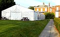 Bosworth Hall marquee, Market Bosworth - geograph.org.uk - 4333218.jpg 800 × 493; 119 KB
-

-
 Bosworth Lake - geograph.org.uk - 4743441.jpg 640 × 401; 28 KB
-
 Bosworth Lake - geograph.org.uk - 4758147.jpg 640 × 426; 52 KB
-
 Bosworth Lake - geograph.org.uk - 4758160.jpg 640 × 398; 39 KB
-
 Bosworth Lake - geograph.org.uk - 4758171.jpg 640 × 426; 48 KB
-
 Bosworth Lake - geograph.org.uk - 4758180.jpg 640 × 426; 61 KB
-
 Bosworth Lake - geograph.org.uk - 4758185.jpg 640 × 409; 47 KB
-
 Bosworth Lake - geograph.org.uk - 4758186.jpg 640 × 426; 44 KB
-
 Bosworth Lake - geograph.org.uk - 4758188.jpg 640 × 426; 49 KB
-
 Bosworth Lake - geograph.org.uk - 4758189.jpg 640 × 426; 52 KB
-
 Bosworth Lake - geograph.org.uk - 4758190.jpg 640 × 426; 50 KB
-
 Bosworth Lake - geograph.org.uk - 4758191.jpg 640 × 426; 59 KB
-
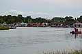
 Bosworth Marina - geograph.org.uk - 4726932.jpg 640 × 426; 45 KB
-
 Bosworth Marina - geograph.org.uk - 4726933.jpg 640 × 381; 29 KB
-
 Bosworth Marina - geograph.org.uk - 4726935.jpg 640 × 426; 37 KB
-
 Bosworth Marina - geograph.org.uk - 4726942.jpg 640 × 344; 57 KB
-
 Bosworth Marina - geograph.org.uk - 4742851.jpg 640 × 426; 76 KB
-
 Bosworth Marina - geograph.org.uk - 4758129.jpg 640 × 426; 69 KB
-
 Bosworth Marina - geograph.org.uk - 4758132.jpg 640 × 426; 71 KB
-

-
 Bosworth Parish Field - Park Street - geograph.org.uk - 3136945.jpg 640 × 480; 92 KB
-
 Bosworth Road - geograph.org.uk - 4490944.jpg 640 × 480; 73 KB
-
 Bosworth Road in Carlton - geograph.org.uk - 5183668.jpg 800 × 530; 179 KB
-

-
 Bosworth Road towards Market Bosworth - geograph.org.uk - 5183681.jpg 800 × 624; 152 KB
-
 Bosworth Road towards Market Bosworth - geograph.org.uk - 922406.jpg 640 × 493; 88 KB
-
 Bosworth Water - geograph.org.uk - 4742876.jpg 640 × 426; 31 KB
-
 Bosworth Water Trust - Cafe - geograph.org.uk - 2374940.jpg 640 × 324; 62 KB
-
 Bosworth Water Trust - geograph.org.uk - 4474291.jpg 640 × 480; 63 KB
-
 Bosworth Water Trust - geograph.org.uk - 4557697.jpg 640 × 480; 59 KB
-
 Bosworth Water Trust - geograph.org.uk - 4709660.jpg 640 × 426; 48 KB
-
 Bosworth Water Trust - geograph.org.uk - 4709663.jpg 640 × 426; 110 KB
-
 Bosworth Water Trust - geograph.org.uk - 922442.jpg 640 × 417; 55 KB
-
 Bosworth Water Trust - geograph.org.uk - 922443.jpg 640 × 466; 60 KB
-
 Bosworth Water Trust - Large Lake - geograph.org.uk - 2374938.jpg 800 × 513; 155 KB
-
 Bosworth Water Trust - Pedalos - geograph.org.uk - 2374949.jpg 800 × 703; 231 KB
-
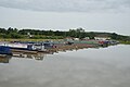
 Bosworth Water Trust - Pontoon Staging - geograph.org.uk - 2374947.jpg 800 × 532; 191 KB
-
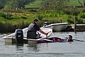 Bosworth Water Trust - Rescue Boat - geograph.org.uk - 2374945.jpg 800 × 537; 231 KB
-
 Bosworth Water Trust sign - geograph.org.uk - 4709651.jpg 640 × 426; 60 KB
-
 Bosworth Wharf Bridge (No. 42) - geograph.org.uk - 4726945.jpg 640 × 426; 88 KB
-
 Bosworth Wharf Bridge (No. 42) - geograph.org.uk - 4726949.jpg 640 × 426; 91 KB
-
 Bosworth Wharf Bridge in Leicestershire - geograph.org.uk - 5298375.jpg 1 280 × 880; 887 KB
-
 Bosworth Wharf Bridge in Leicestershire - geograph.org.uk - 5323927.jpg 1 024 × 655; 615 KB
-
 Bosworth Wharf Bridge No 42 - geograph.org.uk - 5188033.jpg 800 × 769; 231 KB
-
 Bosworth Wharf Bridge, Market Bosworth - geograph.org.uk - 4313462.jpg 800 × 616; 173 KB
-
 Bow Pool - geograph.org.uk - 4754311.jpg 640 × 426; 93 KB
-
 Bow Pool - geograph.org.uk - 4754312.jpg 640 × 426; 80 KB
-
 Bow Pool - geograph.org.uk - 4754326.jpg 640 × 426; 68 KB
-
 Bow Pool - geograph.org.uk - 4754329.jpg 640 × 426; 82 KB
-
 Bow Pool - geograph.org.uk - 4754331.jpg 640 × 426; 66 KB
-
 Bow Pool - geograph.org.uk - 4754332.jpg 640 × 426; 74 KB
-
 Bowling Club - geograph.org.uk - 4754344.jpg 640 × 426; 64 KB
-
 Bus in Market Place, Market Bosworth, img 7912 (16145921260).jpg 3 072 × 2 304; 1,74 MB
-

-
 By the Ashby Canal - geograph.org.uk - 4730669.jpg 640 × 426; 81 KB
-
 Cadeby Lane in Market Bosworth - geograph.org.uk - 1319843.jpg 640 × 359; 70 KB
-


_-_geograph.org.uk_-_4746634.jpg)

_-_geograph.org.uk_-_4746629.jpg)


_-_geograph.org.uk_-_4726945.jpg)
_-_geograph.org.uk_-_4726949.jpg)


.jpg)


