Category:Markt, Mol Belgium
Jump to navigation
Jump to search
| Object location | | View all coordinates using: OpenStreetMap |
|---|
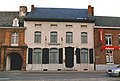
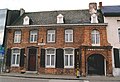
Nederlands: Afbeeldingen van de straat de Markt in Mol-Centrum in de gemeente Mol (België) in de provincie Antwerpen (Belgische provincie) in het noorden van België. De Markt is een deel van de N103 (België) en nabij de N18 (België)
Subcategories
This category has the following 3 subcategories, out of 3 total.
Media in category "Markt, Mol Belgium"
The following 46 files are in this category, out of 46 total.
-
 Burgerhuis te Mol-Centrum.jpg 3,168 × 4,752; 5.41 MB
-
 Enkel huis Mol-Centrum.jpg 3,168 × 4,752; 5.98 MB
-
 Herberg 'Onder den Toren' te Mol-Centrum.jpg 4,324 × 2,883; 7.65 MB
-
 Herenhuis 'De Clercq' of 'De Arend' Mol-Centrum.jpg 4,752 × 3,168; 6.92 MB
-
 Herenhuis 'De Lelie' Mol-Centrum.jpg 4,290 × 3,168; 5.2 MB
-
 Herenhuis 'De Wildeman' Mol-Centrum.jpg 4,752 × 3,168; 5.19 MB
-
 Herenhuis 'Den Engel' Mol-Centrum.jpg 4,752 × 3,168; 6.05 MB
-
 Herenhuis, thans Herba Mol-Centrum.jpg 4,458 × 3,168; 5.45 MB
-
 Herenhuizen 'Het Steentje' en 'Het Baxenshuis' Mol-Centrum.jpg 4,212 × 3,096; 5.14 MB
-
 Huis 'De Meester' Mol-Centrum.jpg 2,586 × 3,168; 2.9 MB
-
 Mol markt 052 - 154090 - onroerenderfgoed.jpg 600 × 798; 32 KB
-
 Mol Markt 1 - 154035 - onroerenderfgoed.jpg 734 × 600; 36 KB
-
 Mol Markt 12 - 154083 - onroerenderfgoed.jpg 755 × 600; 35 KB
-
 Mol Markt 16A - 139615 - onroerenderfgoed.jpg 740 × 591; 166 KB
-
 Mol Markt 16A - 276574 - onroerenderfgoed.jpg 1,440 × 987; 457 KB
-
 Mol Markt 21 - 154084 - onroerenderfgoed.jpg 600 × 789; 36 KB
-
 Mol Markt 22 - 139616 - onroerenderfgoed.jpg 468 × 591; 140 KB
-
 Mol Markt 22 - 276575 - onroerenderfgoed.jpg 1,440 × 982; 419 KB
-
 Mol Markt 24-30 - 139617 - onroerenderfgoed.jpg 742 × 591; 176 KB
-
 Mol Markt 24-30 - 276576 - onroerenderfgoed.jpg 1,440 × 1,005; 412 KB
-
 Mol Markt 24-30 - 276577 - onroerenderfgoed.jpg 986 × 1,440; 458 KB
-
 Mol Markt 24-30 - 276578 - onroerenderfgoed.jpg 1,440 × 994; 454 KB
-
 Mol Markt 24-30 - 276579 - onroerenderfgoed.jpg 1,440 × 973; 406 KB
-
 Mol Markt 24-30 - 276580 - onroerenderfgoed.jpg 1,440 × 987; 554 KB
-
 Mol Markt 24-30 - 276581 - onroerenderfgoed.jpg 978 × 1,440; 345 KB
-
 Mol Markt 3 - 154082 - onroerenderfgoed.jpg 648 × 600; 33 KB
-
 Mol Markt 32 - 139618 - onroerenderfgoed.jpg 752 × 591; 203 KB
-
 Mol Markt 32 - 276582 - onroerenderfgoed.jpg 1,440 × 970; 447 KB
-
 Mol Markt 34 - 154085 - onroerenderfgoed.jpg 800 × 546; 39 KB
-
 Mol Markt 34 - 276583 - onroerenderfgoed.jpg 1,440 × 981; 474 KB
-
 Mol Markt 36 - 276584 - onroerenderfgoed.jpg 984 × 1,440; 425 KB
-
 Mol Markt 38 - 139619 - onroerenderfgoed.jpg 748 × 591; 165 KB
-
 Mol Markt 38 - 276585 - onroerenderfgoed.jpg 1,440 × 969; 398 KB
-
 Mol Markt 38 - 276586 - onroerenderfgoed.jpg 1,440 × 975; 585 KB
-
 Mol Markt 38 - 276587 - onroerenderfgoed.jpg 979 × 1,440; 446 KB
-
 Mol Markt 45 - 154087 - onroerenderfgoed.jpg 704 × 600; 34 KB
-
 Mol Markt 48 - 154088 - onroerenderfgoed.jpg 600 × 768; 31 KB
-
 Mol Markt 5 - 276572 - onroerenderfgoed.jpg 1,440 × 969; 412 KB
-
 Mol Markt 5-3 - 275746 - onroerenderfgoed.jpg 1,440 × 974; 455 KB
-
 Mol Markt 50 - 154089 - onroerenderfgoed.jpg 600 × 758; 32 KB
-
 Mol Markt 62-64 - 154091 - onroerenderfgoed.jpg 800 × 546; 40 KB
-
 Mol Markt 7 - 276573 - onroerenderfgoed.jpg 1,440 × 989; 436 KB
-
 Mol Markt 7-5 - 139614 - onroerenderfgoed.jpg 759 × 591; 170 KB
-
 Neotraditioneel complex te Mol-Centrum.jpg 4,302 × 2,928; 4.05 MB
-
 Rijhuis 'De Oude Post' of 'Het Hemelrijk' Mol-Centrum.jpg 4,752 × 3,168; 5.25 MB
-
 Woningen voor de onderpastoors Mol-Centrum.jpg 4,752 × 3,168; 4.62 MB


