Category:Markt 17, Gouda
Jump to navigation
Jump to search
| Object location | | View all coordinates using: OpenStreetMap |
|---|
 | |||||
| Upload media | |||||
| Instance of |
| ||||
|---|---|---|---|---|---|
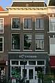
| Location | Gouda, South Holland, Netherlands | ||||
| Street address |
| ||||
| Heritage designation |
| ||||
 | |||||
|
This is a category about rijksmonument number 16851
|
| Address |
|
Media in category "Markt 17, Gouda"
The following 3 files are in this category, out of 3 total.
-
 Markt 17, Gouda (1).jpg 2,432 × 3,711; 4.47 MB
-
 Markt 17, Gouda.jpg 2,048 × 3,072; 2.37 MB
-
 Voorgevel - Gouda - 20082511 - RCE.jpg 944 × 1,200; 228 KB
.jpg)
