Category:Marske, Richmondshire
Jump to navigation
Jump to search
village in Richmondshire, United Kingdom  | |||||
| Upload media | |||||
| Instance of | |||||
|---|---|---|---|---|---|
| Location | Richmondshire, North Yorkshire, Yorkshire and the Humber, England | ||||
| Population |
| ||||
 | |||||
English: Marske is a small crossroads village and civil parish in the English county of North Yorkshire.
Subcategories
This category has the following 6 subcategories, out of 6 total.
B
- Marske Bridge (8 F)
D
- Downholme Bridge (10 F)
E
- St Edmund's Church, Marske (6 F)
M
- Marske Hall, Richmondshire (3 F)
P
- Pillimire Bridge (5 F)
S
- Skelton, Richmondshire (11 F)
Media in category "Marske, Richmondshire"
The following 200 files are in this category, out of 413 total.
(previous page) (next page)-
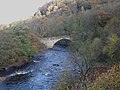 A Bridge Over the River Swale - geograph.org.uk - 286831.jpg 640 × 480; 85 KB
-
 A sign asking for trouble ^ - geograph.org.uk - 6656288.jpg 5,472 × 3,648; 5.34 MB
-
 A Yew grows from a limestone ^ chert scar - geograph.org.uk - 3404540.jpg 4,000 × 3,000; 2.48 MB
-
 A6108 near Kirkgate Wood - geograph.org.uk - 1412082.jpg 640 × 480; 80 KB
-
 Access track to Hutchinson House - geograph.org.uk - 1711788.jpg 2,048 × 1,536; 1.87 MB
-
 Across Marske Beck - geograph.org.uk - 6536253.jpg 5,472 × 3,344; 7.27 MB
-
 Across pastures to a distant obelisk - geograph.org.uk - 6075239.jpg 3,239 × 4,319; 2.74 MB
-
 Across the dale from Rubbing House - geograph.org.uk - 4607348.jpg 4,320 × 3,240; 3.64 MB
-
 Applegarth Scar - geograph.org.uk - 6558766.jpg 1,999 × 1,335; 2.66 MB
-
 Applegarth Scar - geograph.org.uk - 6614456.jpg 2,343 × 1,463; 1.03 MB
-
 Approaching Telfit Farm - geograph.org.uk - 4578874.jpg 3,240 × 4,320; 3.53 MB
-
 Area of disturbed ground - geograph.org.uk - 5544390.jpg 1,500 × 1,125; 1.52 MB
-
 Army range at Cordilleras - geograph.org.uk - 4005270.jpg 640 × 480; 152 KB
-
 At the edge of the range - geograph.org.uk - 5261520.jpg 4,319 × 2,774; 2.46 MB
-
 Avenue of Lime Trees, Marske Hall - geograph.org.uk - 677223.jpg 640 × 426; 273 KB
-
 Avenue of limes at Marske Hall - geograph.org.uk - 6075250.jpg 3,239 × 3,457; 3.95 MB
-
 Barn at Home Farm, Marske - geograph.org.uk - 5547754.jpg 1,024 × 768; 578 KB
-
 Barn Below Deer Park Wood - geograph.org.uk - 677222.jpg 640 × 427; 200 KB
-
 Barn near Marske Hall - geograph.org.uk - 1712006.jpg 1,280 × 914; 496 KB
-
 Barns at Bushy Park - geograph.org.uk - 5616625.jpg 1,024 × 684; 189 KB
-
 Beck and bridge at Helwith - geograph.org.uk - 4579023.jpg 4,320 × 3,240; 4.55 MB
-
 Beech tree below Skelton Lane - geograph.org.uk - 5547895.jpg 1,024 × 768; 929 KB
-
 Bench by Marske Beck - geograph.org.uk - 5547876.jpg 1,024 × 768; 1.29 MB
-
 Benchmark on barn at Bushy Park - geograph.org.uk - 5616610.jpg 1,024 × 684; 231 KB
-
 Benchmark on Clapgate Bank wall - geograph.org.uk - 5616750.jpg 1,024 × 684; 262 KB
-
 Benchmark on Clapgate Bridge - geograph.org.uk - 5616729.jpg 1,024 × 684; 333 KB
-
 Benchmark on gatepost beside track to Sour Nook - geograph.org.uk - 5616556.jpg 1,024 × 684; 263 KB
-
 Beside the road to Marske - geograph.org.uk - 6118422.jpg 1,200 × 1,800; 399 KB
-
 Boulders fallen from Clints Scar - geograph.org.uk - 6560070.jpg 2,000 × 1,228; 2.45 MB
-
 Boundary wall near Deepdale Tree - geograph.org.uk - 1711769.jpg 2,048 × 1,536; 1.64 MB
-
 Boundary wall of the Orangery - geograph.org.uk - 5547886.jpg 1,024 × 768; 1.29 MB
-
 Bridge over Marske Beck - geograph.org.uk - 2275350.jpg 1,600 × 899; 1.77 MB
-
 Bridleway near Orgate Farm - geograph.org.uk - 2130574.jpg 2,048 × 1,536; 1.2 MB
-
 Bridleway on moorland alongside wall - geograph.org.uk - 5544448.jpg 1,500 × 1,125; 1.43 MB
-
 Bridleway through Clints Wood - geograph.org.uk - 4578410.jpg 3,240 × 4,320; 4.05 MB
-
 Bridleway to Hollins Farm - geograph.org.uk - 2388719.jpg 640 × 480; 81 KB
-
 Bridleway to Orgate - geograph.org.uk - 4578428.jpg 4,320 × 3,240; 3.72 MB
-
 Bridleway towards Telfit Bank - geograph.org.uk - 1847935.jpg 1,536 × 2,048; 931 KB
-
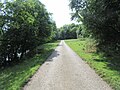
 Building by the river, Marske - geograph.org.uk - 5547850.jpg 1,024 × 768; 856 KB
-
 Bushy Park - geograph.org.uk - 677578.jpg 640 × 425; 250 KB
-
 Cairn below Applegarth Scar - geograph.org.uk - 5929888.jpg 1,024 × 768; 779 KB
-

-

-
 Chapel Cottage, Clints near Marske - geograph.org.uk - 5547816.jpg 1,024 × 768; 880 KB
-
 Church of St Edmund, Marske - geograph.org.uk - 6118258.jpg 1,600 × 1,067; 332 KB
-
 Clapgate Beck - geograph.org.uk - 1050009.jpg 485 × 640; 97 KB
-
 Clapgate Beck - geograph.org.uk - 4005332.jpg 640 × 480; 151 KB
-
 Clapgate Beck - geograph.org.uk - 6118429.jpg 1,600 × 1,136; 246 KB
-
 Clapgate Bridge - geograph.org.uk - 1050017.jpg 640 × 480; 133 KB
-
 Clapgate Gill - geograph.org.uk - 1050026.jpg 640 × 480; 84 KB
-
 Clapgate Gill - geograph.org.uk - 2560998.jpg 3,888 × 2,438; 1.65 MB
-
 Clapgate Gill - geograph.org.uk - 2561008.jpg 3,737 × 2,064; 1.26 MB
-
 Clapgate Gill - geograph.org.uk - 3540467.jpg 3,648 × 2,736; 2.48 MB
-
 Clapgate Gill - geograph.org.uk - 4005336.jpg 640 × 480; 149 KB
-
 Clapgate Gill - geograph.org.uk - 6118428.jpg 1,600 × 1,067; 274 KB
-
 Climbing the Trig - geograph.org.uk - 1847909.jpg 1,536 × 2,048; 1.22 MB
-
 Clinging on to life - geograph.org.uk - 3404531.jpg 3,000 × 4,000; 2.84 MB
-
 Clints Lead Mine - geograph.org.uk - 5717952.jpg 4,000 × 3,000; 3.45 MB
-
 Clints Scar - geograph.org.uk - 2561080.jpg 3,837 × 2,435; 1.63 MB
-
 Clints Scar - geograph.org.uk - 5547919.jpg 1,024 × 768; 602 KB
-
 Coot's nest - geograph.org.uk - 4005315.jpg 640 × 480; 148 KB
-
 Cordilleras Farm - geograph.org.uk - 4005271.jpg 640 × 480; 175 KB
-
 Cordilleras Farm, Marske - geograph.org.uk - 137669.jpg 640 × 479; 98 KB
-
 Cordilleras Lane - geograph.org.uk - 2966121.jpg 1,998 × 2,661; 1.01 MB
-
 Cordilleras Lane - geograph.org.uk - 4005277.jpg 640 × 480; 148 KB
-
 Cordilleras Lane - geograph.org.uk - 4005321.jpg 640 × 480; 128 KB
-
 Cordilleras Lane - geograph.org.uk - 5547889.jpg 1,024 × 768; 1.11 MB
-
 Cordilleras Lane - geograph.org.uk - 6560027.jpg 2,000 × 1,500; 2.84 MB
-
 Cordilleras Lane, Marske - geograph.org.uk - 4005299.jpg 640 × 480; 231 KB
-
 Cottage at Hardstiles Top - geograph.org.uk - 3539048.jpg 3,492 × 2,514; 2.88 MB
-
 Cottage with unusual end, Clints nr. Marske - geograph.org.uk - 2257563.jpg 1,280 × 853; 485 KB
-
 Cottages in valley of Marske Beck - geograph.org.uk - 2275342.jpg 1,600 × 1,111; 2.04 MB
-
 Dales Beck - geograph.org.uk - 6124036.jpg 1,600 × 1,067; 348 KB
-
 Dales Beck, Marrick - geograph.org.uk - 2390292.jpg 640 × 482; 91 KB
-
 Dales Beck, Marrick - geograph.org.uk - 2390330.jpg 640 × 480; 86 KB
-
 David's House, Clints - geograph.org.uk - 5547933.jpg 1,024 × 768; 797 KB
-
 Derelict wall on Cock How - geograph.org.uk - 6682821.jpg 5,469 × 3,078; 7.32 MB
-
 Descending into the valley - geograph.org.uk - 4578447.jpg 3,240 × 4,320; 3.78 MB
-
 Dicky Edge above Throstle Gill - geograph.org.uk - 5716762.jpg 4,000 × 3,000; 2.9 MB
-
 Dicky Edge House (ruin) - geograph.org.uk - 5716758.jpg 4,000 × 3,000; 4.07 MB
-
 Downholme Bridge - geograph.org.uk - 2290626.jpg 1,024 × 768; 208 KB
-
 Downholme Bridge - geograph.org.uk - 2388506.jpg 640 × 482; 78 KB
-
 Downholme Bridge - geograph.org.uk - 6074984.jpg 4,320 × 3,240; 3.39 MB
-
 Downholme Bridge - geograph.org.uk - 6091120.jpg 1,600 × 1,046; 410 KB
-
 Downholme Bridge, near Marske - geograph.org.uk - 2131719.jpg 1,280 × 853; 654 KB
-
 Downstream along the Swale - geograph.org.uk - 6074963.jpg 4,161 × 3,121; 4.07 MB
-
 Dry stone wall - geograph.org.uk - 2290696.jpg 1,024 × 768; 118 KB
-

-
 Drystone wall near Marrick - geograph.org.uk - 2389883.jpg 640 × 481; 94 KB
-

-
 Entrance and drive to Park Top Farm - geograph.org.uk - 3540480.jpg 3,594 × 2,662; 2.03 MB
-
 Entrance to Feldom 5B GPMG SF and Mortar range - geograph.org.uk - 1762527.jpg 2,880 × 2,160; 1.28 MB
-
 Entrance to Feldom Ranges - geograph.org.uk - 4005274.jpg 640 × 480; 100 KB
-
 Entrance to Feldom Ranges - geograph.org.uk - 4005318.jpg 640 × 480; 125 KB
-
 Entrance to Feldom Ranges - geograph.org.uk - 4005356.jpg 640 × 480; 112 KB
-
 Entrance track to Sour Nook - geograph.org.uk - 5616571.jpg 1,024 × 684; 337 KB
-
 Farm House at Bushy Park, Marske - geograph.org.uk - 1711994.jpg 1,600 × 1,067; 429 KB
-
 Farm track near Orgate - geograph.org.uk - 4578450.jpg 4,320 × 3,240; 2.96 MB
-
 Farmland at Harstiles Top - geograph.org.uk - 1583274.jpg 640 × 480; 53 KB
-
 Feldom Gill - geograph.org.uk - 3400300.jpg 4,000 × 3,000; 2.95 MB
-
 Feldom lane in sporting condition - geograph.org.uk - 2188678.jpg 4,320 × 3,240; 5.27 MB
-
 Feldom range - Marske Moor - geograph.org.uk - 1762513.jpg 3,072 × 2,304; 2.9 MB
-
 Feldom Ranges - geograph.org.uk - 4005329.jpg 640 × 480; 138 KB
-
 Feldom Ranges - geograph.org.uk - 4005361.jpg 640 × 480; 172 KB
-
 Feldom Ranges - geograph.org.uk - 4005368.jpg 640 × 480; 120 KB
-
 Field below Telfit Bank - geograph.org.uk - 5544407.jpg 1,500 × 1,125; 1.22 MB
-
 Field north of Hollins Farm - geograph.org.uk - 5929877.jpg 1,024 × 768; 620 KB
-
 Fine Views from Clapgate Scar - geograph.org.uk - 3400313.jpg 4,000 × 3,000; 3.15 MB
-
 Flytip near Marrick - geograph.org.uk - 2389914.jpg 640 × 480; 71 KB
-
 Footbridge at Ellers - geograph.org.uk - 6656308.jpg 5,472 × 3,648; 6.52 MB
-
 Footpath along Clapgate Gill from Clapgate Bank - geograph.org.uk - 5616813.jpg 1,024 × 684; 193 KB
-
 Footpath Along Marske Beck - geograph.org.uk - 676846.jpg 640 × 426; 303 KB
-
 Footpath beside Marske Beck - geograph.org.uk - 6118413.jpg 1,600 × 1,067; 614 KB
-
 Footpath by Marske Beck - geograph.org.uk - 2389072.jpg 640 × 480; 93 KB
-
 Footpath near Marske - geograph.org.uk - 2388726.jpg 640 × 481; 79 KB
-
 Footpath to Helwith - geograph.org.uk - 6536267.jpg 5,472 × 3,648; 7.11 MB
-
 Footpath to Marrick Mills - geograph.org.uk - 677521.jpg 640 × 425; 218 KB
-
 Ford at Helwith - geograph.org.uk - 4579016.jpg 4,320 × 3,240; 3.44 MB
-
 Ford at Helwith Bridge - geograph.org.uk - 4460393.jpg 3,872 × 2,592; 4.72 MB
-
 Fossils in the limestone, Clapgate Scar - geograph.org.uk - 3400321.jpg 4,000 × 3,000; 3.87 MB
-
 Fungus on a tree stump - geograph.org.uk - 5547931.jpg 1,024 × 768; 1.28 MB
-
 Gate over the hedge, Marske - geograph.org.uk - 2388735.jpg 640 × 481; 74 KB
-
 Gateway opposite Otterington Plantation - geograph.org.uk - 5616710.jpg 1,024 × 684; 220 KB
-
 Gravelled road approaching woodland - geograph.org.uk - 6559976.jpg 2,000 × 1,500; 2.11 MB
-
 Grazing land, Downholme - geograph.org.uk - 2388702.jpg 640 × 481; 75 KB
-
 Grazings east of Marske - geograph.org.uk - 5929884.jpg 1,024 × 768; 757 KB
-
 Grouse on the wall - geograph.org.uk - 6074107.jpg 4,320 × 3,240; 1.8 MB
-
 Hardstile - geograph.org.uk - 5929880.jpg 1,024 × 768; 762 KB
-
 Hardstiles Top - geograph.org.uk - 2290666.jpg 1,024 × 768; 135 KB
-
 Head of side valley off Clapgate Gill - geograph.org.uk - 4005349.jpg 640 × 480; 136 KB
-
 Heather beginning to bloom - geograph.org.uk - 6560051.jpg 1,999 × 1,230; 2.06 MB
-
 Heather moorland in the Feldom Ranges - geograph.org.uk - 5915591.jpg 2,000 × 968; 1.76 MB
-
 Helwith - geograph.org.uk - 4678769.jpg 640 × 480; 108 KB
-
 Helwith Bridge - geograph.org.uk - 2130664.jpg 2,048 × 1,536; 1.4 MB
-
 Helwith Bridge - geograph.org.uk - 2561188.jpg 3,888 × 2,536; 2.47 MB
-
 Hey Gill - geograph.org.uk - 3400295.jpg 3,475 × 1,697; 1.61 MB
-
 Hill slopes of Clapgate Gill - geograph.org.uk - 6558807.jpg 2,000 × 1,485; 2.53 MB
-
 Hillside above Marske - geograph.org.uk - 4005304.jpg 640 × 480; 260 KB
-
 Hillside above the Orgate bridleway - geograph.org.uk - 6537523.jpg 5,472 × 2,736; 7.55 MB
-
 Hillside at Rubbing House - geograph.org.uk - 4607345.jpg 4,320 × 3,240; 4.01 MB
-
 House and old barn in Marske - geograph.org.uk - 4005288.jpg 640 × 480; 128 KB
-
 Housing in Marske - geograph.org.uk - 5929882.jpg 1,024 × 768; 769 KB
-
 Hutton's Monument - geograph.org.uk - 1810768.jpg 3,084 × 2,034; 831 KB
-
 Huttons Monument - geograph.org.uk - 1525583.jpg 640 × 480; 64 KB
-
 Isolated Pinnacle on Clints Scar - geograph.org.uk - 5717981.jpg 3,000 × 4,000; 4.25 MB
-
 Isolated Tree, Grass Moor - geograph.org.uk - 864011.jpg 640 × 427; 199 KB
-
 Keep Out - geograph.org.uk - 2966167.jpg 3,248 × 2,187; 1.82 MB
-
 Lime Kiln at Hollins Farm - geograph.org.uk - 513587.jpg 640 × 359; 59 KB
-
 Lime Kiln on Clapgate Bank - geograph.org.uk - 3404560.jpg 3,737 × 2,493; 2.17 MB
-
 Line of old shafts - geograph.org.uk - 6074748.jpg 4,319 × 2,804; 1.74 MB
-
 Lone tree in field near Skelton - geograph.org.uk - 6686647.jpg 2,000 × 1,333; 1.8 MB
-
 Looking down Clapgate Bank - geograph.org.uk - 3917465.jpg 3,264 × 2,448; 3.16 MB
-
 Looking over the dry stone walls - geograph.org.uk - 6124039.jpg 1,600 × 1,118; 225 KB
-
 Low Hollings, Marske. - geograph.org.uk - 513577.jpg 640 × 359; 91 KB
-
 Manor House - geograph.org.uk - 5616822.jpg 1,024 × 684; 135 KB
-
 Marske - geograph.org.uk - 2561042.jpg 3,867 × 2,053; 1.11 MB
-
 Marske Beck - geograph.org.uk - 2389039.jpg 640 × 481; 76 KB
-
 Marske Beck - geograph.org.uk - 2389077.jpg 640 × 481; 112 KB
-
 Marske Beck - geograph.org.uk - 4578434.jpg 3,240 × 4,320; 4.46 MB
-
 Marske Beck - geograph.org.uk - 5547881.jpg 1,024 × 768; 1.01 MB
-
 Marske Beck valley - geograph.org.uk - 4578423.jpg 4,320 × 3,240; 3.07 MB
-
 Marske Hall gardens - geograph.org.uk - 6075253.jpg 4,300 × 2,476; 3.7 MB
-
 Marske Steps - geograph.org.uk - 1058628.jpg 640 × 480; 154 KB
-
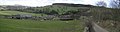
 Marske Village - geograph.org.uk - 128583.jpg 640 × 480; 123 KB
-
 Marske Village.jpg 640 × 170; 34 KB
-
 Mature Tree in a Field - geograph.org.uk - 4682686.jpg 640 × 480; 71 KB
-
 Mature Tree in a Field - geograph.org.uk - 4682693.jpg 640 × 480; 89 KB
-
 Memorial, Marske - geograph.org.uk - 2389116.jpg 640 × 481; 79 KB
-
 Military Exercises - geograph.org.uk - 2622418.jpg 1,000 × 606; 196 KB
-

-
 Moor House - geograph.org.uk - 5547935.jpg 1,024 × 768; 1.03 MB
-
 Moor House Gill Bridge - geograph.org.uk - 5718002.jpg 3,000 × 4,000; 4.1 MB
-
 Moss on the wall, Marrick - geograph.org.uk - 2389901.jpg 640 × 480; 81 KB
-
 Munn End - geograph.org.uk - 2561147.jpg 3,635 × 2,478; 1.79 MB
-
 Musgrove or Cleaburn Pasture - geograph.org.uk - 2290677.jpg 1,024 × 768; 114 KB
-
 Nanny Miller Spring - geograph.org.uk - 2561027.jpg 3,888 × 2,438; 1.85 MB
-
 Near Oxque Bridge - geograph.org.uk - 5887523.jpg 2,048 × 1,536; 1.52 MB
-
 Nissen hut on Cordilleras Lane - geograph.org.uk - 4005273.jpg 640 × 480; 200 KB
-
 North from Skelton Moor - geograph.org.uk - 4579034.jpg 4,320 × 3,240; 3.54 MB
-
 Old Cut Bench Mark on a Gatepost on Telfit Bank - geograph.org.uk - 5718185.jpg 3,000 × 4,000; 4.53 MB
-
 Old plough lines above the river - geograph.org.uk - 6074970.jpg 3,937 × 2,686; 1.7 MB
-
 Old Waterwheel at Marske - geograph.org.uk - 71424.jpg 640 × 430; 125 KB
-

-
 Old waterwheel by Pillimire Bridge, Marske - geograph.org.uk - 5607243.jpg 5,184 × 2,920; 7.31 MB
-
 On Bent Hill - geograph.org.uk - 864052.jpg 640 × 427; 187 KB
-
 On Wether Hill - geograph.org.uk - 865111.jpg 640 × 427; 173 KB
-
 Or gate Force in spate - geograph.org.uk - 4754844.jpg 640 × 480; 109 KB
-
 Orgate Bridge - geograph.org.uk - 4578439.jpg 4,320 × 3,240; 2.83 MB
-
 Orgate Bridge Ford - geograph.org.uk - 5718926.jpg 4,032 × 3,024; 4.71 MB
-
 Orgate Farm - geograph.org.uk - 4578432.jpg 3,240 × 2,880; 2.53 MB
-
 Orgate Farm - geograph.org.uk - 5547928.jpg 1,024 × 768; 795 KB
-
 Orgate Force - geograph.org.uk - 2233120.jpg 1,024 × 768; 257 KB
-
 Orgate Force - geograph.org.uk - 4712712.jpg 3,751 × 2,500; 1.97 MB
-
 Orgate Force - geograph.org.uk - 6630180.jpg 1,600 × 1,200; 571 KB
-
 Orgate Force on Marske Beck - geograph.org.uk - 957804.jpg 640 × 480; 149 KB
-
 Ornamental Lake, Marske Hall - geograph.org.uk - 2131698.jpg 1,280 × 853; 450 KB
-
 Pack Horse bridge over Marske Beck - geograph.org.uk - 2540146.jpg 1,770 × 1,161; 459 KB
-
 Paddy's Bridge - geograph.org.uk - 1502540.jpg 640 × 480; 127 KB
-
 Pastures between Marske ^ Pillimire Bridge - geograph.org.uk - 5607237.jpg 5,184 × 2,920; 5.48 MB
-
 Path across the moor - geograph.org.uk - 4579042.jpg 4,320 × 3,240; 2.62 MB


_-_geograph.org.uk_-_5716758.jpg)


