Category:Marston Meysey
Jump to navigation
Jump to search
civil parish in Wiltshire, England  | |||||
| Upload media | |||||
| Instance of | |||||
|---|---|---|---|---|---|
| Location | Wiltshire, South West England, England | ||||
| official website | |||||
 | |||||
English: Marston Meysey, pronounced and sometimes also spelt Marston Maisey, is a village in Wiltshire, England, lying three miles north east of Cricklade on the county boundary with Gloucestershire.
Subcategories
This category has only the following subcategory.
M
Media in category "Marston Meysey"
The following 69 files are in this category, out of 69 total.
-
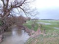 Ampney Brook from Sheeppen Bridge - geograph.org.uk - 350346.jpg 640 × 480; 109 KB
-
 B1 at Fairford - geograph.org.uk - 5431725.jpg 1,000 × 662; 602 KB
-
 B1 at Fairford - geograph.org.uk - 5431726.jpg 1,000 × 662; 490 KB
-
 B52 at Fairford - geograph.org.uk - 5431545.jpg 1,000 × 662; 445 KB
-
 Barn, Marston Meysey - geograph.org.uk - 3336033.jpg 4,000 × 3,000; 3.44 MB
-
 Barns south-west of Manor House, Marston Meysey - geograph.org.uk - 3351697.jpg 4,000 × 3,000; 2.85 MB
-

-
 Bridleway, Marston Meysey - geograph.org.uk - 3350849.jpg 4,000 × 3,000; 2.87 MB
-
 Country lane, Marston Meysey - geograph.org.uk - 3251357.jpg 4,000 × 3,000; 2.95 MB
-
 Drive at Round House Farm - geograph.org.uk - 3276556.jpg 768 × 1,024; 539 KB
-

-
 Entrance to new gravel works near Marston Meysey - geograph.org.uk - 3276551.jpg 1,024 × 768; 487 KB
-
 Entrance to the Old Spotted Cow pub - geograph.org.uk - 1570497.jpg 640 × 480; 123 KB
-
 Fairford Airbase - geograph.org.uk - 2144144.jpg 640 × 480; 32 KB
-
 Farmland north of Castle Eaton - geograph.org.uk - 5079666.jpg 2,592 × 1,944; 2.03 MB
-
 Farmland north-west of Castle Eaton - geograph.org.uk - 5079674.jpg 2,592 × 1,944; 2.14 MB
-
 Field of wheat - geograph.org.uk - 5455902.jpg 1,024 × 768; 256 KB
-
 Fields north of Castle Eaton - geograph.org.uk - 3265389.jpg 4,000 × 3,000; 2.92 MB
-
 Former byway to Marston Meysey - geograph.org.uk - 5455847.jpg 1,024 × 768; 329 KB
-

-
 Grange Farmhouse, Marston Meysey - geograph.org.uk - 3348718.jpg 3,928 × 2,888; 3.06 MB
-
 House beside a country road - geograph.org.uk - 5455963.jpg 1,024 × 768; 222 KB
-
 Houses along The Street, Marston Meysey - geograph.org.uk - 1570865.jpg 640 × 480; 145 KB
-
 In old colours - geograph.org.uk - 4586754.jpg 2,304 × 1,704; 1.38 MB
-
 Lake below Marston Hill House - geograph.org.uk - 2878735.jpg 4,000 × 3,000; 5.65 MB
-
 Land south of Marston Meysey Roundhouse - geograph.org.uk - 3350871.jpg 4,000 × 3,000; 2.87 MB
-
 Lane - geograph.org.uk - 5431779.jpg 1,000 × 662; 949 KB
-

-
 Magpies Farm (formerly the Three Magpies public house) - geograph.org.uk - 2878500.jpg 3,984 × 2,692; 6.2 MB
-
 Marston Hill - geograph.org.uk - 332212.jpg 640 × 446; 52 KB
-
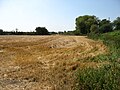
 Marston Meysey gravel workiing - geograph.org.uk - 1177717.jpg 640 × 480; 40 KB
-
 Marston Meysey roundhouse (geograph 3336995).jpg 3,904 × 2,920; 3.3 MB
-
 Marston Meysey, Wiltshire - geograph.org.uk - 1137400.jpg 640 × 480; 140 KB
-
 Middle House, The Street, Marston Meysey (geograph 3350903).jpg 4,000 × 3,000; 2.87 MB
-
 Minor road, Castle Eaton - geograph.org.uk - 3248844.jpg 1,024 × 766; 156 KB
-
 Old Spotted Cow pub, Marston Meysey - geograph.org.uk - 1570501.jpg 640 × 480; 138 KB
-
 Public footpath to Marston Meysey Roundhouse - geograph.org.uk - 3350864.jpg 4,000 × 3,000; 2.79 MB
-
 Public footpath, Marston Meysey - geograph.org.uk - 3348721.jpg 3,000 × 4,000; 2.7 MB
-
 RAF Fairford - geograph.org.uk - 1054401.jpg 640 × 427; 76 KB
-
 RAF Fairford crash gate - geograph.org.uk - 5431763.jpg 1,000 × 662; 792 KB
-
 RAF Fairford crash gate - geograph.org.uk - 5431764.jpg 1,000 × 662; 822 KB
-
 RAF Fairford perimeter fence - geograph.org.uk - 5431774.jpg 1,000 × 662; 951 KB
-
 RAF Fairford perimeter fence - geograph.org.uk - 5431776.jpg 1,000 × 662; 866 KB
-
 Road junction, near Marston Meysey - geograph.org.uk - 1137424.jpg 640 × 480; 145 KB
-
 Route of public footpath east of Marston Meysey Roundhouse - geograph.org.uk - 3350875.jpg 4,000 × 3,000; 3.19 MB
-
 Sheeppen Bridge inscription - geograph.org.uk - 354578.jpg 640 × 480; 98 KB
-
 Staring down the barrel - geograph.org.uk - 4583290.jpg 1,704 × 2,304; 1,002 KB
-
 Telephone box outside former post office - geograph.org.uk - 1570870.jpg 640 × 480; 152 KB
-

-

-
 The north-east end of The Street, Marston Meysey - geograph.org.uk - 3276247.jpg 1,024 × 768; 534 KB
-
 The Old Post Office, The Street, Marston Meysey - geograph.org.uk - 3350906.jpg 4,000 × 3,000; 2.88 MB
-
 The Old Spotted Cow - geograph.org.uk - 3276253.jpg 1,024 × 768; 504 KB
-

-
 Three Wells House, The Street, Marston Meysey - geograph.org.uk - 3336092.jpg 4,000 × 3,000; 2.84 MB
-
 Un-named lane junction south of Blackburr Farm - geograph.org.uk - 3938656.jpg 3,598 × 2,656; 1.9 MB
-
 Wetstone Bridge - geograph.org.uk - 3276564.jpg 1,024 × 768; 500 KB
-

-
 Culvert by the lane to Marston Meysey - geograph.org.uk - 350350.jpg 640 × 480; 123 KB
-
 Isis in flood 4 - geograph.org.uk - 357130.jpg 640 × 480; 69 KB
-
 No through road - geograph.org.uk - 331075.jpg 640 × 480; 83 KB
-
 Oaks Road - geograph.org.uk - 350348.jpg 640 × 480; 113 KB
-
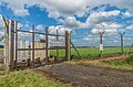
 Perimeter gate, RAF Fairford - geograph.org.uk - 331071.jpg 640 × 480; 81 KB
-
 Round House farm - geograph.org.uk - 330891.jpg 640 × 480; 77 KB
-
 South Leaze cottage - geograph.org.uk - 331080.jpg 640 × 480; 94 KB
-
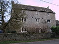
 The Manor, Marston Meysey - geograph.org.uk - 331047.jpg 640 × 480; 67 KB
-
 The Old Spotted Cow - geograph.org.uk - 331038.jpg 640 × 456; 78 KB
-
 The Old vicarage, Marston Meysey - geograph.org.uk - 331051.jpg 640 × 480; 78 KB
-
 The Street, Marston Meysey - geograph.org.uk - 331056.jpg 640 × 480; 80 KB


_-_geograph.org.uk_-_2878500.jpg)


.jpg)

.jpg)


