Category:May 1990 in Wales
Jump to navigation
Jump to search
English: Images taken in Wales in this month of 1990 (not the date of the upload).
| Jan | Feb | Mar | Apr | May | Jun | Jul | Aug | Sep | Oct | Nov | Dec | ||
| ← | 0 | 1 | 11 | 3 | 37 | 2 | 1 | 10 | 19 | 0 | 0 | 0 | → |
|---|
Media in category "May 1990 in Wales"
The following 37 files are in this category, out of 37 total.
-
 17.05.90 Barmouth 150.118 (6710344021).jpg 1,560 × 1,023; 375 KB
-
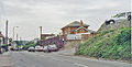
 Aberbeeg junction of railways and valley geograph-3222919-by-Ben-Brooksbank.jpg 2,371 × 1,624; 4.58 MB
-
 Abergavenny Brecon Road geograph-3918626-by-Ben-Brooksbank.jpg 2,344 × 1,375; 3.12 MB
-
 Bynea station geograph-3271994-by-Ben-Brooksbank.jpg 2,395 × 1,488; 3.77 MB
-
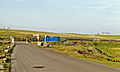
 Caerau station site geograph-3295458-by-Ben-Brooksbank.jpg 2,256 × 1,450; 2.99 MB
-
 Caerleon station site geograph-3295041-by-Ben-Brooksbank.jpg 2,360 × 1,628; 3.91 MB
-
 Caerphilly station geograph-3831208-by-Ben-Brooksbank.jpg 2,390 × 1,440; 2.08 MB
-
 Church Village Halt site geograph-3306011-by-Ben-Brooksbank.jpg 1,748 × 1,094; 1.53 MB
-
 Cilfrew station site geograph-3306122-by-Ben-Brooksbank.jpg 2,395 × 1,352; 2.36 MB
-
 Clydach-on-Tawe South site of station geograph-3310065-by-Ben-Brooksbank.jpg 2,395 × 1,504; 2.98 MB
-

-
 Cockett station site geograph-3311652-by-Ben-Brooksbank.jpg 2,395 × 1,563; 3.67 MB
-
 Coelbren geograph-3854271-by-Ben-Brooksbank.jpg 2,363 × 1,590; 2.93 MB
-
 Conwy Bay as viewed from Penmaen-bach - geograph.org.uk - 476056.jpg 640 × 395; 48 KB
-
 Conwy Mountain path - geograph.org.uk - 476124.jpg 640 × 391; 43 KB
-
 Craig-y-nos (Penwyllt) station (remains) geograph-3325235-by-Ben-Brooksbank.jpg 2,353 × 1,461; 3 MB
-
 Cross Hands station site geograph-3361063-by-Ben-Brooksbank.jpg 2,395 × 1,456; 3.62 MB
-
 Cross Inn station (remains) geograph-3334440-by-Ben-Brooksbank.jpg 1,196 × 604; 860 KB
-
 Cross Keys station site geograph-3334467-by-Ben-Brooksbank.jpg 2,331 × 1,490; 2.21 MB
-
 Crumlin (High Level) station site geograph-3341574-by-Ben-Brooksbank.jpg 2,395 × 1,436; 3.13 MB
-
 Crumlin (Low Level) station site geograph-3341633-by-Ben-Brooksbank.jpg 2,352 × 1,380; 2.78 MB
-
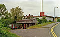
 Crumlin Viaduct site geograph-3342868-by-Ben-Brooksbank.jpg 2,320 × 1,533; 4.44 MB
-
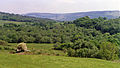
 Cwm Afon valley geograph-3362788-by-Ben-Brooksbank.jpg 2,271 × 1,557; 2.99 MB
-
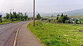
 Cwm Bargoed station site geograph-3360380-by-Ben-Brooksbank.jpg 2,394 × 1,443; 3.19 MB
-
 Cwm station site geograph-3360013-by-Ben-Brooksbank.jpg 2,345 × 1,445; 3.32 MB
-
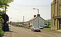
 Cwmavon station site geograph-3360079-by-Ben-Brooksbank.jpg 2,335 × 1,492; 2.5 MB
-
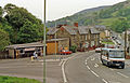
 Cwmbran station geograph-3859536-by-Ben-Brooksbank.jpg 2,401 × 1,547; 3.31 MB
-
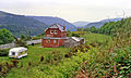
 Cwmdu station site and Llynvi Valley geograph-3361007-by-Ben-Brooksbank.jpg 2,395 × 1,474; 2.83 MB
-
 Cwmllynfell station site geograph-3361034-by-Ben-Brooksbank.jpg 2,345 × 1,308; 2.29 MB
-
 Cymmer stations site geograph-3363035-by-Ben-Brooksbank.jpg 2,354 × 1,575; 4.16 MB
-
 Dingestow station site geograph-3412608-by-Ben-Brooksbank.jpg 2,343 × 1,455; 3.62 MB
-
-
 Gallows Point at low tide - geograph.org.uk - 476169.jpg 640 × 419; 66 KB
-
 Summit of Penmaen-bach - geograph.org.uk - 476097.jpg 640 × 417; 63 KB
-
 Sychnant Pass - geograph.org.uk - 476010.jpg 640 × 418; 51 KB
-
 Valley of the Gele, after flood - geograph.org.uk - 60430.jpg 640 × 431; 55 KB
-
 View east over Afon Conwy from Cogwrn - geograph.org.uk - 476040.jpg 640 × 419; 66 KB
.jpg)


_station_(remains)_geograph-3325235-by-Ben-Brooksbank.jpg)

_geograph-3334440-by-Ben-Brooksbank.jpg)

_station_site_geograph-3341574-by-Ben-Brooksbank.jpg)
_station_site_geograph-3341633-by-Ben-Brooksbank.jpg)


