Category:May 2001 in Argyll and Bute
Jump to navigation
Jump to search
Council areas (municipalities) of Scotland: Aberdeenshire · Argyll and Bute · Edinburgh · Highland · North Ayrshire · Perth and Kinross ·
Deutsch: Bilder, die im Mai 2001 in Argyll and Bute aufgenommen worden sind. Bitte beachten Sie, dass dies weder das Datum des Uploads noch das Datum des Scannens eines Fotos ist.
English: Images/pictures taken in Argyll and Bute during May 2001. Note this is not the date of the upload, nor the date a photo was scanned.
Español: Fotografías o imágenes tomadas en Argyll and Bute durante mayo 2001. No es la fecha de subida ni escaneo, sino la fecha en que las fotografías o imágenes se crearon.
Esperanto: Bildoj faritaj en Argyll and Bute en majo 2001. Tio ne estas la dato, kiam la bildoj estis alŝutitaj aŭ skanitaj.
Français : Photographies ou images prises en Argyll and Bute durant mai 2001. Ce n'est pas la date du téléchargement ou du scan.
Galego: Fotografías ou imaxes tomadas en Argyll and Bute durante maio 2001. Non é a data de subida nin escaneamento, senón a data na que se crearon as fotografías ou imaxes.
Italiano: Fotografie o immagini scattate a Argyll and Bute nel maggio 2001. Nota bene: la data non si riferisce né a quella di upload né a quella in cui la foto è stata digitalizzata.
Norsk bokmål: Bilder tatt i Argyll and Bute i løpet av mai 2001. Merk at dette ikke er datoen for opplasting, eller når et bilde har blitt skannet.
Norsk nynorsk: Bilete teke i Argyll and Bute i løpet av mai 2001. Merk at dette ikkje er datoen for opplasting, eller når eit bilete har vorte skanna.
Русский: Изображения, сделанные в Argyll and Bute в течение май 2001 (не дата загрузки изображения).
Українська: Зображення, зроблені в Argyll and Bute протягом травень 2001. Зауважте, що це не дата завантаження чи дата сканування фотографії.
| May 2000 | ← | May 2001 | → | May 2002 | |||||||
| Jan | Feb | Mar | Apr | May | Jun | Jul | Aug | Sep | Oct | Nov | Dec |
| 0 | 0 | 0 | 0 | 55 | 0 | 0 | 0 | 0 | 0 | 0 | 0 |
|---|---|---|---|---|---|---|---|---|---|---|---|
Media in category "May 2001 in Argyll and Bute"
The following 55 files are in this category, out of 55 total.
-
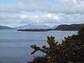
 Above the Sound of Mull - geograph.org.uk - 972159.jpg 640 × 480; 60 KB
-
 Back Bay, Iona - geograph.org.uk - 920192.jpg 640 × 480; 75 KB
-
 Basalt columns, Fingal's Cave, Staffa - geograph.org.uk - 841687.jpg 480 × 640; 122 KB
-
 Bay at Fionnphort - geograph.org.uk - 972188.jpg 640 × 480; 61 KB
-
 Ben More from Glen Leidle - geograph.org.uk - 972183.jpg 640 × 480; 61 KB
-
 Bunessan Jetty - geograph.org.uk - 920200.jpg 640 × 480; 68 KB
-
 Calgary Bay, Isle of Mull - geograph.org.uk - 920072.jpg 640 × 236; 39 KB
-
 Carsaig Bay - geograph.org.uk - 972177.jpg 480 × 640; 65 KB
-
 Carsaig Bay, Isle of Mull - geograph.org.uk - 920103.jpg 640 × 480; 69 KB
-

-
 Clachan Bridge Isle of Seil - geograph.org.uk - 961453.jpg 626 × 428; 62 KB
-
 Clear Felling at Bloody Bay - geograph.org.uk - 971825.jpg 640 × 480; 54 KB
-
 Columnar Basalt on Staffa - geograph.org.uk - 920186.jpg 640 × 480; 97 KB
-
 Cove by the Jetty - geograph.org.uk - 972935.jpg 480 × 640; 91 KB
-
 Cruise Ship in Oban Harbour - geograph.org.uk - 971804.jpg 640 × 480; 56 KB
-

-
 Dervaig - geograph.org.uk - 971838.jpg 640 × 254; 31 KB
-
 Dun I - geograph.org.uk - 972993.jpg 640 × 480; 48 KB
-
 Dunollie Castle, Oban - geograph.org.uk - 920060.jpg 640 × 480; 64 KB
-
 Eilean a'Chapuill - geograph.org.uk - 1228544.jpg 640 × 460; 100 KB
-
 Faerie Isles - geograph.org.uk - 1228549.jpg 640 × 460; 98 KB
-
 Fingal's Cave, Staffa - geograph.org.uk - 920188.jpg 640 × 480; 119 KB
-

-
 Glengorm Castle - geograph.org.uk - 971815.jpg 640 × 480; 49 KB
-
 Goat on the Foreshore east of Carsaig Bay - geograph.org.uk - 920106.jpg 640 × 480; 129 KB
-
 Iona Abbey in the Early Morning - geograph.org.uk - 972926.jpg 640 × 402; 44 KB
-
 Iona Ferry at Fionnphort - geograph.org.uk - 972883.jpg 640 × 480; 59 KB
-

-
 Loch Na Keal - geograph.org.uk - 972154.jpg 640 × 480; 41 KB
-
 Loch Scridain from Knockan - geograph.org.uk - 973461.jpg 640 × 480; 54 KB
-
 Loch Tuath - geograph.org.uk - 972111.jpg 640 × 480; 46 KB
-
 Loch Tuath - geograph.org.uk - 972119.jpg 640 × 480; 47 KB
-
 Maclean's Cross, Iona - geograph.org.uk - 972919.jpg 480 × 640; 82 KB
-
 Oban Harbour - geograph.org.uk - 920057.jpg 640 × 480; 65 KB
-
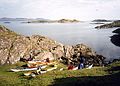 Port Bealach nan Gail - geograph.org.uk - 1228538.jpg 640 × 460; 100 KB
-
 Port Uisken - geograph.org.uk - 973009.jpg 640 × 480; 79 KB
-
 Puffin on the North coast of Staffa - geograph.org.uk - 841694.jpg 480 × 640; 66 KB
-
 Puffins on the North-west coast of Staffa - geograph.org.uk - 841698.jpg 640 × 480; 108 KB
-
 Rockpool Life - geograph.org.uk - 920110.jpg 640 × 480; 138 KB
-
 Rocks on the Beach at Fionnphort - geograph.org.uk - 972192.jpg 480 × 640; 60 KB
-
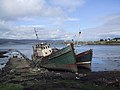 Rotting boats at Salen, Isle of Mull - geograph.org.uk - 920093.jpg 640 × 480; 64 KB
-
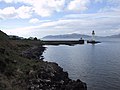
 Rubha nan Gall Lighthouse - geograph.org.uk - 972173.jpg 640 × 480; 57 KB
-
 Shoreline North of Tobermory - geograph.org.uk - 972171.jpg 640 × 480; 60 KB
-
 South Side of Calgary Bay - geograph.org.uk - 971860.jpg 640 × 480; 68 KB
-
 The Abbey, Iona - geograph.org.uk - 920196.jpg 640 × 480; 61 KB
-
 The Landing Stage on Staffa - geograph.org.uk - 972978.jpg 640 × 480; 115 KB
-
 The Nunnery, Iona - geograph.org.uk - 972909.jpg 480 × 640; 76 KB
-
 The Sound Of Mull - geograph.org.uk - 972170.jpg 640 × 480; 57 KB
-
 The South End of Staffa - geograph.org.uk - 972945.jpg 640 × 480; 54 KB
-
 The stalkers path from Loch na Tuadh - geograph.org.uk - 873437.jpg 448 × 640; 112 KB
-
 The West Coast of Staffa - geograph.org.uk - 972968.jpg 640 × 480; 73 KB
-
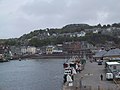
 Tobermory Waterfront - geograph.org.uk - 920066.jpg 640 × 480; 70 KB
-

-
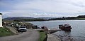 Ulva Ferry, Isle of Mull - geograph.org.uk - 920083.jpg 640 × 316; 41 KB
-
 Gometra Harbour - geograph.org.uk - 274761.jpg 640 × 451; 54 KB


