Category:May 2008 in the East Riding of Yorkshire
Jump to navigation
Jump to search
Ceremonial counties of England: Bedfordshire · Berkshire · Buckinghamshire · Cambridgeshire · Cheshire · Cornwall · Cumbria · Derbyshire · Devon · Dorset · Durham · East Riding of Yorkshire · East Sussex · Essex · Gloucestershire · Greater London · Greater Manchester · Hampshire · Herefordshire · Hertfordshire · Isle of Wight · Kent · Lancashire · Leicestershire · Lincolnshire · Merseyside · Norfolk · North Yorkshire · Northamptonshire · Northumberland · Nottinghamshire · Oxfordshire · Rutland · Shropshire · Somerset · South Yorkshire · Staffordshire · Suffolk · Surrey · Tyne and Wear · Warwickshire · West Midlands · West Sussex · West Yorkshire · Wiltshire · Worcestershire
City-counties: Bristol ·
Former historic counties:
Other former counties:
City-counties: Bristol ·
Former historic counties:
Other former counties:
Deutsch: Bilder, die im Mai 2008 in the East Riding of Yorkshire aufgenommen worden sind. Bitte beachten Sie, dass dies weder das Datum des Uploads noch das Datum des Scannens eines Fotos ist.
English: Images/pictures taken in the East Riding of Yorkshire during May 2008. Note this is not the date of the upload, nor the date a photo was scanned.
Español: Fotografías o imágenes tomadas en the East Riding of Yorkshire durante mayo 2008. No es la fecha de subida ni escaneo, sino la fecha en que las fotografías o imágenes se crearon.
Esperanto: Bildoj faritaj en the East Riding of Yorkshire en majo 2008. Tio ne estas la dato, kiam la bildoj estis alŝutitaj aŭ skanitaj.
Français : Photographies ou images prises en the East Riding of Yorkshire durant mai 2008. Ce n'est pas la date du téléchargement ou du scan.
Galego: Fotografías ou imaxes tomadas en the East Riding of Yorkshire durante maio 2008. Non é a data de subida nin escaneamento, senón a data na que se crearon as fotografías ou imaxes.
Italiano: Fotografie o immagini scattate a the East Riding of Yorkshire nel maggio 2008. Nota bene: la data non si riferisce né a quella di upload né a quella in cui la foto è stata digitalizzata.
Norsk bokmål: Bilder tatt i the East Riding of Yorkshire i løpet av mai 2008. Merk at dette ikke er datoen for opplasting, eller når et bilde har blitt skannet.
Norsk nynorsk: Bilete teke i the East Riding of Yorkshire i løpet av mai 2008. Merk at dette ikkje er datoen for opplasting, eller når eit bilete har vorte skanna.
Русский: Изображения, сделанные в the East Riding of Yorkshire в течение май 2008 (не дата загрузки изображения).
Українська: Зображення, зроблені в the East Riding of Yorkshire протягом травень 2008. Зауважте, що це не дата завантаження чи дата сканування фотографії.
| May 2007 | ← | May 2008 | → | May 2009 | |||||||
| Jan | Feb | Mar | Apr | May | Jun | Jul | Aug | Sep | Oct | Nov | Dec |
| 269 | 503 | 525 | 507 | 737 | 327 | 436 | 406 | 149 | 154 | 319 | 181 |
|---|---|---|---|---|---|---|---|---|---|---|---|
Subcategories
This category has the following 2 subcategories, out of 2 total.
Media in category "May 2008 in the East Riding of Yorkshire"
The following 200 files are in this category, out of 735 total.
(previous page) (next page)-
 'Cally' in Hedon - geograph.org.uk - 825212.jpg 480 × 640; 154 KB
-
 The Foresters Arms, Beverley - geograph.org.uk - 804007.jpg 640 × 437; 91 KB
-
 Gilberdyke Junction.jpg 640 × 477; 199 KB
-
 King George's Field, South Cave - geograph.org.uk - 827555.jpg 640 × 421; 96 KB
-
 A bridge over the Hudson Way - geograph.org.uk - 826416.jpg 640 × 592; 360 KB
-
 A bridge over the Hudson Way - geograph.org.uk - 826449.jpg 640 × 433; 309 KB
-
 A fine pheasant - geograph.org.uk - 793645.jpg 640 × 427; 98 KB
-
 A house on Breighton Road, Gunby - geograph.org.uk - 807472.jpg 640 × 480; 255 KB
-
 A narrow footbridge - geograph.org.uk - 794676.jpg 640 × 353; 215 KB
-
 A parting of the ways, Bubwith - geograph.org.uk - 793341.jpg 640 × 480; 302 KB
-
 A parting of the ways, East Yorks. - geograph.org.uk - 793248.jpg 640 × 480; 266 KB
-
 A piece of the Yorkshire Wolds Way - geograph.org.uk - 802308.jpg 640 × 427; 181 KB
-
 A quick snack - geograph.org.uk - 793577.jpg 480 × 640; 108 KB
-
 A Sloop on the River Humber - geograph.org.uk - 806206.jpg 640 × 480; 59 KB
-
 A sycamore in the churchyard - geograph.org.uk - 809454.jpg 640 × 480; 209 KB
-
 A terrace in Main Street, South Dalton - geograph.org.uk - 809484.jpg 640 × 465; 160 KB
-
 A walk through the woods - geograph.org.uk - 793627.jpg 640 × 480; 104 KB
-
 A White House - geograph.org.uk - 821201.jpg 640 × 427; 69 KB
-
 A1079 High Point - geograph.org.uk - 825126.jpg 640 × 378; 140 KB
-
 Access road to Monckton Walk - geograph.org.uk - 802215.jpg 640 × 427; 154 KB
-

-
-
 Across farmland towards Gardham - geograph.org.uk - 813928.jpg 640 × 478; 206 KB
-
 Aerial Runway - geograph.org.uk - 792426.jpg 531 × 640; 124 KB
-
 All Saints C. of E., Barmston - geograph.org.uk - 795056.jpg 640 × 428; 193 KB
-
 All Saints Church Brough.jpg 2,272 × 1,704; 1.28 MB
-
 All Saints Church Bubwith.jpg 640 × 480; 312 KB
-
 All Saints Church Tower, Sancton - geograph.org.uk - 801812.jpg 427 × 640; 289 KB
-
 All Saints Church, Barmston - geograph.org.uk - 810705.jpg 640 × 458; 109 KB
-
 All Saints Church, Barmston - geograph.org.uk - 810708.jpg 640 × 453; 81 KB
-
 All Saints Church, Barmston - geograph.org.uk - 810720.jpg 640 × 493; 144 KB
-
 All Saints Church, Bubwith - geograph.org.uk - 807981.jpg 480 × 640; 238 KB
-
 All Saints Church, Routh - geograph.org.uk - 785992.jpg 480 × 640; 196 KB
-
 All Saints Church, Sancton - geograph.org.uk - 801797.jpg 640 × 406; 179 KB
-
 All Saints Church, Sancton, East Yorks. - geograph.org.uk - 801766.jpg 640 × 410; 168 KB
-
 All Saints Church, Skipsea - geograph.org.uk - 810136.jpg 640 × 473; 74 KB
-
 All Saints Church, Skipsea - geograph.org.uk - 810137.jpg 640 × 464; 76 KB
-
 All Saints Church, South Cave - geograph.org.uk - 827577.jpg 640 × 483; 129 KB
-
 Alley off Ladygate, Beverley - geograph.org.uk - 837824.jpg 480 × 640; 81 KB
-
 Along Spring Road - geograph.org.uk - 808112.jpg 640 × 478; 249 KB
-
 Alpacas at Tickton - geograph.org.uk - 786147.jpg 640 × 555; 198 KB
-
 An outbuilding, Sledmere House - geograph.org.uk - 785440.jpg 640 × 427; 181 KB
-
 Ann Routh's Hospital, Keldgate - geograph.org.uk - 824670.jpg 640 × 406; 90 KB
-
 Ann Routh's Hospital, Keldgate - geograph.org.uk - 824689.jpg 632 × 640; 155 KB
-
 Ann Routh's Hospital, Keldgate - geograph.org.uk - 824709.jpg 640 × 425; 86 KB
-
 Approaching the Morrisons Roundabout - geograph.org.uk - 825010.jpg 640 × 302; 152 KB
-
 Arable land south of Newland - geograph.org.uk - 807971.jpg 640 × 427; 75 KB
-
 At the end of Souttergate in Hedon - geograph.org.uk - 798659.jpg 640 × 502; 103 KB
-
 Bamforth Farm, Wawne - geograph.org.uk - 786735.jpg 630 × 473; 191 KB
-
 Bank into Kiplingcotes chalk pit - geograph.org.uk - 808521.jpg 640 × 478; 312 KB
-
 Barley Ears - geograph.org.uk - 825230.jpg 640 × 480; 107 KB
-
 Barley Field - geograph.org.uk - 815591.jpg 640 × 542; 155 KB
-
 Barmston Beach Caravan Park - geograph.org.uk - 794770.jpg 640 × 480; 227 KB
-
 Barmston Garage - geograph.org.uk - 813084.jpg 640 × 447; 80 KB
-
 Barmston Main Drain - geograph.org.uk - 794650.jpg 480 × 640; 195 KB
-
 Barmston Main Drain - geograph.org.uk - 794660.jpg 480 × 640; 230 KB
-
 Barmston Main Drain - geograph.org.uk - 794872.jpg 640 × 480; 218 KB
-
 Barmston Main Drain - geograph.org.uk - 810606.jpg 453 × 640; 112 KB
-
 Barmston Main Drain - geograph.org.uk - 810615.jpg 640 × 465; 129 KB
-
 Barmston Main Drain outflow - geograph.org.uk - 794868.jpg 640 × 321; 167 KB
-
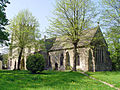
 Barmston Methodist Church.jpg 640 × 439; 81 KB
-
 Barnet Shoot Buckton.jpg 469 × 640; 99 KB
-
 Bartlett Nab, Bempton - geograph.org.uk - 813672.jpg 483 × 640; 93 KB
-
 Bartlett Nab, Bempton - geograph.org.uk - 813674.jpg 475 × 640; 124 KB
-
 Beach groyne Spurn Head - geograph.org.uk - 819719.jpg 640 × 480; 72 KB
-
 Beach groyne Spurn Head - geograph.org.uk - 819721.jpg 640 × 451; 64 KB
-
 Beckside, Beverley - geograph.org.uk - 804021.jpg 640 × 425; 86 KB
-
 Beeches Farm, Faxfleet - geograph.org.uk - 806909.jpg 640 × 471; 167 KB
-
 Bench on the Hudson Way - geograph.org.uk - 808518.jpg 640 × 478; 261 KB
-
 Beverley Bar - The Gateway - geograph.org.uk - 816403.jpg 480 × 640; 138 KB
-
 Beverley Beck - geograph.org.uk - 797647.jpg 586 × 640; 101 KB
-
 Beverley Fire Station - geograph.org.uk - 820569.jpg 640 × 363; 62 KB
-
 Beverley Market - geograph.org.uk - 813995.jpg 640 × 478; 235 KB
-
 Beverley Market Cross - Detail.jpg 582 × 640; 90 KB
-
 Beverley Market Cross.jpg 640 × 619; 101 KB
-
 Beverley Minster - geograph.org.uk - 800231.jpg 640 × 502; 101 KB
-
 Beverley Minster - geograph.org.uk - 811088.jpg 480 × 640; 128 KB
-
 Beverley Minster - Interior - geograph.org.uk - 790818.jpg 546 × 640; 106 KB
-
 Beverley Minster - South Transept - geograph.org.uk - 827328.jpg 544 × 640; 163 KB
-
 Beverley Minster - South Transept.jpg 640 × 628; 185 KB
-
 Beverley Minster - The West Door - geograph.org.uk - 811096.jpg 640 × 480; 132 KB
-
 Beverley Minster - West Front - geograph.org.uk - 795962.jpg 505 × 640; 126 KB
-
 Beverley Minster - West Front - geograph.org.uk - 811106.jpg 480 × 640; 90 KB
-
 Beverley Minster Parish Centre - geograph.org.uk - 790849.jpg 552 × 640; 143 KB
-
 Beverley North Bar - geograph.org.uk - 807482.jpg 499 × 640; 131 KB
-
 Beverley North Bar.jpg 542 × 640; 133 KB
-
 Beverley Public Library and Art Gallery - geograph.org.uk - 816339.jpg 640 × 413; 106 KB
-
 Beverley Register Office - geograph.org.uk - 817931.jpg 640 × 444; 96 KB
-
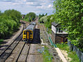
 Beverley Station - geograph.org.uk - 798535.jpg 640 × 443; 90 KB
-
 Beverley Telephone Exchange - geograph.org.uk - 809506.jpg 640 × 580; 123 KB
-
 Church of St. Nicholas, Beverley - geograph.org.uk - 797703.jpg 640 × 471; 94 KB
-
 Bishop Burton Wold - geograph.org.uk - 796548.jpg 640 × 480; 199 KB
-
 Blacktoft Lane, Blacktoft - geograph.org.uk - 808344.jpg 640 × 442; 205 KB
-
 Blue Bin Day in Hedon - geograph.org.uk - 813443.jpg 640 × 480; 96 KB
-
 Boats queueing off Spurn Head - geograph.org.uk - 817474.jpg 640 × 477; 82 KB
-
 Brickdale, Ulrome - geograph.org.uk - 810578.jpg 640 × 449; 115 KB
-
 Bridge over A1079 - geograph.org.uk - 836596.jpg 640 × 369; 136 KB
-
 Bridleway crossing under the Hudson Way - geograph.org.uk - 813931.jpg 640 × 478; 241 KB
-
 Bridleway in Hedon - geograph.org.uk - 825210.jpg 640 × 480; 197 KB
-
 Bridlington Harbour - geograph.org.uk - 813248.jpg 640 × 452; 68 KB
-
 Bridlington Harbour - geograph.org.uk - 813249.jpg 640 × 480; 82 KB
-
 Bridlington Harbour - geograph.org.uk - 813252.jpg 640 × 446; 70 KB
-
 Bridlington Harbour - geograph.org.uk - 813256.jpg 473 × 640; 69 KB
-
 Bridlington Priory.jpg 1,280 × 960; 329 KB
-
 Bridlington Workhouse - geograph.org.uk - 820422.jpg 640 × 418; 66 KB
-
 Broomfleetrailwaystations platforms 30may08.jpg 3,456 × 2,304; 2.85 MB
-
 Bubwith and Harlthorpe Drain, East Yorks. - geograph.org.uk - 793261.jpg 480 × 640; 283 KB
-
 Bubwith ings over Bottoms Drain - geograph.org.uk - 1229718.jpg 640 × 480; 37 KB
-
 Bubwith ings over Ings Drain - geograph.org.uk - 1229724.jpg 640 × 480; 39 KB
-
 Bubwith Ings over Ings Drain - geograph.org.uk - 789653.jpg 640 × 480; 40 KB
-
 Buckton Cliffs - geograph.org.uk - 813714.jpg 487 × 640; 109 KB
-
 Buckton Cliffs - geograph.org.uk - 813718.jpg 480 × 640; 127 KB
-
 Buckton Cliffs - geograph.org.uk - 813720.jpg 471 × 640; 141 KB
-
 Bull Sand Fort - geograph.org.uk - 817486.jpg 640 × 318; 40 KB
-
 Burstwick Drain - geograph.org.uk - 807186.jpg 480 × 640; 122 KB
-

-
 Burstwick Drain near to the A1033 - geograph.org.uk - 813444.jpg 640 × 480; 105 KB
-
 Burton Agnes Station - geograph.org.uk - 821318.jpg 640 × 427; 70 KB
-
 Cables and rape - geograph.org.uk - 796688.jpg 640 × 473; 156 KB
-
 Carnaby Station - geograph.org.uk - 820445.jpg 640 × 427; 102 KB
-
 Carr House Farm - geograph.org.uk - 786644.jpg 640 × 480; 178 KB
-
 Catch of the day - geograph.org.uk - 817470.jpg 478 × 640; 84 KB
-
 Cave Castle Golf Club, South Cave - geograph.org.uk - 827582.jpg 640 × 475; 125 KB
-
 Chalk Bank hide - geograph.org.uk - 817519.jpg 640 × 480; 61 KB
-
 Chalk Bridge - geograph.org.uk - 813851.jpg 640 × 478; 284 KB
-
 Chalk Bridge - geograph.org.uk - 825727.jpg 480 × 640; 241 KB
-
 Charles II arms - Beverley Minster.jpg 623 × 640; 110 KB
-
 Cherry Blossom in the churchyard - geograph.org.uk - 808004.jpg 640 × 435; 160 KB
-
 Cherry Burton Cricket Club - 15th May 2008.JPG 2,103 × 1,784; 853 KB
-
 Cherry Burton Railway Station - geograph.org.uk - 826428.jpg 640 × 480; 242 KB
-
 Cherry Burton railway station.jpg 640 × 478; 242 KB
-
 Cherry Tree Lane, Beverley - geograph.org.uk - 803995.jpg 640 × 425; 78 KB
-
 Chestnut Tree - geograph.org.uk - 811084.jpg 630 × 640; 180 KB
-
 Church Hill, South Cave - geograph.org.uk - 827557.jpg 640 × 400; 65 KB
-
 Church of Saint Mary, Beverley - geograph.org.uk - 806927.jpg 640 × 512; 99 KB
-
 Church of St. Mary, Beverley.jpg 1,987 × 1,688; 2.02 MB
-
 Church Tower, All Saints Bubwith - geograph.org.uk - 807996.jpg 480 × 640; 188 KB
-
 Clay cliffs and sea defences - geograph.org.uk - 794807.jpg 640 × 374; 176 KB
-
 Clematis - geograph.org.uk - 809548.jpg 375 × 640; 189 KB
-

-
 Cliff Farm, Ulrome - geograph.org.uk - 810188.jpg 640 × 490; 71 KB
-

-
 Coastal Stones at Kilnsea - geograph.org.uk - 785943.jpg 640 × 480; 89 KB
-
 Coastguard Houses, Ulrome - geograph.org.uk - 810223.jpg 640 × 469; 74 KB
-
 Coastguard Houses, Ulrome, East Yorks. - geograph.org.uk - 794518.jpg 640 × 480; 132 KB
-
 Cobble Gap, Skipsea Cliff - geograph.org.uk - 810196.jpg 640 × 480; 98 KB
-
 Comber Dale - geograph.org.uk - 813511.jpg 640 × 480; 72 KB
-
 Comber Dale, South Cave - geograph.org.uk - 829285.jpg 640 × 430; 94 KB
-
 Comber Dale, South Cave - geograph.org.uk - 829289.jpg 640 × 403; 101 KB
-
 Coombs Yard, Beverley - geograph.org.uk - 813358.jpg 480 × 640; 141 KB
-
 Corner Farm, Ulrome - geograph.org.uk - 810240.jpg 640 × 456; 91 KB
-
 Coronation Gardens, Beverley - geograph.org.uk - 807518.jpg 640 × 480; 112 KB
-
 Coronation Gardens, Beverley - geograph.org.uk - 816414.jpg 640 × 480; 102 KB
-
 Cottingham Cemetery - geograph.org.uk - 805662.jpg 640 × 480; 199 KB
-
 County Hall, Cross Street, Beverley - geograph.org.uk - 793357.jpg 640 × 630; 125 KB
-
 Cross Street, Beverley - geograph.org.uk - 793288.jpg 640 × 419; 72 KB
-
 Crossing the Gardham Road - geograph.org.uk - 813934.jpg 640 × 478; 240 KB
-
 Dene Woods, Cottingham - geograph.org.uk - 805668.jpg 480 × 640; 198 KB
-
 Disused chalk quarry - geograph.org.uk - 810994.jpg 640 × 478; 269 KB
-
 Dock Leaves Galore^ - geograph.org.uk - 803304.jpg 640 × 480; 162 KB
-
 Dog and Duck Lane, Beverley - geograph.org.uk - 913533.jpg 590 × 640; 133 KB
-
 Don't believe the Sat Nav^ - geograph.org.uk - 817570.jpg 640 × 443; 88 KB
-
 Doorway - County Hall - geograph.org.uk - 793392.jpg 491 × 640; 106 KB
-
 Drain near Faxfleet - geograph.org.uk - 806922.jpg 480 × 640; 210 KB
-
 Drewton Tunnel - geograph.org.uk - 829380.jpg 640 × 453; 78 KB
-
 Drewton Tunnel - geograph.org.uk - 829385.jpg 640 × 414; 94 KB
-
 Drewton Tunnel - geograph.org.uk - 829398.jpg 640 × 478; 52 KB
-
 Driffield Road crosses the Hudson Way - geograph.org.uk - 826482.jpg 640 × 480; 311 KB
-
 Dyer Lane, Beverley - geograph.org.uk - 820601.jpg 577 × 640; 84 KB
-
 Dyer Lane, Beverley - geograph.org.uk - 823349.jpg 480 × 640; 92 KB
-
 Early Morning on Station Lane, Hedon - geograph.org.uk - 794206.jpg 480 × 640; 174 KB
-

-
 East of Fraisthorpe - geograph.org.uk - 813094.jpg 640 × 451; 64 KB
-
 East Plantation, Walkington Wold - geograph.org.uk - 802225.jpg 640 × 427; 203 KB
-
 East Riding County Hall.jpg 640 × 512; 85 KB
-
 Eastburn Beck - geograph.org.uk - 809586.jpg 640 × 480; 327 KB
-
 Eastgate, Beverley - geograph.org.uk - 793231.jpg 640 × 594; 104 KB
-
 Eastgate, Beverley - geograph.org.uk - 793256.jpg 640 × 465; 91 KB
-
 Eastgate, Beverley - geograph.org.uk - 803983.jpg 640 × 425; 91 KB
-
 Eastgate, Beverley - geograph.org.uk - 827348.jpg 640 × 425; 110 KB
-
 Electricity Sub Station - geograph.org.uk - 825137.jpg 640 × 410; 228 KB
-
 End of the plantation - geograph.org.uk - 796703.jpg 640 × 480; 217 KB
-
 Etton Fields Farm - geograph.org.uk - 826395.jpg 640 × 379; 104 KB
-
 Etton Wold - geograph.org.uk - 813830.jpg 640 × 478; 254 KB
-
 Everthorpe High Road - geograph.org.uk - 827593.jpg 474 × 640; 166 KB
-
 Everthorpe High Road - geograph.org.uk - 827600.jpg 480 × 640; 156 KB
-
 Everthorpe Quarry - geograph.org.uk - 827608.jpg 640 × 440; 108 KB
-
 Face on a Branch^ - geograph.org.uk - 810424.jpg 480 × 640; 112 KB
-
 Fantastic Farm Flowerbed - geograph.org.uk - 788679.jpg 640 × 480; 112 KB
-
 Farm buildings - geograph.org.uk - 820474.jpg 640 × 427; 83 KB
-
 Farm track to Etton - geograph.org.uk - 813965.jpg 640 × 478; 243 KB
-
 Farmhouse at Wawne Grange - geograph.org.uk - 786752.jpg 640 × 457; 197 KB
-
 Farmland along the Hudson Way - geograph.org.uk - 813923.jpg 640 × 478; 243 KB
-
 Farmland along the Hudson Way - geograph.org.uk - 813983.jpg 640 × 478; 234 KB
-

-
 Ferry Beck, Everthorpe - geograph.org.uk - 827591.jpg 640 × 463; 141 KB
-
 Ferry Beck, Everthorpe - geograph.org.uk - 828392.jpg 640 × 411; 83 KB
-
 Field awaiting seeding - geograph.org.uk - 808520.jpg 640 × 478; 264 KB
-
 Field House Farm Harlthorpe.jpg 640 × 354; 169 KB
-
 Field near Manor House Farm, Routh - geograph.org.uk - 786682.jpg 640 × 455; 190 KB


,_East_Yorks._-_geograph.org.uk_-_801664.jpg)


