Category:Mechtenberg
Jump to navigation
Jump to search
| Object location | | View all coordinates using: OpenStreetMap |
|---|
hill in Germany  | |||||
| Upload media | |||||
| Instance of | |||||
|---|---|---|---|---|---|
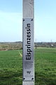
| Location |
| ||||
| Elevation above sea level |
| ||||
 | |||||
Subcategories
This category has the following 3 subcategories, out of 3 total.
Media in category "Mechtenberg"
The following 15 files are in this category, out of 15 total.
-
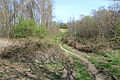
 Essen - Am Mechtenberg - NSG - Mechtenberg + Bismarckturm 01 ies.jpg 5,616 × 3,744; 20.57 MB
-
 Essen - Am Mechtenberg - NSG - Mechtenberg 01 ies.jpg 5,616 × 3,744; 25.34 MB
-
 Essen - Am Mechtenberg - NSG - Mechtenberg 02 ies.jpg 5,616 × 3,744; 19.73 MB
-
 Essen - Am Mechtenberg - NSG - Mechtenberg 03 ies.jpg 5,616 × 3,744; 25.61 MB
-
 Essen - Am Mechtenberg - NSG - Mechtenberg 04 ies.jpg 5,616 × 3,744; 13.64 MB
-
 Essen - Am Mechtenberg - NSG - Mechtenberg 05 ies.jpg 5,616 × 3,744; 16.51 MB
-
 Essen - Am Mechtenberg - NSG - Mechtenberg 06 ies.jpg 5,616 × 3,744; 17.94 MB
-
 Essen - Am Mechtenberg - NSG - Mechtenberg 07 ies.jpg 5,616 × 3,744; 12.27 MB
-
 Essen - Am Mechtenberg - NSG - Mechtenberg 08 ies.jpg 3,744 × 5,616; 10.63 MB
-
 Essen - Am Mechtenberg - NSG - Mechtenberg 09 ies.jpg 3,744 × 5,616; 12.89 MB
-
 Essen - Zeche Bonifacius Schacht1 (Mechtenberg) 01 ies.jpg 5,616 × 3,744; 18.41 MB
-
 Essen Kray Mechtenberg E 8421 201801.jpg 3,264 × 2,448; 2.78 MB
-
 Mechtenberg2009.jpg 2,816 × 2,112; 3.3 MB
-
 NSG E-005 Mechtenberg (Essen) 01.jpg 4,000 × 3,000; 5.8 MB
-
 NSG E-005 Mechtenberg (Essen) 09.jpg 4,000 × 3,000; 3.68 MB


_01_ies.jpg)

_01.jpg)
_09.jpg)