Category:Merrimac, Wisconsin
Jump to navigation
Jump to search
village in Sauk County, Wisconsin, United States   | |||||
| Upload media | |||||
| Instance of |
| ||||
|---|---|---|---|---|---|
| Location | Sauk County, Wisconsin | ||||
| Located in or next to body of water | |||||
| Inception |
| ||||
| Population |
| ||||
| Area |
| ||||
| Elevation above sea level |
| ||||
 | |||||
English: Media related to Merrimac, Wisconsin, a village on Lake Wisconsin in Sauk County, Wisconsin, United States.
Subcategories
This category has the following 3 subcategories, out of 3 total.
M
- Merrimac Bridge (38 F)
T
- Tourist Park at Lake Wisconsin (12 F)
Media in category "Merrimac, Wisconsin"
The following 28 files are in this category, out of 28 total.
-
 Barn East of Devils Lake - panoramio.jpg 4,896 × 3,672; 4.62 MB
-
 Barn near Lake Wisconsin - panoramio.jpg 4,896 × 3,672; 5.02 MB
-
 Barn near Merrimac - panoramio.jpg 4,896 × 3,672; 5.29 MB
-
 Bluff Road - panoramio.jpg 4,859 × 3,307; 6.21 MB
-
 Colsac III Ferry - panoramio.jpg 4,608 × 3,456; 9.49 MB
-
 Concessions stand at western dock - panoramio.jpg 4,896 × 3,672; 5.78 MB
-
 David J. Stoner House - panoramio.jpg 4,896 × 3,672; 4.43 MB
-
 Devil's Head Ski Resort During Autumn - panoramio.jpg 4,849 × 3,072; 4.68 MB
-
 Fall Colors at Lake Wisconsin - panoramio.jpg 4,896 × 3,672; 6.46 MB
-
 Farm near Merrimac - panoramio.jpg 4,868 × 2,735; 3.68 MB
-
 Ferry Crossing Bar ^ Grill - panoramio.jpg 4,608 × 3,456; 6.26 MB
-
 Ferry Landing Concessions - panoramio (1).jpg 4,896 × 3,672; 6.85 MB
-
 Ferry Landing Concessions - panoramio.jpg 4,896 × 3,672; 5.68 MB
-
 Hwy 78 at County Hwy DL - panoramio.jpg 4,896 × 3,672; 5.47 MB
-
 J. H. Craig House - panoramio.jpg 4,896 × 3,672; 8.13 MB
-
 Main Street Merrimac - panoramio.jpg 4,896 × 3,672; 6.87 MB
-
 Merrimac Population ^ Sauk County Welcome Sign - panoramio.jpg 4,896 × 3,672; 6.99 MB
-
 Merrimac Tower - panoramio.jpg 551 × 390; 48 KB
-
 Merrimac Town Hall - panoramio (1).jpg 4,896 × 3,672; 5.27 MB
-
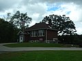 Merrimac Town Hall - panoramio.jpg 4,896 × 3,672; 5.82 MB
-
 Merrimac WI - panoramio.jpg 3,672 × 4,896; 8.24 MB
-
 MerrimacFerryDocksWinter.jpg 2,304 × 1,728; 844 KB
-
 Near Devils Lake State Park - panoramio.jpg 4,896 × 3,672; 5.65 MB
-
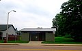 Restrooms on Northside - panoramio.jpg 4,458 × 2,783; 3.15 MB
-
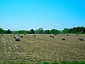 Round Bales - panoramio.jpg 4,608 × 3,456; 6.29 MB
-
 St. Mary Health of the Sick Catholic Church - panoramio.jpg 3,072 × 2,304; 2.49 MB
-
 Stone arch bridge on WSOR Formerly C^NW Railway - panoramio.jpg 4,608 × 3,456; 6.87 MB
-
 WIMap-doton-Merrimac.png 292 × 310; 26 KB


.jpg)


.jpg)


