Category:Milestones in Buckinghamshire
Jump to navigation
Jump to search
Ceremonial counties of England: Bedfordshire · Berkshire · Buckinghamshire · Cambridgeshire · Cheshire · Cornwall · Cumbria · Derbyshire · Devon · Dorset · Durham · East Riding of Yorkshire · East Sussex · Essex · Gloucestershire · Greater London · Greater Manchester · Hampshire · Herefordshire · Hertfordshire · Kent · Lancashire · Leicestershire · Lincolnshire · Merseyside · Norfolk · North Yorkshire · Northamptonshire · Northumberland · Nottinghamshire · Oxfordshire · Rutland · Shropshire · Somerset · South Yorkshire · Staffordshire · Suffolk · Surrey · Tyne and Wear · Warwickshire · West Midlands · West Sussex · West Yorkshire · Wiltshire · Worcestershire
City-counties: Bristol ·
Former historic counties:
Other former counties:
City-counties: Bristol ·
Former historic counties:
Other former counties:

Subcategories
This category has the following 2 subcategories, out of 2 total.
G
- Gott's Monument (2 F)
M
Media in category "Milestones in Buckinghamshire"
The following 181 files are in this category, out of 181 total.
-
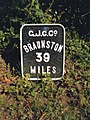
 41 Miles to Braunston - geograph.org.uk - 1354578.jpg 480 × 640; 111 KB
-
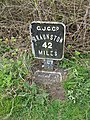
 43 Miles to Braunston - geograph.org.uk - 1354509.jpg 480 × 640; 144 KB
-

-

-
 Half mile marker, Grand Union Canal near Denham (geograph 4497755).jpg 3,648 × 2,736; 3.99 MB
-
 Kingswood Lane - geograph.org.uk - 1562904.jpg 640 × 480; 75 KB
-
 Marlow, obelisk (geograph 5932922).jpg 1,600 × 1,200; 300 KB
-
 Mile post in Longwick - geograph.org.uk - 1595705.jpg 426 × 640; 82 KB
-
 Milemarker by the Grand Union Canal, Bletchley (geograph 6095577).jpg 1,151 × 1,530; 224 KB
-
 Milepost (geograph 4354640).jpg 640 × 480; 134 KB
-
 Milepost - geograph.org.uk - 153753.jpg 480 × 640; 196 KB
-
 Milepost next to Isworth Farm Bridge No 63 (geograph 4745960).jpg 800 × 600; 204 KB
-
 Milepost south of junction with Chessfield Park, Little Chalfont, June 2015 01.jpg 1,536 × 2,048; 1.21 MB
-
 Milepost south of junction with Chessfield Park, Little Chalfont, June 2015 02.jpg 1,536 × 2,048; 1.3 MB
-
 Milestone by Aylesbury Road - geograph.org.uk - 5628221.jpg 2,655 × 2,466; 1.69 MB
-
 Milestone in Stone village - geograph.org.uk - 1592170.jpg 480 × 640; 107 KB
-
 Milestone on A4129 between Monks Risborough and Thame - geograph.org.uk - 3904087.jpg 4,320 × 3,240; 5.17 MB
-
 Milestone on Great Missenden By-Pass - geograph.org.uk - 2651105.jpg 3,072 × 2,304; 1.78 MB
-
 Milestone Oxford Road (geograph 6742354).jpg 316 × 733; 93 KB
-
 Milestone Oxford Road, Gerrards Cross (geograph 6742369).jpg 413 × 739; 106 KB
-
 Millennium milepost on Weasel Lane (geograph 6029200).jpg 1,600 × 1,067; 504 KB
-
 Modern Milepost at Marlow Road-Bisham Road junction (geograph 5622361).jpg 911 × 1,747; 172 KB
-
 Obelisk Milestone by the A4155, High Street, Marlow (geograph 6020956).jpg 802 × 1,024; 128 KB
-

-

-
 Old Boundary Marker by Sandpit Hill, Finmere (geograph 6048453).jpg 857 × 1,618; 257 KB
-
 Old Boundary Marker by the A4, Bath Road, Taplow parish (geograph 6051371).jpg 879 × 1,382; 162 KB
-
 Old Boundary Marker by the A40, London Road, Knave's Beech (geograph 6094710).jpg 1,050 × 1,715; 253 KB
-
 Old Commemorative marker by the A40, Beaconsfield parish (geograph 6049473).jpg 793 × 1,286; 170 KB
-
 Old milemarker by the Grand Union Canal, (geograph 6076770).jpg 480 × 720; 106 KB
-

-
 Old milemarker by the Grand Union Canal, Ivinghoe (geograph 6076715).jpg 1,177 × 1,554; 282 KB
-
 Old milemarker by the Grand Union Canal, Ivinghoe Lock 32 (geograph 6095566).jpg 1,191 × 1,537; 226 KB
-
 Old milemarker by the Grand Union Canal, Marsworth (geograph 6076798).jpg 1,167 × 1,534; 219 KB
-
 Old milemarker by the Grand Union Canal, Soulbury (geograph 6095668).jpg 1,171 × 1,507; 237 KB
-
 Old milemarker by the Grand Union Canal, Stoke Hammond (geograph 6076688).jpg 1,176 × 1,588; 226 KB
-
 Old Milepost by Buckingham Road, Edgcott (geograph 5622457).jpg 1,093 × 1,800; 314 KB
-
 Old Milepost by former A422, on Chicheley Hill (geograph 5622550).jpg 965 × 1,629; 207 KB
-
 Old Milepost by High Street, Newport Pagnell (geograph 5622464).jpg 975 × 1,672; 199 KB
-
 Old Milepost by Newport Road, New Bradwell (geograph 5622463).jpg 729 × 1,243; 133 KB
-
 Old Milepost by Stratford Road, Wolverton (geograph 5622462).jpg 697 × 1,125; 110 KB
-
 Old Milepost by the A41 in Kingswood (geograph 5622515).jpg 1,115 × 1,768; 376 KB
-
 Old Milepost by the A41, east of Waddesdon (geograph 5622513).jpg 1,007 × 1,607; 375 KB
-
 Old Milepost by the A41, High Street, Waddesdon (geograph 5362107).jpg 450 × 600; 264 KB
-
 Old Milepost by the A41, north of Westcott (geograph 5622514).jpg 1,115 × 1,715; 380 KB
-

-
 Old Milepost by the A413 in Maids Moreton (geograph 5622465).jpg 1,018 × 1,725; 212 KB
-
 Old Milepost by the A4155, near Medmenham Mill (geograph 5622565).jpg 986 × 1,704; 239 KB
-
 Old Milepost by the A418 in Dinton (geograph 5622449).jpg 890 × 1,393; 266 KB
-
 Old Milepost by the A418 in Stone (geograph 5622448).jpg 932 × 1,393; 213 KB
-
 Old Milepost by the A418, Aylesbury Road, Bierton (geograph 5622446).jpg 1,018 × 1,575; 291 KB
-
 Old Milepost by the A418, north of Haddenham (geograph 5622450).jpg 654 × 804; 127 KB
-
 Old Milepost by the A418, Oxford Road, Stone (geograph 5362053).jpg 858 × 1,162; 256 KB
-
 Old Milepost by the A418, south west of Wing (geograph 5622447).jpg 1,061 × 1,640; 265 KB
-
 Old Milepost by the A422 in Astwood (geograph 5622552).jpg 740 × 1,382; 129 KB
-
 Old Milepost by the A422, at Buckingham Canal reservoir (geograph 5622460).jpg 1,040 × 1,672; 301 KB
-
 Old Milepost by the A422, north east of Chicheley (geograph 5622551).jpg 772 × 1,125; 117 KB
-
 Old Milepost by the A509 near Emberton Country Park (geograph 5622558).jpg 761 × 1,168; 124 KB
-
 Old Milepost by the A509, High Street, Olney (geograph 5622559).jpg 900 × 1,447; 112 KB
-
 Old Milepost by the A509, north of Olney (geograph 5622560).jpg 954 × 1,372; 221 KB
-
 Old Milepost by the A509, south of Emberton (geograph 5622557).jpg 890 × 1,447; 184 KB
-
 Old Milepost by the A509, south of Newport Pagnell (geograph 5622562).jpg 1,050 × 1,575; 298 KB
-
 Old Milepost by the A5130 in Broughton, Milton Keynes (geograph 5622563).jpg 932 × 1,425; 183 KB
-
 Old Milepost by the A5130, Woburn Sands (geograph 5294583).jpg 480 × 640; 86 KB
-
 Old Milepost by the B4011 in Oakley (geograph 5622573).jpg 804 × 1,350; 171 KB
-

-
 Old Milepost by the B4011, north of Long Crendon (geograph 5622571).jpg 1,018 × 1,457; 264 KB
-
 Old Milepost by the B4011, north of Oakley (geograph 5622574).jpg 986 × 1,586; 293 KB
-
 Old Milepost by the B4011, south east of Oakley (geograph 5362113).jpg 1,500 × 2,000; 366 KB
-

-

-
 Old Milepost by the B526 near Gayhurst (geograph 5622554).jpg 825 × 1,490; 210 KB
-
 Old Milepost by the B526, south of Stoke Goldington (geograph 5622555).jpg 783 × 1,232; 130 KB
-
 Old Milepost by the former A509, north of Sherington (geograph 5622556).jpg 868 × 1,307; 138 KB
-
 Old Milepost by Wycombe Road, Marlow (geograph 5622567).jpg 1,018 × 1,468; 168 KB
-
 Old Milepost by Wycombe Road, Marlow (geograph 6020990).jpg 768 × 1,024; 221 KB
-
 Old Milepost in Grendon Underwood (geograph 5622454).jpg 793 × 1,286; 178 KB
-
 Old Milepost north east of Kingswood (geograph 5622453).jpg 975 × 1,532; 305 KB
-
 Old Milepost north of Grebe Lake (geograph 5622458).jpg 932 × 1,607; 273 KB
-
 Old Milepost north of Grendon Underwood (geograph 5622455).jpg 911 × 1,597; 278 KB
-
 Old Milepost north of Three Bridge Mill (geograph 5622459).jpg 1,018 × 1,682; 354 KB
-
 Old Milepost on Newport Road, Woolstone (geograph 5622553).jpg 997 × 1,532; 203 KB
-
 Old Milepost on Tickford Street, Newport Pagnell (geograph 5622561).jpg 890 × 1,243; 205 KB
-
 Old Milepost south of Ludgershall (geograph 5622451).jpg 954 × 1,575; 219 KB
-
 Old Milepost south west of Kingswood (geograph 5622452).jpg 954 × 1,457; 257 KB
-
 Old Milepost, Newport Road, Wavendon (geograph 5294565).jpg 1,200 × 1,600; 364 KB
-
-
 Old Milestone by bridleway north of Stone, Bucks (geograph 5622588).jpg 879 × 1,329; 143 KB
-
 Old Milestone by High Street, Colnbrook (geograph 5622466).jpg 1,536 × 2,048; 644 KB
-
 Old Milestone by the A4 in Burnham - 'LONDON 24' (geograph 5622474).jpg 1,190 × 1,768; 238 KB
-
 Old Milestone by the A40 by Wilton Park (geograph 5622534).jpg 997 × 1,318; 215 KB
-
 Old Milestone by the A40 in Beaconsfield (geograph 5622535).jpg 986 × 1,404; 217 KB
-
 Old Milestone by the A40 in Denham (geograph 5622529).jpg 1,115 × 1,640; 284 KB
-
 Old Milestone by the A40 in Denham (geograph 5622530).jpg 1,018 × 1,640; 244 KB
-
 Old Milestone by the A40 in Gerrards Cross (geograph 5622531).jpg 1,018 × 1,640; 223 KB
-
 Old Milestone by the A40 in Gerrards Cross (geograph 5622532).jpg 1,329 × 1,179; 194 KB
-
 Old Milestone by the A40 in Loudwater (geograph 5622537).jpg 1,050 × 1,715; 293 KB
-
 Old Milestone by the A40 in Stokenchurch (geograph 5622545).jpg 975 × 1,607; 246 KB
-
 Old Milestone by the A40 in West Wycombe (geograph 5622540).jpg 793 × 1,629; 120 KB
-
 Old Milestone by the A40 near Piddington (geograph 5622542).jpg 1,093 × 1,511; 217 KB
-
 Old Milestone by the A40, north east of Horsleys Green (geograph 5622544).jpg 1,061 × 1,436; 206 KB
-
 Old Milestone by the A40, north of Loudwater (geograph 5622538).jpg 922 × 1,682; 171 KB
-
 Old Milestone by the A40, south east of Beacon's Bottom (geograph 5622543).jpg 943 × 1,522; 182 KB
-
 Old Milestone by the A40, west of Beaconsfield (geograph 5622536).jpg 1,179 × 1,693; 286 KB
-
 Old Milestone by the A40, west of Chalfont St Peter (geograph 5622533).jpg 1,329 × 1,179; 285 KB
-
 Old Milestone by the A40, west of West Wycombe (geograph 5622541).jpg 1,029 × 1,436; 234 KB
-

-
 Old Milestone by the A4010 (geograph 5622587).jpg 900 × 1,586; 198 KB
-
 Old Milestone by the A4010 in Little Kimble (geograph 5622584).jpg 765 × 1,253; 130 KB
-
 Old Milestone by the A4010 in Monks Risborough (geograph 5622582).jpg 923 × 1,409; 148 KB
-
 Old Milestone by the A4010 in Princes Risborough (geograph 5622581).jpg 954 × 1,650; 195 KB
-
 Old Milestone by the A4010, Aylesbury Road (geograph 5622583).jpg 1,018 × 1,490; 283 KB
-
 Old Milestone by the A4010, north east of Little Kimble (geograph 5622585).jpg 1,536 × 2,048; 719 KB
-
 Old Milestone by the A4010, north of North Lee (geograph 5622586).jpg 954 × 1,522; 197 KB
-
 Old Milestone by the A4010, Saunderton (geograph 5362114).jpg 960 × 720; 179 KB
-
 Old Milestone by the A4010, Wycombe Road (geograph 5622580).jpg 857 × 1,007; 141 KB
-
 Old Milestone by the A4129 by Whirlbush Farm (geograph 5622576).jpg 954 × 1,329; 251 KB
-
 Old Milestone by the A4129 in Kingsey (geograph 5622575).jpg 954 × 1,500; 305 KB
-
 Old Milestone by the A4129 in Longwick (geograph 5622578).jpg 932 × 1,415; 169 KB
-
 Old Milestone by the A4129 in Princes Risborough (geograph 5622579).jpg 890 × 1,340; 223 KB
-
 Old Milestone by the A4129, north of Longwick by Ray Farm (geograph 5622577).jpg 825 × 1,415; 184 KB
-
 Old Milestone by the A413 (geograph 5622485).jpg 1,061 × 1,350; 237 KB
-
 Old Milestone by the A413 (geograph 5622487).jpg 932 × 1,007; 226 KB
-
 Old Milestone by the A413 Amersham Road (geograph 5622484).jpg 1,600 × 1,200; 447 KB
-
 Old Milestone by the A413 at Weedon Hill (geograph 5622498).jpg 900 × 1,329; 226 KB
-
 Old Milestone by the A413 in Abbey Park (geograph 5622488).jpg 954 × 1,275; 227 KB
-
 Old Milestone by the A413 in Aylesbury (geograph 5622497).jpg 815 × 975; 149 KB
-
 Old Milestone by the A413 in Buckingham (geograph 5622508).jpg 1,040 × 1,682; 342 KB
-
 Old Milestone by the A413 in Chalfont St Peter (geograph 5622481).jpg 986 × 1,232; 190 KB
-
 Old Milestone by the A413 in Stoke Mandeville (geograph 5622495).jpg 900 × 1,136; 193 KB
-
 Old Milestone by the A413 in Wendover Dean (geograph 5622491).jpg 932 × 1,458; 273 KB
-
 Old Milestone by the A413 in Whitchurch (geograph 5622500).jpg 986 × 1,393; 236 KB
-
 Old Milestone by the A413 near Addington (geograph 5622505).jpg 997 × 1,457; 247 KB
-
 Old Milestone by the A413 near Little London (geograph 5622492).jpg 975 × 1,532; 315 KB
-
 Old Milestone by the A413, Amersham Road (geograph 5622479).jpg 1,200 × 1,600; 457 KB
-
 Old Milestone by the A413, east of Little Missenden (geograph 5362094).jpg 1,009 × 1,405; 409 KB
-
 Old Milestone by the A413, near Buxlow Farm (geograph 5622501).jpg 1,200 × 804; 214 KB
-
 Old Milestone by the A413, near North Hill Farm (geograph 5622502).jpg 825 × 1,329; 232 KB
-
 Old Milestone by the A413, north of Chalfont Common (geograph 5622483).jpg 1,007 × 1,436; 262 KB
-
 Old Milestone by the A413, north of Great Missenden (geograph 5622490).jpg 932 × 1,265; 235 KB
-
 Old Milestone by the A413, north of Winslow (geograph 5622504).jpg 932 × 1,618; 300 KB
-
 Old Milestone by the A413, south east of Padbury (geograph 5362096).jpg 527 × 800; 281 KB
-
 Old Milestone by the A413, south of Adstock (geograph 5622506).jpg 922 × 1,532; 228 KB
-
 Old Milestone by the A413, south of Amersham (geograph 5622486).jpg 1,200 × 1,600; 393 KB
-
 Old Milestone by the A413, south of Padbury Bridge (geograph 5622507).jpg 900 × 1,447; 235 KB
-
 Old Milestone by the A413, south of Winslow (geograph 5622503).jpg 954 × 1,618; 280 KB
-
 Old Milestone by the A413, west of Weedon (geograph 5622499).jpg 986 × 1,393; 272 KB
-
 Old Milestone by the A4155, Market Square, Marlow (geograph 5622566).jpg 1,018 × 1,704; 212 KB
-
 Old Milestone by the A421, east of Tingewick (geograph 5622511).jpg 1,007 × 1,607; 240 KB
-
 Old Milestone by the A422 west of Westbury (geograph 5622516).jpg 1,029 × 1,543; 303 KB
-

-

-
 Old Milestone by the A5, Little Brickhill (geograph 5880973).jpg 682 × 1,024; 324 KB
-
 Old Milestone by the A5, south of Little Brickhill (geograph 5622517).jpg 922 × 1,415; 247 KB
-
 Old Milestone by the A5, west of Little Brickhill (geograph 5622518).jpg 825 × 1,318; 215 KB
-
 Old Milestone by the B4009, north of Wendover (geograph 5622494).jpg 975 × 1,532; 271 KB
-
 Old Milestone by the B482 in Lane End, High Wycombe (geograph 5622549).jpg 975 × 1,607; 225 KB
-
 Old Milestone by the B482 near Marlow Bottom (geograph 5622546).jpg 1,093 × 1,757; 313 KB
-
 Old Milestone by the B482, north of Marlow Bottom (geograph 5622547).jpg 965 × 1,125; 222 KB
-
 Old Milestone by the B482, west of Wycombe Air Park (geograph 5622548).jpg 1,018 × 1,682; 214 KB
-
 Old Milestone by the former A413 in Chalfont St Peter (geograph 5622480).jpg 997 × 1,275; 220 KB
-
 Old Milestone by the former A413 in Great Missenden (geograph 5622489).jpg 1,536 × 2,048; 709 KB
-
 Old Milestone by the former A413 in Wendover (geograph 5622493).jpg 1,018 × 1,575; 299 KB
-

-
-
 Old Milestone by the former A5 in Denbigh West, Bletchley (geograph 5622520).jpg 879 × 1,350; 187 KB
-
 Old Milestone by the former A5 in Loughton, Milton Keynes (geograph 5622522).jpg 825 × 1,307; 165 KB
-
 Old Milestone by the former A5 in Loughton, Milton Keynes (geograph 5622523).jpg 793 × 1,232; 159 KB
-
 Old Milestone by the former A5 in Milton Keynes (geograph 5622521).jpg 879 × 1,265; 200 KB
-
 Old Milestone by the former A5 in Stony Stratford (geograph 5622526).jpg 793 × 1,318; 162 KB
-

-

-
 Old Milestone in Gott's Monument, Chesham Lane (geograph 5622482).jpg 1,447 × 997; 211 KB
-
 Old Milestone in Tingewick (geograph 5622512).jpg 1,115 × 1,136; 161 KB
-
 Old Milestone on the A413, south of Aylesbury (geograph 5622496).jpg 986 × 1,393; 253 KB
-
 Old Milestone on Tingewick Road, west of Buckingham (geograph 5622509).jpg 922 × 1,532; 289 KB
-
 Old Milestones on the Little Market House, High Wycombe (geograph 5622539).jpg 1,629 × 1,007; 198 KB
-
 Replica milemarker by the Grand Union Canal, Bletchley (geograph 6076666).jpg 1,181 × 1,562; 233 KB
-
 Milestone, Studley Green - geograph.org.uk - 104420.jpg 480 × 640; 170 KB
-
 The last remains of Milepost (geograph 5314209).jpg 4,128 × 2,322; 6.66 MB
-
 War and Piece (geograph 1669802).jpg 1,920 × 2,560; 1.96 MB


.jpg)
.jpg)

.jpg)

.jpg)
.jpg)

.jpg)


.jpg)
.jpg)
.jpg)
.jpg)
.jpg)
.jpg)
.jpg)
.jpg)
.jpg)
.jpg)
.jpg)
.jpg)
.jpg)
.jpg)
.jpg)
.jpg)
.jpg)
.jpg)
.jpg)
.jpg)
.jpg)
.jpg)
.jpg)
.jpg)
.jpg)
.jpg)
.jpg)
.jpg)
.jpg)
.jpg)
.jpg)
.jpg)
.jpg)
.jpg)
.jpg)
.jpg)
.jpg)
.jpg)
.jpg)
.jpg)
.jpg)
.jpg)
.jpg)
.jpg)
.jpg)
.jpg)
.jpg)
.jpg)
.jpg)
.jpg)
.jpg)
.jpg)
.jpg)
.jpg)
.jpg)
.jpg)
.jpg)
.jpg)
.jpg)
.jpg)
.jpg)
.jpg)
.jpg)
.jpg)
.jpg)
.jpg)
.jpg)

.jpg)
.jpg)
.jpg)
.jpg)
.jpg)
.jpg)
.jpg)
.jpg)
.jpg)
.jpg)
.jpg)
.jpg)
.jpg)
.jpg)
.jpg)
.jpg)
.jpg)
.jpg)
.jpg)
.jpg)
.jpg)
.jpg)
.jpg)
.jpg)
.jpg)
.jpg)
.jpg)
.jpg)
.jpg)
.jpg)
.jpg)
.jpg)
.jpg)
.jpg)
.jpg)
.jpg)
.jpg)
.jpg)
.jpg)
.jpg)
.jpg)
.jpg)
.jpg)
.jpg)
.jpg)
.jpg)
.jpg)
.jpg)
.jpg)
.jpg)
.jpg)
.jpg)
.jpg)
.jpg)
.jpg)
.jpg)
.jpg)
.jpg)
.jpg)
.jpg)
.jpg)
.jpg)
.jpg)
.jpg)
.jpg)
.jpg)
.jpg)
.jpg)
.jpg)
.jpg)
.jpg)
.jpg)
.jpg)
.jpg)
.jpg)
.jpg)
.jpg)
.jpg)
.jpg)
.jpg)
.jpg)
.jpg)
.jpg)
.jpg)
.jpg)
.jpg)
.jpg)

.jpg)
.jpg)
.jpg)
.jpg)
.jpg)
.jpg)
.jpg)