Category:Military training on Dartmoor
Jump to navigation
Jump to search
Subcategories
This category has the following 2 subcategories, out of 2 total.
R
- Rippon Tor rifle range (16 F)
- Rowtor Target Railway (7 F)
Media in category "Military training on Dartmoor"
The following 48 files are in this category, out of 48 total.
-
 29 Commando Regiment, Royal Artillery Commando Conditioning Course MOD 45149252.jpg 4,064 × 2,704; 1.85 MB
-

-
 Black a ven Brook - geograph.org.uk - 432314.jpg 640 × 302; 61 KB
-
 Dartmoor Beast 2.jpg 449 × 337; 77 KB
-
 Dartmoor OP15.jpg 4,288 × 2,848; 4.43 MB
-
 Dartmoor OP22.jpg 4,120 × 2,592; 4.08 MB
-
 Dartmoor ranges - geograph.org.uk - 373629.jpg 413 × 640; 60 KB
-
 Firing range, on Langstone Moor - geograph.org.uk - 1386513.jpg 640 × 480; 59 KB
-
 Grazing land, near Moor Brook - geograph.org.uk - 992277.jpg 640 × 480; 83 KB
-
 Gun emplacement, on Black Down - geograph.org.uk - 1424756.jpg 640 × 480; 68 KB
-
 Hangingstone Hill - geograph.org.uk - 1484304.jpg 640 × 427; 64 KB
-
 Hangingstone Hill summit.jpg 4,020 × 2,680; 3.84 MB
-
 Hart Tor rifle range - geograph.org.uk - 1197655.jpg 640 × 427; 77 KB
-
 Hart Tor rifle range - geograph.org.uk - 1197665.jpg 640 × 427; 101 KB
-
 Hart Tor rifle range - geograph.org.uk - 1197673.jpg 640 × 427; 82 KB
-
 Kitty Tor - geograph.org.uk - 1556963.jpg 640 × 427; 44 KB
-
 Metal shed, on top of Yes Tor - geograph.org.uk - 1424666.jpg 640 × 480; 91 KB
-
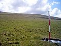
 Military flagpole on Watchet Hill - geograph.org.uk - 1517051.jpg 640 × 427; 60 KB
-
 Military observation post - geograph.org.uk - 1491383.jpg 640 × 427; 62 KB
-
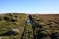 Military Target Railway - geograph.org.uk - 1575494.jpg 640 × 427; 78 KB
-
 MOD Danger Area Flagpole - geograph.org.uk - 224679.jpg 480 × 640; 60 KB
-
 MoD Hut at Holming Beam Car Park - geograph.org.uk - 1174316.jpg 640 × 426; 79 KB
-
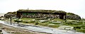 North Dartmoor bunker - geograph.org.uk - 432319.jpg 640 × 255; 50 KB
-
 Observation Post , Okement Hill - geograph.org.uk - 1484103.jpg 640 × 427; 73 KB
-
 Observation Post 3 - geograph.org.uk - 1575509.jpg 640 × 427; 71 KB
-
 Observation Post, Yes Tor - geograph.org.uk - 683766.jpg 640 × 480; 91 KB
-
 Oke Tor Range Warden's Shelter - geograph.org.uk - 1517998.jpg 640 × 427; 73 KB
-
-
 OP17 near Steeperton Gorge - geograph.org.uk - 427621.jpg 640 × 448; 135 KB
-

-
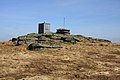
 Radio mast and trig point on Yes Tor - geograph.org.uk - 1624273.jpg 640 × 480; 56 KB
-
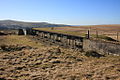
 Range huts on Standon Hill - geograph.org.uk - 417283.jpg 640 × 269; 31 KB
-
 Range warden's hut - geograph.org.uk - 1740260.jpg 1,024 × 683; 166 KB
-
 Rifle target at Willsworthy - geograph.org.uk - 135723.jpg 640 × 425; 138 KB
-
 Rough Tor - geograph.org.uk - 1204630.jpg 640 × 427; 71 KB
-
 Sea King on Dartmoor.jpg 2,517 × 1,803; 1.53 MB
-
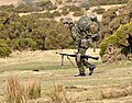 Soldier at Brisworthy.jpg 3,068 × 2,392; 1.73 MB
-
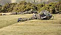 Soldiers at Brisworthy.jpg 4,208 × 2,416; 3.6 MB
-
 Starstreak launcher on Dartmoor.jpg 3,726 × 2,693; 2.81 MB
-
 Target Trolley Shed - geograph.org.uk - 1575476.jpg 640 × 427; 109 KB
-
 Telephone tapping point near New Bridge - geograph.org.uk - 427625.jpg 412 × 639; 120 KB
-

-
 Warning sign on Yes Tor - geograph.org.uk - 7907.jpg 640 × 480; 76 KB
-
 Willsworthy Range - geograph.org.uk - 1740067.jpg 1,024 × 683; 158 KB
-
 Willsworthy Range.jpg 3,908 × 2,720; 2.21 MB
-
 Willsworthy Rifle Range - geograph.org.uk - 1740117.jpg 1,024 × 683; 193 KB
-
 Willsworthy Rifle Range - geograph.org.uk - 1740126.jpg 1,024 × 683; 220 KB
-
 Willsworthy Rifle Range - geograph.org.uk - 1740137.jpg 1,024 × 683; 196 KB


