Category:Mittelriede
Jump to navigation
Jump to search
river in Germany  | |||||
| Upload media | |||||
| Instance of | |||||
|---|---|---|---|---|---|
| Location | Brunswick, Lower Saxony, Germany | ||||
| Length |
| ||||
| Mouth of the watercourse | |||||
| Drainage basin |
| ||||
 | |||||
Subcategories
This category has only the following subcategory.
F
- Fischergraben (Mittelriede) (10 F)
Media in category "Mittelriede"
The following 13 files are in this category, out of 13 total.
-
 Braunschweig Map 1714-1750.jpg 932 × 762; 625 KB
-
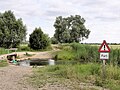
 BS Mittelriede Mündung.JPG 3,648 × 2,736; 3.81 MB
-
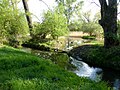
 BS Mittelriede.JPG 3,648 × 2,736; 3.2 MB
-
 Karte Schunterkanal Braunschweig von 1761.jpg 1,024 × 1,176; 194 KB
-
 Mittelriede Renaturierungsgebiet B1 Auenwaldbereich.jpg 1,280 × 960; 715 KB
-
 Mittelriede Renaturierungsgebiet B1 Furt 201307.jpg 1,280 × 960; 684 KB
-
 Mittelriede Renaturierungsgebiet B1 Panorama Auenwaldbereich.jpg 2,560 × 563; 787 KB
-
 MittelriedeTafelmakerweg KanalHindernis201904.jpg 2,000 × 2,667; 3.19 MB
-
 MittelriedeTafelmakerweg KanalUndAbzweig201904.jpg 2,000 × 1,500; 2.31 MB
-
 MittelriedeTafelmakerweg KanalUndMulde201904.jpg 2,000 × 1,500; 2.27 MB
-
 MittelriedeTafelmakerweg MuendungAltNeu201904.jpg 2,000 × 1,500; 2.62 MB
-
 MittelriedeTafelmakerweg VerzweigungAltNeu201904.jpg 2,000 × 1,500; 2.45 MB
-
 SK20-001C StadtplanBS-200ppi -Apr2019- Ausschnitt Prinzenpark.jpg 750 × 711; 408 KB


