Category:Mittlerer Grumbacher Teich
Jump to navigation
Jump to search
.jpg) | |||||
| Upload media | |||||
| Instance of |
| ||||
|---|---|---|---|---|---|
| Part of |
| ||||
| Location | Goslar, Lower Saxony, Germany | ||||
 | |||||
Media in category "Mittlerer Grumbacher Teich"
The following 16 files are in this category, out of 16 total.
-
 Grumb T Mittl (3).jpg 2,048 × 1,536; 1.41 MB
-
 Grumb T Mittl v Ost.jpg 2,048 × 1,536; 1.43 MB
-
 Liebesbankweg - panoramio (18).jpg 5,184 × 3,456; 13.44 MB
-
 Liebesbankweg - panoramio (19).jpg 5,184 × 3,456; 18.11 MB
-
 Liebesbankweg - panoramio (20).jpg 3,456 × 5,184; 16.96 MB
-
 Liebesbankweg - panoramio (21).jpg 5,184 × 3,456; 11.13 MB
-
 Liebesbankweg - panoramio (24).jpg 5,184 × 3,456; 10.92 MB
-
 LSG Harz (LK Goslar) - Oberer Grumbacher Teich (7).jpg 5,472 × 3,648; 11.92 MB
-
 M Gr T Hochwasserentlastung links (2010).jpg 2,048 × 1,536; 1.44 MB
-
 Mittl Grumbacher Teich Blick auf Wasserfläche und Damm des Ob Grumb Teiches.jpg 2,048 × 1,536; 1.41 MB
-
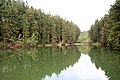
 Mittlerer Grumbacher Teich.jpg 2,048 × 1,536; 1.44 MB
-
 MittlererGrummbacherTeich-Damm.jpg 2,256 × 1,419; 920 KB
-
 MittlererGrummbacherTeich-Schild2.jpg 2,256 × 1,422; 848 KB
-
 MittlererGrummbacherTeich.jpg 2,253 × 1,362; 837 KB
-
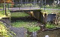 MittlererGrummbacherTeichAusflut.jpg 2,265 × 1,398; 800 KB
-
 Oberer Mittlerer Grumbacher Teich Schild.jpg 795 × 1,107; 1.33 MB
.jpg)

.jpg)
.jpg)
.jpg)
.jpg)
_-_Oberer_Grumbacher_Teich_(7).jpg)
.jpg)


