Category:Mole Valley District
Jump to navigation
Jump to search
local government district in Surrey, England   | |||||
| Upload media | |||||
| Instance of | |||||
|---|---|---|---|---|---|
| Location | Surrey, South East England, England | ||||
| Capital | |||||
| Legislative body |
| ||||
| Population |
| ||||
| Area |
| ||||
| official website | |||||
 | |||||
English: Mole Valley is a local government district of the county of Surrey in England.
Subcategories
This category has the following 17 subcategories, out of 17 total.
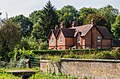
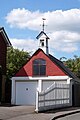
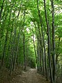
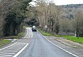
Media in category "Mole Valley District"
The following 200 files are in this category, out of 1,976 total.
(previous page) (next page)-
 "Greenfields" - geograph.org.uk - 5272972.jpg 2,560 × 1,920; 3.19 MB
-
 'Clan Line' - geograph.org.uk - 6082589.jpg 4,320 × 2,430; 7.71 MB
-
 'Flying Scotsman' - geograph.org.uk - 6168038.jpg 3,780 × 2,520; 7.79 MB
-
 'Union of South Africa' - geograph.org.uk - 6042719.jpg 5,245 × 2,950; 4.83 MB
-
 'Union of South Africa' - geograph.org.uk - 6044388.jpg 5,870 × 3,301; 5.47 MB
-
 174 Barnett Wood Lane - geograph.org.uk - 5980304.jpg 1,024 × 678; 797 KB
-
 194 - 196 Barnett Wood Lane - geograph.org.uk - 5979953.jpg 1,024 × 678; 526 KB
-
 2012 Olympic Cycle Race Sculpture - geograph.org.uk - 3373862.jpg 1,600 × 1,006; 313 KB
-
 40 Acre Field - geograph.org.uk - 2877575.jpg 640 × 425; 458 KB
-
 40 Ottways Lane - geograph.org.uk - 5918674.jpg 1,024 × 678; 553 KB
-
 70 - 80 Woodfield Lane - geograph.org.uk - 5973430.jpg 1,024 × 678; 552 KB
-
 9 - 10 Milton Street - geograph.org.uk - 5138048.jpg 1,000 × 662; 1,020 KB
-
 A classic Roller at Polesden Lacey - geograph.org.uk - 3139524.jpg 4,000 × 3,000; 3.13 MB
-
 A corner of the green at Westcott - geograph.org.uk - 3480270.jpg 640 × 427; 89 KB
-
-
 A green pond, Great Bookham Common - geograph.org.uk - 2690576.jpg 640 × 480; 156 KB
-
 A horse at Bocketts Farm, Fetcham - geograph.org.uk - 5497352.jpg 682 × 1,024; 105 KB
-
 A leafy churchyard - geograph.org.uk - 2703029.jpg 640 × 480; 176 KB
-
 A lonesome walk - geograph.org.uk - 3313520.jpg 640 × 480; 136 KB
-
 A pastoral scene, North Holmwood - geograph.org.uk - 2264320.jpg 640 × 480; 77 KB
-
 A ride on Ashtead Common - geograph.org.uk - 5602774.jpg 1,024 × 683; 220 KB
-
 A single tree - geograph.org.uk - 4903518.jpg 640 × 426; 66 KB
-
 A small beech woodland - geograph.org.uk - 3138498.jpg 2,272 × 1,704; 2.88 MB
-
 A stroll on the lawns - geograph.org.uk - 3028111.jpg 4,436 × 2,810; 4.39 MB
-

-
 A wooded path, Mole Valley - Flickr - lostajy.jpg 1,920 × 2,560; 2.29 MB
-
 A young alpaca, Bocketts Farm, Fetcham - geograph.org.uk - 5497361.jpg 1,024 × 682; 76 KB
-
 A24 - geograph.org.uk - 4859955.jpg 640 × 521; 106 KB
-
 A24 - geograph.org.uk - 4861506.jpg 640 × 568; 109 KB
-
 A24 - geograph.org.uk - 4861515.jpg 640 × 441; 71 KB
-
 A24 crosses the M25 - geograph.org.uk - 2608972.jpg 640 × 430; 33 KB
-
 A24 Overbridge, M25 - geograph.org.uk - 4510550.jpg 640 × 426; 61 KB
-
 A24, northbound - geograph.org.uk - 4892902.jpg 640 × 371; 57 KB
-
 A24, northbound - geograph.org.uk - 4892917.jpg 640 × 426; 49 KB
-
 A24, south of Burford Bridge - geograph.org.uk - 4861552.jpg 640 × 382; 56 KB
-
 A24, southbound - geograph.org.uk - 4859948.jpg 640 × 382; 53 KB
-
 A24, southbound - geograph.org.uk - 4861511.jpg 640 × 344; 52 KB
-
 A24, southbound - geograph.org.uk - 4861819.jpg 640 × 396; 39 KB
-
 A243 - geograph.org.uk - 4859933.jpg 640 × 338; 40 KB
-
 A243 - geograph.org.uk - 4859935.jpg 640 × 391; 42 KB
-
 A243 - geograph.org.uk - 4859939.jpg 640 × 374; 33 KB
-
 A243 - geograph.org.uk - 4859942.jpg 640 × 307; 32 KB
-
 A25 - geograph.org.uk - 4937675.jpg 640 × 426; 91 KB
-
 A25 - geograph.org.uk - 4937682.jpg 640 × 426; 91 KB
-
 A25 - geograph.org.uk - 4937685.jpg 640 × 426; 89 KB
-
 A25 at Pipp Brook - geograph.org.uk - 5949992.jpg 3,171 × 2,041; 936 KB
-
 A25 at Westcott, near Dorking - geograph.org.uk - 6240460.jpg 1,024 × 768; 240 KB
-
 A25 Guildford Road, Westcott - geograph.org.uk - 2774963.jpg 4,320 × 3,240; 4.6 MB
-
 A25 Guildford Road, Westcott - geograph.org.uk - 2778088.jpg 4,320 × 3,240; 4.68 MB
-
 A25, eastbound - geograph.org.uk - 4861858.jpg 640 × 409; 56 KB
-
 A25, Guildford Rd - geograph.org.uk - 4937994.jpg 640 × 426; 84 KB
-
 A25, Guildford Rd - geograph.org.uk - 4938023.jpg 640 × 426; 90 KB
-
 Abandoned part of Oaklawn Road - geograph.org.uk - 3593103.jpg 3,888 × 2,592; 6 MB
-
 Access Bridge , M25 - geograph.org.uk - 5701855.jpg 640 × 426; 56 KB
-
 Access Bridge over the M25 - geograph.org.uk - 4565223.jpg 640 × 426; 60 KB
-
 Access Bridge over the M25 - geograph.org.uk - 5034502.jpg 640 × 426; 53 KB
-
 Access Bridge, M25 - geograph.org.uk - 5106823.jpg 640 × 407; 53 KB
-
 Access Bridge, M25 - geograph.org.uk - 5844209.jpg 1,024 × 661; 104 KB
-
 Access road to Merrylands Farm - geograph.org.uk - 4140038.jpg 2,048 × 1,536; 1.37 MB
-
 Adlers Lane, Westhumble, near Dorking - geograph.org.uk - 6223344.jpg 1,024 × 768; 146 KB
-
 Admiral's Road - geograph.org.uk - 5402827.jpg 1,000 × 662; 661 KB
-
 Admiral's Road - geograph.org.uk - 5403556.jpg 1,000 × 662; 776 KB
-
 Admiral's Road - geograph.org.uk - 5403877.jpg 1,000 × 662; 840 KB
-
 Admiral's Road - geograph.org.uk - 5403878.jpg 1,000 × 662; 646 KB
-
 Admiral's Road - geograph.org.uk - 5403879.jpg 1,000 × 662; 743 KB
-
 Admiral's Road on Bockett's Farm - geograph.org.uk - 3919877.jpg 2,560 × 1,920; 2.01 MB
-
 Albert Road - geograph.org.uk - 2437599.jpg 2,560 × 1,920; 1.97 MB
-
 Alder by the River Mole, north of Mickleham - geograph.org.uk - 2799207.jpg 728 × 1,024; 149 KB
-
 Alexander Lodge Care Home - geograph.org.uk - 5918656.jpg 1,024 × 678; 852 KB
-
 All weather path, Epsom Common - geograph.org.uk - 4797963.jpg 1,600 × 1,200; 1.4 MB
-
 All weather path, Epsom Common - geograph.org.uk - 4797981.jpg 1,600 × 1,200; 1.37 MB
-
-

-
-
 Alongside Bonds Lake - geograph.org.uk - 5138140.jpg 1,000 × 662; 1.05 MB
-
 Alongside Bonds Lake - geograph.org.uk - 5138142.jpg 1,000 × 662; 1.05 MB
-
 Alongside the River Mole - geograph.org.uk - 5398114.jpg 1,000 × 662; 795 KB
-
 Alongside the River Mole - geograph.org.uk - 5398115.jpg 1,000 × 662; 811 KB
-
 An oak on Ashtead Common - geograph.org.uk - 5602780.jpg 1,024 × 683; 300 KB
-
 Animal feed container - geograph.org.uk - 4895248.jpg 640 × 426; 106 KB
-
 Anti-clockwise M25 - geograph.org.uk - 3731627.jpg 640 × 480; 260 KB
-

-
 Anticlockwise M25 near Stoke D'Abernon - geograph.org.uk - 3731179.jpg 640 × 480; 249 KB
-
 Approaching a roundabout, A24 - geograph.org.uk - 4892897.jpg 640 × 367; 54 KB
-
 Approaching Givons Grove Roundabout - geograph.org.uk - 2983558.jpg 800 × 600; 112 KB
-
 Approaching Mid Holmwood - geograph.org.uk - 2386139.jpg 2,560 × 1,920; 1.78 MB
-

-
 Art Deco houses on Newton Wood Road - geograph.org.uk - 3908138.jpg 2,560 × 1,920; 1.62 MB
-
-
 Ashstead churchyard - geograph.org.uk - 2703022.jpg 640 × 480; 141 KB
-
 Ashtead Baptist Church - geograph.org.uk - 5979954.jpg 1,024 × 678; 533 KB
-
 Ashtead Church - geograph.org.uk - 2434471.jpg 1,920 × 2,560; 2.31 MB
-
 Ashtead Church Ceiling - geograph.org.uk - 2434489.jpg 2,560 × 1,920; 2.15 MB
-
 Ashtead Common - geograph.org.uk - 2196125.jpg 4,320 × 3,240; 3.74 MB
-
 Ashtead Common - geograph.org.uk - 2196159.jpg 4,320 × 3,240; 4.5 MB
-
 Ashtead Common - geograph.org.uk - 2212496.jpg 1,600 × 1,200; 612 KB
-
 Ashtead Common - geograph.org.uk - 4797885.jpg 1,600 × 1,200; 1.26 MB
-
 Ashtead Common - geograph.org.uk - 5885959.jpg 1,024 × 678; 1.07 MB
-
 Ashtead Common - geograph.org.uk - 5886587.jpg 1,024 × 678; 857 KB
-
 Ashtead Common - geograph.org.uk - 5886590.jpg 1,024 × 678; 1,021 KB
-
 Ashtead Common - geograph.org.uk - 5888287.jpg 1,024 × 678; 849 KB
-
 Ashtead Common - geograph.org.uk - 5972318.jpg 1,024 × 678; 969 KB
-
 Ashtead Common from Woodfield Road - geograph.org.uk - 4146210.jpg 2,304 × 1,728; 822 KB
-
 Ashtead Common from Woodfield Road - geograph.org.uk - 4146218.jpg 2,304 × 1,728; 825 KB
-
 Ashtead Downs - geograph.org.uk - 2437406.jpg 2,560 × 1,920; 2.29 MB
-
 Ashtead Dry Cleaners The Street Ashtead - geograph.org.uk - 2876170.jpg 2,560 × 1,440; 507 KB
-
 Ashtead Fruiterers - geograph.org.uk - 2437564.jpg 2,560 × 1,920; 1.94 MB
-
 Ashtead Lodge - geograph.org.uk - 2434373.jpg 2,560 × 1,920; 2.28 MB
-
 Ashtead Park Garden Centre - geograph.org.uk - 5587389.jpg 1,000 × 662; 595 KB
-
 Ashtead Park Nature Reserve - geograph.org.uk - 2434405.jpg 2,560 × 1,920; 2.33 MB
-
 Ashtead Park Pond - geograph.org.uk - 2434410.jpg 2,560 × 1,920; 2.43 MB
-
 Ashtead Peace Memorial Hall - geograph.org.uk - 5973971.jpg 1,024 × 678; 748 KB
-

-
 Ashtead Post Office, 39 The Street - geograph.org.uk - 2103762.jpg 1,024 × 803; 217 KB
-
 Ashtead Station - geograph.org.uk - 5906293.jpg 1,024 × 678; 565 KB
-
 Ashtead station from the footbridge - geograph.org.uk - 4146290.jpg 2,304 × 1,728; 844 KB
-
 Ashtead Village Club, 104 The Street - geograph.org.uk - 2103730.jpg 1,024 × 773; 191 KB
-
 Ashtead Woods Road - geograph.org.uk - 4145585.jpg 2,304 × 1,728; 820 KB
-
 Ashtead Woods Road - geograph.org.uk - 4145595.jpg 2,304 × 1,728; 793 KB
-
 Ashtead Woods Road - geograph.org.uk - 4145600.jpg 2,304 × 1,728; 784 KB
-
 Ashtead Youth Centre - geograph.org.uk - 5906313.jpg 1,024 × 678; 611 KB
-
 Ashtead, Chalk Lane - geograph.org.uk - 2437386.jpg 2,560 × 1,920; 2.43 MB
-
 Ashtead, postbox № KT21 21, Overdale - geograph.org.uk - 4332597.jpg 480 × 640; 87 KB
-
 Ashurst Drive, Box Hill - geograph.org.uk - 4789113.jpg 2,242 × 1,642; 1.34 MB
-
 Ashurst Place - geograph.org.uk - 5787171.jpg 1,024 × 678; 717 KB
-
 Ashurst Place, Dorking - geograph.org.uk - 3384828.jpg 1,600 × 1,116; 310 KB
-
 Autumn colours by Reigate Road - geograph.org.uk - 2675065.jpg 640 × 480; 95 KB
-
-
 Aviva sports ground - geograph.org.uk - 5100722.jpg 1,000 × 662; 795 KB
-
 Aviva sports ground - geograph.org.uk - 5100723.jpg 1,000 × 662; 917 KB
-
 B2033 near Tyrrells Wood - geograph.org.uk - 2311721.jpg 480 × 640; 115 KB
-
 B2038 - geograph.org.uk - 5141507.jpg 640 × 323; 57 KB
-
 B2038 - geograph.org.uk - 5345238.jpg 640 × 425; 90 KB
-
 B2430 Bridge, M25 - geograph.org.uk - 4510569.jpg 640 × 426; 57 KB
-
 B2430 Bridge, M25 - geograph.org.uk - 5038727.jpg 640 × 451; 58 KB
-
 Bagden Lodge, Chapel Lane - geograph.org.uk - 2766327.jpg 1,600 × 1,200; 551 KB
-
 Balchins Lane - geograph.org.uk - 4937993.jpg 640 × 426; 104 KB
-
 Barn at Milehouse Farm - geograph.org.uk - 4294025.jpg 2,560 × 1,920; 1.21 MB
-
 Barn at Stockman's - geograph.org.uk - 2537421.jpg 1,024 × 1,024; 249 KB
-
 Barn, Chadhurst Farm - geograph.org.uk - 4895197.jpg 640 × 426; 52 KB
-
 Barn, Chadhurst Farm - geograph.org.uk - 4895207.jpg 640 × 404; 54 KB
-
 Barn, Landbarn Farm - geograph.org.uk - 2271702.jpg 640 × 339; 51 KB
-
 Barn, Milehouse - geograph.org.uk - 4889462.jpg 640 × 426; 50 KB
-
 Barn, Westlees Farm - geograph.org.uk - 4895287.jpg 640 × 426; 82 KB
-
 Barnett Wood Lane - geograph.org.uk - 5979952.jpg 1,024 × 678; 582 KB
-
 Barnmeadow Lane - geograph.org.uk - 2801026.jpg 4,288 × 3,216; 3.48 MB
-
 Barns by path junction - geograph.org.uk - 5813061.jpg 1,024 × 764; 250 KB
-
 Barns, Milehouse - geograph.org.uk - 4889459.jpg 640 × 426; 55 KB
-
 Beales Road - geograph.org.uk - 2690086.jpg 640 × 428; 104 KB
-
 Beaverbrook golf course - geograph.org.uk - 5932566.jpg 1,024 × 678; 680 KB
-
 Beech tree near Big High Grove - geograph.org.uk - 4223583.jpg 2,048 × 1,536; 4.14 MB
-
 Beech trees by the Pilgrims' Way - geograph.org.uk - 4675422.jpg 685 × 1,024; 268 KB
-
 Beechwood by Thirty Acres Barn - geograph.org.uk - 2437447.jpg 2,560 × 1,920; 2.25 MB
-
 Beechy Wood - geograph.org.uk - 5744271.jpg 2,783 × 1,856; 7.68 MB
-
 Beechy Wood - geograph.org.uk - 5744274.jpg 3,180 × 2,121; 7.59 MB
-
 Bell Lane at the corner of Bell Lane Close, Fetcham - geograph.org.uk - 3919869.jpg 2,560 × 1,920; 2.11 MB
-
 Bell Lane Close, Fetcham - geograph.org.uk - 3919810.jpg 2,560 × 1,920; 2.08 MB
-
 Bell Lane, Fetcham - geograph.org.uk - 3919864.jpg 2,560 × 1,920; 1.91 MB
-
 Below the North Downs - geograph.org.uk - 5144188.jpg 640 × 498; 67 KB
-
 Below the North Downs - geograph.org.uk - 5345262.jpg 640 × 425; 61 KB
-
 Bend on Ashtead Woods Road - geograph.org.uk - 4145588.jpg 2,304 × 1,728; 811 KB
-
 Bend on Ermyn Way, Ashtead - geograph.org.uk - 4248026.jpg 2,560 × 1,920; 2.04 MB
-
 Bend on Zigzag Road, Box Hill - geograph.org.uk - 4177763.jpg 2,560 × 1,920; 2.19 MB
-
 Beside Box Hill - geograph.org.uk - 4190600.jpg 4,000 × 3,000; 3.18 MB
-
 Betchworth Tunnel - geograph.org.uk - 1817219.jpg 640 × 426; 136 KB
-
 Betchworth Tunnel, southern end - geograph.org.uk - 5812504.jpg 1,024 × 768; 413 KB
-
 Birch Court on Links Road, Ashtead - geograph.org.uk - 4146228.jpg 2,304 × 1,728; 674 KB
-
 Bird hide, Bookham Common - geograph.org.uk - 4567501.jpg 2,000 × 1,333; 2.95 MB
-
 Blackbrook Road, Blackbrook - geograph.org.uk - 4176971.jpg 2,560 × 1,920; 1.89 MB
-
 Blackbrook, Chandler Close - geograph.org.uk - 4451513.jpg 4,608 × 3,456; 6.35 MB
-
 Blackbrook, Surrey, The 'Royal Oak' - geograph.org.uk - 4395161.jpg 4,608 × 3,456; 6.93 MB
-
 Blackthorne Road - geograph.org.uk - 5403891.jpg 1,000 × 662; 496 KB
-
 Bocketts Farm - geograph.org.uk - 4241670.jpg 700 × 525; 143 KB
-
 Bocketts Farm - Tearooms - geograph.org.uk - 5253841.jpg 2,560 × 1,920; 2.93 MB
-
 Bocketts Farm, Fetcham - geograph.org.uk - 5497335.jpg 1,024 × 682; 196 KB
-

-
 Bookham Common - geograph.org.uk - 3122705.jpg 2,048 × 1,536; 3.32 MB
-
 Bookham Common - geograph.org.uk - 3122724.jpg 2,048 × 1,536; 2.34 MB
-
 Bookham Common - geograph.org.uk - 3122732.jpg 2,048 × 1,536; 2.3 MB
-
 Bookham Common - geograph.org.uk - 3122805.jpg 1,977 × 1,481; 2.3 MB
-
 Bookham Common - geograph.org.uk - 4140028.jpg 2,048 × 1,536; 1.49 MB
-
 Bookham Common - geograph.org.uk - 4146876.jpg 2,048 × 1,536; 1.8 MB
-
 Bookham Common - geograph.org.uk - 4147683.jpg 2,048 × 1,536; 1.53 MB
-
 Bookham Common - geograph.org.uk - 4566883.jpg 2,000 × 1,333; 2.24 MB
-
 Bookham Common western plain - geograph.org.uk - 4146723.jpg 2,017 × 1,514; 985 KB
-
 Bookham Commons - geograph.org.uk - 2801014.jpg 4,288 × 3,216; 3.36 MB
-
 Bookham Grove House - geograph.org.uk - 2802768.jpg 4,288 × 3,216; 3.62 MB
-
 Bookham Riding Club Field - geograph.org.uk - 5408895.jpg 1,000 × 662; 672 KB
-
 Bookham Road looking towards Hundred Pound Bridge - geograph.org.uk - 4147146.jpg 2,560 × 1,920; 1.9 MB
-
 Bookham Telephone Exchange, Surrey - geograph.org.uk - 2323697.jpg 3,072 × 2,304; 1.79 MB
-
 Bookham village sign - geograph.org.uk - 5743941.jpg 662 × 1,000; 1.04 MB
-
 Bovine Bookham - geograph.org.uk - 5281491.jpg 3,437 × 2,576; 3.41 MB
-
 Box Hill - geograph.org.uk - 3048179.jpg 640 × 425; 376 KB
-
 Box Hill Café - geograph.org.uk - 5308140.jpg 3,985 × 2,656; 7.3 MB
-
 Box Hill Country Store - geograph.org.uk - 2266043.jpg 640 × 426; 100 KB
-
 Box Hill footbridge over the River Mole - geograph.org.uk - 2110267.jpg 3,072 × 2,304; 4.76 MB
-
 Box Hill seen from part of the North Downs Way - geograph.org.uk - 2853802.jpg 3,968 × 2,976; 2.72 MB
-
 Box Hill Village Hall - geograph.org.uk - 4225625.jpg 1,600 × 1,200; 279 KB
-
 Box Hill, Bridleway off the B2033 - geograph.org.uk - 3590905.jpg 640 × 427; 159 KB
-
 Box Hill, Country Stores - geograph.org.uk - 3590886.jpg 3,456 × 2,304; 5.08 MB


_-_geograph.org.uk_-_2830968.jpg)
_-_geograph.org.uk_-_2831033.jpg)


_-_geograph.org.uk_-_3731298.jpg)


