Category:Molenstraat 13, Coevorden
Jump to navigation
Jump to search
| Object location | | View all coordinates using: OpenStreetMap |
|---|
 | |||||
| Upload media | |||||
| Instance of | |||||
|---|---|---|---|---|---|
| Location | Coevorden, Drenthe, Netherlands | ||||
| Street address |
| ||||
| Heritage designation |
| ||||
 | |||||
|
This is a category about rijksmonument number 11498
|
| Address |
|
Media in category "Molenstraat 13, Coevorden"
The following 7 files are in this category, out of 7 total.
-
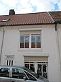 Coevorden Molenstraat 13.jpg 3,000 × 4,000; 611 KB
-
 Coevorden Molenstraat 5-21.jpg 4,000 × 3,000; 1.03 MB
-
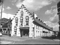
 Coevorden Molenstraat 5-31 Voorm. Kazerne.jpg 4,000 × 3,000; 1.04 MB
-
 Overzicht - Coevorden - 20047069 - RCE.jpg 1,192 × 1,200; 300 KB
-
 Voor- en zijgevel nr. F 146-31 - Coevorden - 20467238 - RCE.jpg 1,200 × 900; 139 KB
-
 Voor- zijgevel - Coevorden - 20047045 - RCE.jpg 1,188 × 1,200; 284 KB
-
 Voorgevel - Coevorden - 20047044 - RCE.jpg 1,193 × 1,200; 285 KB


