Category:Monkstown, County Dublin
Jump to navigation
Jump to search
English: Monkstown , is a village in the south Dublin suburbs, located in Dún Laoghaire-Rathdown County, Ireland. It is located on the coast, between the towns of Blackrock and Dún Laoghaire. The DART stations of Seapoint and Salthill and Monkstown serve the village.
suburb in Leinster, Ireland   | |||||
| Upload media | |||||
| Instance of | |||||
|---|---|---|---|---|---|
| Location | Dún Laoghaire–Rathdown, Ireland | ||||
 | |||||
Subcategories
This category has the following 3 subcategories, out of 3 total.
M
- Monkstown Castle (24 F)
- Monkstown Church, Dublin (17 F)
Media in category "Monkstown, County Dublin"
The following 45 files are in this category, out of 45 total.
-
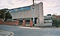
 Car park at Salthill and Monkstown station - geograph.org.uk - 3377011.jpg 2,592 × 1,936; 1.75 MB
-
 Carrickbrennan Churchyard.JPG 2,304 × 3,072; 2.69 MB
-
 CBC Monkstown 1843 bulding, Tower and 1986 building.jpg 1,023 × 398; 93 KB
-
 Coastal walkway alongside the DART line - geograph.org.uk - 1972049.jpg 1,024 × 742; 150 KB
-
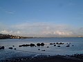
 Dublin Bay - Seapoint.jpg 8,758 × 5,839; 20.56 MB
-
-
 Graffiti on sea wall next to the Dart line - geograph.org.uk - 1972042.jpg 1,024 × 768; 159 KB
-
 IRMG 20200609 125813 (49988078761).jpg 3,024 × 4,032; 4.57 MB
-
 LambertPuppetTheatre.jpg 3,072 × 2,304; 1.94 MB
-
 Monkstown - County Dublin (Near Dun Laoghaire) (1659429077).jpg 2,048 × 1,365; 529 KB
-
 Monkstown - County Dublin (Near Dun Laoghaire) (1659429361).jpg 2,048 × 1,365; 434 KB
-
 Monkstown - County Dublin (Near Dun Laoghaire) (1659429851).jpg 2,048 × 1,365; 398 KB
-
 Monkstown - County Dublin (Near Dun Laoghaire) (1659430141).jpg 2,048 × 1,365; 391 KB
-
 Monkstown - County Dublin (Near Dun Laoghaire) (1659430391).jpg 2,048 × 1,365; 404 KB
-
 Monkstown - County Dublin (Near Dun Laoghaire) (1659431017).jpg 2,048 × 1,365; 431 KB
-
 Monkstown - County Dublin (Near Dun Laoghaire) (1659431331).jpg 2,048 × 1,365; 458 KB
-
 Monkstown - County Dublin (Near Dun Laoghaire) (1659432317).jpg 2,048 × 1,365; 559 KB
-
 Monkstown - County Dublin (Near Dun Laoghaire) (1659433249).jpg 2,048 × 1,365; 705 KB
-
 Monkstown - County Dublin (Near Dun Laoghaire) (1659434073).jpg 2,048 × 1,365; 631 KB
-
 Monkstown - County Dublin (Near Dun Laoghaire) (1659434415).jpg 2,048 × 1,365; 561 KB
-
 Monkstown - County Dublin (Near Dun Laoghaire) (1659435055).jpg 2,048 × 1,365; 474 KB
-
 Monkstown - County Dublin (Near Dun Laoghaire) (1659435437).jpg 2,048 × 1,365; 582 KB
-
 Monkstown - County Dublin (Near Dun Laoghaire) (1660289056).jpg 2,048 × 1,365; 505 KB
-
 Monkstown - County Dublin (Near Dun Laoghaire) (1660289376).jpg 2,048 × 1,365; 433 KB
-
 Monkstown - County Dublin (Near Dun Laoghaire) (1660290242).jpg 2,048 × 1,365; 370 KB
-
 Monkstown - County Dublin (Near Dun Laoghaire) (1660292464).jpg 2,048 × 1,365; 947 KB
-
 Monkstown - County Dublin (Near Dun Laoghaire) (1660294098).jpg 2,048 × 1,365; 623 KB
-
 Monkstown - County Dublin (Near Dun Laoghaire) (1660295102).jpg 2,048 × 1,365; 454 KB
-
 Monkstown - County Dublin (Near Dun Laoghaire) (1660296166).jpg 2,048 × 1,365; 453 KB
-
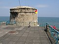 Monkstown Martello Tower - geograph.org.uk - 459721.jpg 640 × 480; 82 KB
-
 Monkstown St. Patrick's Church Interior Nave South West 1.jpg 4,492 × 3,356; 5.04 MB
-
 Monkstown St. Patrick's Church Interior Nave South West 2.jpg 4,496 × 3,374; 5.44 MB
-
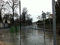
 Old Dunleary Road towards Dun Laoghaire - geograph.org.uk - 4144170.jpg 1,600 × 1,200; 1.03 MB
-

-

-

-
 Salle D'armes Duffy.jpg 3,264 × 2,448; 2.99 MB
-
 Salthill and Monkstown Station - geograph.org.uk - 1972029.jpg 1,024 × 766; 173 KB
-
 Scoil Lorcain, Monkstown.JPG 3,072 × 2,304; 2.52 MB
-
 Seapoint Avenue, Monkstown - geograph.org.uk - 4144197.jpg 1,600 × 1,178; 900 KB
-
 Seapoint Monkstown Panorama1.jpg 8,765 × 2,543; 4.33 MB
-
 Stradbrook Road - geograph.org.uk - 3389449.jpg 2,592 × 1,936; 2 MB
-
 Terrace on Old Dunleary Road - geograph.org.uk - 4098800.jpg 4,608 × 3,456; 3.52 MB
-
 Towards seapoint - geograph.org.uk - 84997.jpg 640 × 480; 59 KB
-
 Waiting for green - geograph.org.uk - 4211365.jpg 4,608 × 3,456; 3.26 MB


.jpg)

_(1659429077).jpg)
_(1659429361).jpg)
_(1659429851).jpg)
_(1659430141).jpg)
_(1659430391).jpg)
_(1659431017).jpg)
_(1659431331).jpg)
_(1659432317).jpg)
_(1659433249).jpg)
_(1659434073).jpg)
_(1659434415).jpg)
_(1659435055).jpg)
_(1659435437).jpg)
_(1660289056).jpg)
_(1660289376).jpg)
_(1660290242).jpg)
_(1660292464).jpg)
_(1660294098).jpg)
_(1660295102).jpg)
_(1660296166).jpg)


