Category:Moretonhampstead
Jump to navigation
Jump to search
town in Teignbridge, Devon, UK  | |||||
| Upload media | |||||
| Instance of | |||||
|---|---|---|---|---|---|
| Located in protected area | |||||
| Location | Teignbridge, Devon, South West England, England | ||||
| official website | |||||
 | |||||
English: Moretonhampstead is a small market town and civil parish in Devon, England. It lies on the edge of Dartmoor and is notable for having the longest one-word name of any place in England. The parish church is dedicated to St. Andrew. Moretonhampstead is twinned with Betton in France.
Polski: Moretonhampstead - miasto w Wielkiej Brytanii, w Anglii w hrabstwie Devon, położone na skraju Parku Narodowego Dartmoor w dolinie Wray. W 2002 roku uzyskała tytuł Village of the Year. Mimo oficjalnego statusu miasta miejscowość zachowuje wiejski charakter.
Română: Moretonhampstead este un oraş în comitatul Devon, regiunea South West, Anglia. Oraşul aparţine districtului Teignbridge.
Subcategories
This category has the following 16 subcategories, out of 16 total.
A
- Almshouses, Moretonhampstead (6 F)
C
- Clifford Bridge, Devon (4 F)
- Cranbrook Castle (5 F)
F
- Fingle Bridge (42 F)
- Fingle Woods (32 F)
M
- Mearsdon Manor (3 F)
P
T
W
- Wooston Castle (3 F)
Media in category "Moretonhampstead"
The following 200 files are in this category, out of 1,006 total.
(previous page) (next page)-
 177 'Tortoise' completes a hill climb - geograph.org.uk - 1116142.jpg 640 × 480; 107 KB
-
 A quiet street in Moretonhampstead - geograph.org.uk - 75218.jpg 640 × 480; 116 KB
-

-
 A382 at Moretonhampstead - geograph.org.uk - 3940214.jpg 1,600 × 929; 268 KB
-
 A382 in the Wray valley - geograph.org.uk - 1228449.jpg 640 × 480; 108 KB
-
 A382 in the Wray valley - geograph.org.uk - 1228454.jpg 640 × 480; 108 KB
-
 A382 junction with Pepperdon Hall Lane - geograph.org.uk - 5125162.jpg 1,600 × 1,198; 769 KB
-
 A382 near King's Bridge - geograph.org.uk - 3923350.jpg 1,600 × 1,063; 380 KB
-
 Across the Teign - geograph.org.uk - 3123778.jpg 480 × 640; 126 KB
-
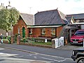
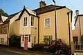
 Almshouses, Cross Street - geograph.org.uk - 6137081.jpg 640 × 423; 92 KB
-
 Anthocharis cardamines - geograph.org.uk - 1292386.jpg 640 × 445; 51 KB
-
 Arable field near Pepperdon Down - geograph.org.uk - 3323057.jpg 581 × 640; 111 KB
-
 Artistic railings - geograph.org.uk - 5933689.jpg 4,320 × 3,240; 4.36 MB
-
 Ash by the Wray Valley Trail - geograph.org.uk - 3321577.jpg 493 × 640; 106 KB
-
 Ash House near Linscott - geograph.org.uk - 3922733.jpg 1,920 × 1,263; 497 KB
-
 Ash House near Linscott - geograph.org.uk - 4021888.jpg 1,920 × 2,485; 977 KB
-
 Auto dans une rue, Moretonhampstead - geograph.org.uk - 237288.jpg 640 × 480; 74 KB
-
 B3212 - geograph.org.uk - 5257428.jpg 640 × 426; 85 KB
-
 B3212 - geograph.org.uk - 5257431.jpg 640 × 426; 100 KB
-
 B3212 - geograph.org.uk - 5257436.jpg 640 × 426; 95 KB
-
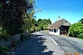
 B3212 approaching Moretonhampstead - geograph.org.uk - 5406684.jpg 800 × 600; 127 KB
-
 B3212 at Lowton - geograph.org.uk - 4033754.jpg 640 × 397; 73 KB
-
 B3212 near Cossick Farm - geograph.org.uk - 5257427.jpg 640 × 426; 84 KB
-
 B3212 near Doccombe - geograph.org.uk - 1292792.jpg 640 × 399; 85 KB
-
 B3212, Moretonhampstead - geograph.org.uk - 5257433.jpg 640 × 426; 57 KB
-
 Barn conversion (geograph 5946143).jpg 4,320 × 3,240; 2.78 MB
-
 Beeches by Pepperdon Down - geograph.org.uk - 1290988.jpg 640 × 480; 157 KB
-
 Beeches by the lane - geograph.org.uk - 1290833.jpg 500 × 640; 93 KB
-
 Belt of trees near Pepperdon Down - geograph.org.uk - 1290959.jpg 480 × 640; 161 KB
-
 Betton Way, Moretonhampstead - geograph.org.uk - 1294119.jpg 640 × 431; 74 KB
-
 Black beetle, Mardon Down - geograph.org.uk - 1292420.jpg 640 × 487; 109 KB
-
 Bluebells in Woodcock Wood (2) - geograph.org.uk - 1292367.jpg 640 × 488; 165 KB
-
 Bluebells in Woodcock Wood (3) - geograph.org.uk - 1292373.jpg 640 × 480; 141 KB
-
 Bluebells in Woodcock Wood - geograph.org.uk - 1292050.jpg 640 × 480; 154 KB
-
 Bluebells on Mardon Down - geograph.org.uk - 2999090.jpg 640 × 480; 125 KB
-
 Boggy land, near Bowden Farm - geograph.org.uk - 1115516.jpg 640 × 480; 79 KB
-
 Boulder by the path, Halscombe - geograph.org.uk - 3324295.jpg 640 × 476; 108 KB
-
 Boulder strewn knoll - geograph.org.uk - 2172154.jpg 1,024 × 683; 158 KB
-
 Bowring Library - geograph.org.uk - 5933694.jpg 4,320 × 3,240; 2.68 MB
-
 Bowring Mead - Station Road - geograph.org.uk - 3923345.jpg 1,600 × 1,071; 237 KB
-

-
 Bracken on the earthwork of Wooston Castle - geograph.org.uk - 5933556.jpg 1,600 × 1,200; 1.05 MB
-
 Bridge across the Wray Brook - geograph.org.uk - 3321612.jpg 640 × 480; 102 KB
-
 Bridge for Wray Valley Trail - geograph.org.uk - 5125178.jpg 1,600 × 1,196; 855 KB
-
 Bridge near Forder - geograph.org.uk - 3922713.jpg 1,920 × 1,440; 720 KB
-
 Bridge on Wray Valley Trail - geograph.org.uk - 3320697.jpg 640 × 466; 83 KB
-

-
 Bridge, Wray Valley Trail - geograph.org.uk - 3321001.jpg 475 × 640; 88 KB
-
 Bridge, Wray Valley Trail - geograph.org.uk - 3321140.jpg 640 × 480; 104 KB
-
 Bridle path to Fingle Bridge - geograph.org.uk - 3015728.jpg 4,000 × 3,000; 4.81 MB
-
 Bridleway above Doccombe - geograph.org.uk - 1292809.jpg 480 × 640; 149 KB
-
 Bridleway near Leign - geograph.org.uk - 1291998.jpg 640 × 471; 108 KB
-
 Bridleway near Leign - geograph.org.uk - 1292034.jpg 640 × 480; 136 KB
-
 Bridleway near Leign - geograph.org.uk - 1292380.jpg 480 × 640; 121 KB
-
 Bridleway to Butterdon Down - geograph.org.uk - 5335694.jpg 3,072 × 2,048; 1.34 MB
-
 Bridleway to Leign - geograph.org.uk - 1291945.jpg 640 × 480; 135 KB
-
 Bridleway to Moretonhampstead - geograph.org.uk - 5102579.jpg 1,600 × 1,067; 884 KB
-
 Brinning Lane - geograph.org.uk - 3320157.jpg 480 × 640; 122 KB
-
 Budleigh Farm - geograph.org.uk - 3321758.jpg 640 × 467; 54 KB
-
 Budleigh Farm campsite - geograph.org.uk - 1188805.jpg 640 × 264; 73 KB
-
 Buildings by the Wray Valley Trail - geograph.org.uk - 3320778.jpg 640 × 403; 51 KB
-
 Buildings near Clifford Bridge - geograph.org.uk - 2619764.jpg 640 × 462; 87 KB
-
 Bull near Beara Farm - geograph.org.uk - 3930622.jpg 1,907 × 2,124; 1.09 MB
-
 Bullock near Wadley Brook - geograph.org.uk - 1468520.jpg 640 × 469; 106 KB
-
 Bullocks near Wadley Brook (2) - geograph.org.uk - 1468536.jpg 640 × 501; 135 KB
-
 Bullocks near Wadley Brook - geograph.org.uk - 1468526.jpg 640 × 480; 133 KB
-
 Bullocks, Cranbrook - geograph.org.uk - 1478476.jpg 640 × 454; 86 KB
-
 Butterdon Down - geograph.org.uk - 5336134.jpg 3,072 × 1,895; 1.21 MB
-
 Butterdon Down - geograph.org.uk - 5336161.jpg 3,072 × 2,048; 1.44 MB
-
 Butterdon Down - geograph.org.uk - 5336290.jpg 3,072 × 2,048; 1.29 MB
-
 By the Wray Valley Trail - geograph.org.uk - 3320712.jpg 640 × 462; 92 KB
-
 Byway, Sloncombe - geograph.org.uk - 1468560.jpg 469 × 640; 143 KB
-
 Cairn circle on Mardon Down - geograph.org.uk - 2095775.jpg 1,024 × 683; 172 KB
-
 Cairn Circle, Mardon Down - geograph.org.uk - 4156469.jpg 1,600 × 1,200; 362 KB
-
 Car park and bus station - geograph.org.uk - 5955916.jpg 4,320 × 3,240; 3.26 MB
-
 Car park signage - geograph.org.uk - 3961094.jpg 4,912 × 3,264; 5.63 MB
-

-
 Cattle grid, near Mardon Down - geograph.org.uk - 1116683.jpg 640 × 480; 72 KB
-
 Cattle near Greenawell - geograph.org.uk - 4141706.jpg 1,920 × 1,224; 584 KB
-
 Cattle near Greenawell - geograph.org.uk - 4142476.jpg 1,920 × 1,294; 616 KB
-
 Cattle near Pepperdon Farm - geograph.org.uk - 3322700.jpg 512 × 640; 105 KB
-
 Centre of Moretonhampstead - geograph.org.uk - 3923336.jpg 4,676 × 3,022; 2.68 MB
-
 Charcoal kiln, Whiddon Wood - geograph.org.uk - 2190828.jpg 640 × 480; 127 KB
-
 Charles Wood - geograph.org.uk - 1478247.jpg 480 × 640; 89 KB
-
 Cherry Brook Farmhouse - geograph.org.uk - 1468546.jpg 640 × 480; 110 KB
-
 Church of St Andrew, Fore Street, Moretonhampstead - geograph.org.uk - 6121922.jpg 3,456 × 4,608; 5.07 MB
-
 Cleared and replanted woodland near Butterdon - geograph.org.uk - 5336408.jpg 3,072 × 2,048; 1.35 MB
-
 Cleared and replanted woodland near Butterdon - geograph.org.uk - 5336467.jpg 3,072 × 2,048; 1.37 MB
-
 Clifford Farm - geograph.org.uk - 1095791.jpg 640 × 480; 77 KB
-
 Cod Wood - geograph.org.uk - 1932904.jpg 640 × 480; 356 KB
-
 Cod Wood - geograph.org.uk - 2676487.jpg 640 × 480; 121 KB
-
 Coleridge Wood - geograph.org.uk - 1095771.jpg 640 × 480; 134 KB
-
 Community Club - geograph.org.uk - 5932774.jpg 4,320 × 3,240; 3.1 MB
-
 Construction on a weir on the River Teign - geograph.org.uk - 5483088.jpg 1,200 × 1,600; 930 KB
-
 Corner shop - Court Street - geograph.org.uk - 3946037.jpg 4,912 × 3,264; 4.66 MB
-
 Cossick Cross - geograph.org.uk - 3205694.jpg 800 × 600; 170 KB
-
 Cossick Cross - geograph.org.uk - 3323151.jpg 640 × 425; 70 KB
-
 Cossick Cross on B3212 - geograph.org.uk - 3203325.jpg 1,024 × 768; 453 KB
-
 Cossick Farm - geograph.org.uk - 3323132.jpg 640 × 434; 72 KB
-
 Cottage at Doccombe - geograph.org.uk - 1292723.jpg 640 × 467; 98 KB
-
 Cottages along Court Street - geograph.org.uk - 3946027.jpg 4,912 × 3,264; 5.16 MB
-
 Cottages by Station Road car park - geograph.org.uk - 3961117.jpg 1,600 × 1,063; 398 KB
-
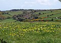
 Country near the Hennock Reservoirs - geograph.org.uk - 37690.jpg 640 × 425; 81 KB
-
 Countryside near Bearland - geograph.org.uk - 1467589.jpg 640 × 480; 88 KB
-
-

-
 Countryside near Howton - geograph.org.uk - 1478557.jpg 640 × 480; 67 KB
-
 Countryside west of Moretonhampstead - geograph.org.uk - 4021969.jpg 1,915 × 1,363; 556 KB
-
 Court St - geograph.org.uk - 5257434.jpg 640 × 426; 58 KB
-
 Court Street - Pound Street - geograph.org.uk - 3946035.jpg 4,912 × 3,264; 5.22 MB
-
 Court Street railings, Moretonhampstead - geograph.org.uk - 1395287.jpg 640 × 480; 213 KB
-
 Court Street, looking east - geograph.org.uk - 4166401.jpg 640 × 480; 77 KB
-
 Court Street, Moretonhampstead (2022-08-25) 01.jpg 5,568 × 3,712; 13.52 MB
-
 Court Street, Moretonhampstead (2022-08-25) 02.jpg 3,712 × 5,568; 15.23 MB
-
 Court Street, Moretonhampstead (2022-08-25) 03.jpg 3,712 × 5,568; 16.51 MB
-
 Court Street, Moretonhampstead (2022-08-25) 04.jpg 3,712 × 5,568; 15.45 MB
-
 Court Street, Moretonhampstead (2022-08-25) 05.jpg 5,568 × 3,712; 14.9 MB
-
 Court Street, Moretonhampstead (2022-08-25) 06.jpg 3,712 × 5,568; 15.17 MB
-
 Court Street, Moretonhampstead (2022-08-25) 07.jpg 5,568 × 3,712; 12.39 MB
-
 Court Street, Moretonhampstead (2022-08-25) 08.jpg 5,568 × 3,712; 14.23 MB
-
 Court Street, Moretonhampstead (2022-08-25) 09.jpg 5,568 × 3,712; 14 MB
-
 Court Street, Moretonhampstead (2022-08-25) 10.jpg 3,712 × 5,568; 14.71 MB
-
 Court Street, Moretonhampstead (2022-08-25) 11.jpg 3,712 × 5,568; 18.26 MB
-
 Court Street, Moretonhampstead (2022-08-25) 12.jpg 5,568 × 3,712; 19.66 MB
-
 Court Street, Moretonhampstead - geograph.org.uk - 1114843.jpg 640 × 480; 60 KB
-
 Court Street, Moretonhampstead - geograph.org.uk - 1293942.jpg 487 × 640; 85 KB
-
 Court Street, Moretonhampstead - geograph.org.uk - 237287.jpg 480 × 640; 69 KB
-
 Court Street, Moretonhampstead - geograph.org.uk - 6130124.jpg 4,608 × 2,592; 3.67 MB
-
 Court Street, Moretonhampstead - geograph.org.uk - 939448.jpg 640 × 480; 122 KB
-
 Cranbrook Down - geograph.org.uk - 1116030.jpg 640 × 480; 110 KB
-
 Cranbrook Down from Butterdon Down - geograph.org.uk - 1229757.jpg 640 × 427; 40 KB
-
 Cranbrook Farm - geograph.org.uk - 1115552.jpg 640 × 480; 85 KB
-
 Cross Street looking east. - geograph.org.uk - 1808746.jpg 640 × 480; 64 KB
-
 Cross Street Moretonhampstead - geograph.org.uk - 5406671.jpg 3,284 × 2,285; 2.73 MB
-
 Cross Street, Moretonhampstead (2022-08-25) 01.jpg 3,712 × 5,568; 13.03 MB
-
 Cross Street, Moretonhampstead (2022-08-25) 02.jpg 5,568 × 3,712; 12.02 MB
-
 Cross Street, Moretonhampstead (2022-08-25) 03.jpg 5,568 × 3,712; 12.82 MB
-
 Cross Street, Moretonhampstead (2022-08-25) 04.jpg 5,568 × 3,712; 11.6 MB
-
 Cross Street, Moretonhampstead (2022-08-25) 05.jpg 5,568 × 3,712; 13.78 MB
-
 Cross Street, Moretonhampstead (2022-08-25) 06.jpg 5,568 × 3,712; 13.8 MB
-
 Cross Street, Moretonhampstead (2022-08-25) 08.jpg 5,568 × 3,712; 14.43 MB
-
 Cross Street, Moretonhampstead (2022-08-25) 09.jpg 5,568 × 3,712; 15.13 MB
-
 Cross Street, Moretonhampstead (2022-08-25) 10.jpg 3,712 × 5,568; 18.93 MB
-
 Cross Street, Moretonhampstead (2022-08-25) 11.jpg 5,568 × 3,712; 20.26 MB
-
 Cross Street, Moretonhampstead (2022-08-25) 12.jpg 5,568 × 3,712; 13.54 MB
-
 Cross Street, Moretonhampstead (2022-08-25) 13.jpg 5,568 × 3,712; 20.15 MB
-
 Cross Street, Moretonhampstead (2022-08-25) 14.jpg 5,568 × 3,712; 18.97 MB
-
 Cross Street, Moretonhampstead (2022-08-25) 15.jpg 5,568 × 3,712; 21.22 MB
-
 Cross Street, Moretonhampstead (2022-08-25) 19.jpg 5,568 × 3,712; 15.3 MB
-
 Cross Street, Moretonhampstead (2022-08-25) 20.jpg 5,568 × 3,712; 17.72 MB
-
 Cross Street, Moretonhampstead (2022-08-25) 21.jpg 5,568 × 3,712; 15.26 MB
-
 Cross Street, Moretonhampstead (2022-08-25) 22.jpg 5,568 × 3,712; 13.39 MB
-
 Cross Street, Moretonhampstead (2022-08-25) 23.jpg 5,568 × 3,712; 12.55 MB
-
 Cross Street, Moretonhampstead (2022-08-25) 24.jpg 3,712 × 5,568; 13.17 MB
-
 Cross Tree Pottery, Moretonhampstead - geograph.org.uk - 2774955.jpg 640 × 480; 83 KB
-
 Cut tree, Cod Wood - geograph.org.uk - 4372579.jpg 1,920 × 2,560; 1.24 MB
-
 Cyclepath near Moretonhampstead - geograph.org.uk - 3320143.jpg 640 × 418; 53 KB
-
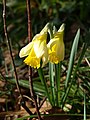 Daffodils, Dunsford Wood - geograph.org.uk - 2297236.jpg 480 × 640; 57 KB
-
 Dandelions near Doccombe Cross - geograph.org.uk - 1292838.jpg 640 × 456; 108 KB
-
 Dartmoor National Park , Country Road - geograph.org.uk - 1412519.jpg 640 × 480; 106 KB
-

-
 Dartmoor, Mardon Down - geograph.org.uk - 438460.jpg 640 × 480; 87 KB
-
 Dartmoor, Mardon Down - geograph.org.uk - 438644.jpg 640 × 480; 137 KB
-
 Dead bracken above Steward Wood - geograph.org.uk - 3322353.jpg 640 × 480; 106 KB
-
 Devon cattle - geograph.org.uk - 25525.jpg 640 × 480; 74 KB
-
 Doccombe - geograph.org.uk - 1292781.jpg 640 × 426; 74 KB
-
 Doccombe - geograph.org.uk - 18293.jpg 640 × 425; 81 KB
-
 Doccombe Cross - geograph.org.uk - 1292830.jpg 640 × 480; 95 KB
-
 Doccombe Cross - geograph.org.uk - 3323350.jpg 640 × 417; 70 KB
-
 Doccombe from Mardon Down - geograph.org.uk - 1292660.jpg 640 × 480; 124 KB
-
 Doccombe from the west - geograph.org.uk - 1292883.jpg 640 × 480; 108 KB
-
 Double stile near Pepperdon Farm - geograph.org.uk - 3322542.jpg 640 × 475; 96 KB
-
 Drive of Holcombe residential home - geograph.org.uk - 2614866.jpg 600 × 800; 544 KB
-
 Dunsford Wood - geograph.org.uk - 1932907.jpg 640 × 480; 361 KB
-
 Dunsford Wood - geograph.org.uk - 1932914.jpg 640 × 480; 127 KB
-
 Edge of Steward Wood - geograph.org.uk - 3321930.jpg 640 × 434; 129 KB
-

-
 Electricity substation - geograph.org.uk - 5955914.jpg 4,320 × 3,240; 4.54 MB
-
 Entrance to Holcombe House - geograph.org.uk - 1115459.jpg 640 × 480; 128 KB
-
 Entrance to Moretonhampstead - geograph.org.uk - 4304390.jpg 640 × 480; 55 KB
-
 Entrance to Moretonhampstead - geograph.org.uk - 4304393.jpg 640 × 480; 55 KB
-
 Entrance to Wooston Farm - geograph.org.uk - 1116665.jpg 640 × 480; 77 KB
-
 Evening light - Court Street - geograph.org.uk - 3946054.jpg 4,912 × 3,264; 4.44 MB
-
 Evidence of a former railway - geograph.org.uk - 3940186.jpg 1,600 × 1,017; 442 KB
-
 Ewe and lambs near Bowden - geograph.org.uk - 5336614.jpg 1,164 × 884; 240 KB
-
 Exeter trial 2009 - geograph.org.uk - 1116515.jpg 640 × 480; 93 KB
-
 Farm bridge - geograph.org.uk - 3270757.jpg 1,024 × 683; 288 KB
-
 Farm building, near Mardon Down - geograph.org.uk - 1095149.jpg 640 × 480; 113 KB
-
 Farm buildings, Cranbrook - geograph.org.uk - 1115991.jpg 640 × 480; 90 KB
-
 Farm buildings, Cranbrook - geograph.org.uk - 1234907.jpg 640 × 427; 273 KB
-
 Farm buildings, Cranbrook - geograph.org.uk - 1478467.jpg 640 × 480; 98 KB
-
 Farm road to Great Parford - geograph.org.uk - 168422.jpg 640 × 480; 92 KB
-
 Farm road, Bearland - geograph.org.uk - 1467626.jpg 640 × 480; 94 KB
-
 Farm track to Addiscott - geograph.org.uk - 1293059.jpg 480 × 640; 142 KB
-

-
 Farmland beneath Wray Cleath (wood) - geograph.org.uk - 3923356.jpg 4,912 × 3,264; 5.75 MB
-
 Farmland beneath Wray Cleath - geograph.org.uk - 3921186.jpg 4,912 × 3,264; 5.59 MB
-
 Farmland near Great Parford - geograph.org.uk - 4003526.jpg 1,920 × 1,316; 564 KB
-
 Fern, Doccombe - geograph.org.uk - 1292801.jpg 512 × 640; 149 KB
-


.jpg)


_-_geograph.org.uk_-_1292367.jpg)
_-_geograph.org.uk_-_1292373.jpg)


_-_geograph.org.uk_-_1468536.jpg)


_01.jpg)
_02.jpg)
_03.jpg)
_04.jpg)
_05.jpg)
_06.jpg)
_07.jpg)
_08.jpg)
_09.jpg)
_10.jpg)
_11.jpg)
_12.jpg)


_01.jpg)
_02.jpg)
_03.jpg)
_04.jpg)
_05.jpg)
_06.jpg)
_08.jpg)
_09.jpg)
_10.jpg)
_11.jpg)
_12.jpg)
_13.jpg)
_14.jpg)
_15.jpg)
_19.jpg)
_20.jpg)
_21.jpg)
_22.jpg)
_23.jpg)
_24.jpg)


_-_geograph.org.uk_-_3923356.jpg)


