Category:Mourne Wall
Vai alla navigazione
Vai alla ricerca
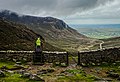
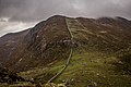
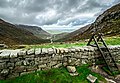
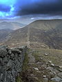
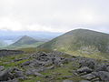
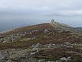
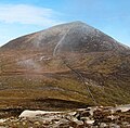
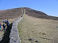
English: The Mourne Wall is a wall that was constructed to enclose a reservoir's catchment area in the Mourne Mountains, Northern Ireland. It was built between 1904 and 1922 by the Belfast Water Commissioners to enclose the water catchment in the Mournes.
Italiano: Il Mourne Wall è un muro che fu costruito per chiudere il bacino della riserva naturale di Silent Valley, nella zona delle montagne di Mourne, nella contea di Down, Irlanda del Nord.
construction  | |||||
| Carica un file multimediale | |||||
| Istanza di |
| ||||
|---|---|---|---|---|---|
| Materiale usato | |||||
| Luogo | Irlanda del Nord | ||||
| Attraversa | |||||
| Data di fondazione o creazione |
| ||||
 | |||||
File nella categoria "Mourne Wall"
Questa categoria contiene 72 file, indicati di seguito, su un totale di 72.
-
 Ascending Slievenaglogh - geograph.org.uk - 1205560.jpg 640 × 480; 347 KB
-
 By the Mourne Wall on Slieve Bearnagh - geograph.org.uk - 103631.jpg 640 × 480; 85 KB
-

-
 Gate and stile in the Mourne Wall - geograph.org.uk - 1138052.jpg 640 × 459; 260 KB
-
 Hare's Gap - geograph.org.uk - 437612.jpg 480 × 640; 80 KB
-
 Mourne Mountains 0001.jpg 5 184 × 3 456; 6,82 MB
-
 Mourne Mountains 0004.jpg 5 184 × 3 456; 8,48 MB
-
 Mourne Mountains 0005.jpg 3 777 × 2 585; 3,36 MB
-
 Mourne Mountains 0006.jpg 5 940 × 3 852; 10,33 MB
-
 Mourne Mountains 002.jpg 5 184 × 3 456; 7,29 MB
-
 Mourne Mountains 01.jpg 5 184 × 3 456; 9,14 MB
-
 Mourne Mountains 08.jpg 5 184 × 3 456; 8,51 MB
-
 Mourne Mountains 11.jpg 3 720 × 3 906; 10,7 MB
-
 Mourne Mountains 12.jpg 3 477 × 2 407; 3,98 MB
-
 Mourne Wall 01.jpg 2 616 × 3 488; 4,82 MB
-
 Mourne Wall 02.jpg 2 616 × 3 488; 5,35 MB
-
 Mourne Wall 03.jpg 1 200 × 1 600; 1,19 MB
-
 Mourne Wall 04.jpg 900 × 1 200; 836 KB
-
 Mourne Wall 05.jpg 1 200 × 1 600; 1,22 MB
-
 Mourne wall donard.jpg 395 × 263; 74 KB
-
 Mourne Wall near Annalong Wood - geograph.org.uk - 1138055.jpg 640 × 413; 274 KB
-
 Mourne Wall near Carrick Little - geograph.org.uk - 1138058.jpg 640 × 439; 244 KB
-
 Mourne Wall near Slieve Muck - geograph.org.uk - 1206324.jpg 640 × 501; 488 KB
-
 Mourne Wall near Slieve Muck - geograph.org.uk - 1206337.jpg 640 × 480; 408 KB
-
 Mourne Wall towards Slieve Binnian - geograph.org.uk - 1136940.jpg 640 × 454; 290 KB
-
 Mourne Wall, Slievenaglogh - geograph.org.uk - 1205550.jpg 640 × 514; 403 KB
-
 Mourne Wall, Slievenaglogh - geograph.org.uk - 1205553.jpg 640 × 480; 321 KB
-
 Mourne Wall, Slievenaglogh - geograph.org.uk - 1205558.jpg 640 × 480; 438 KB
-
 Mourne Wall, Slievenaglogh - geograph.org.uk - 1205562.jpg 640 × 480; 453 KB
-
 Mourne Wall, Slievenaglogh - geograph.org.uk - 1205566.jpg 640 × 522; 357 KB
-
 Mourne Wall, Slievenaglogh - geograph.org.uk - 1205568.jpg 640 × 388; 348 KB
-
 Mourne Wall, Slievenaglogh - geograph.org.uk - 1205571.jpg 640 × 410; 296 KB
-
 Mourne Wall, Slievenaglogh - geograph.org.uk - 1206255.jpg 640 × 480; 382 KB
-
 Mourne Wall, Slievenaglogh - geograph.org.uk - 1206262.jpg 640 × 480; 443 KB
-
 Mourne Wall, Slievenaglogh - geograph.org.uk - 1206294.jpg 640 × 480; 347 KB
-
 Mourne Wall, Slievenaglogh - geograph.org.uk - 1206298.jpg 640 × 480; 354 KB
-
 Mourne Wall, Slievenaglogh - geograph.org.uk - 1206346.jpg 640 × 480; 415 KB
-
-
 On the road to the Summit of Donard. - geograph.org.uk - 235382.jpg 640 × 480; 76 KB
-

-
 Slieve Bearnagh Mourne Mts Wall Oct 2016.jpg 3 872 × 2 592; 2,87 MB
-
 Slieve Donard - geograph.org.uk - 1521930.jpg 640 × 480; 78 KB
-
 Stile and gate on the Mourne Wall - geograph.org.uk - 1206307.jpg 640 × 480; 360 KB
-
 Stile and gate on the Mourne Wall - geograph.org.uk - 1206315.jpg 640 × 480; 371 KB
-
 Stile near Slievenaglogh - geograph.org.uk - 1205514.jpg 640 × 429; 332 KB
-

-

-

-
 Summit of Slieve Meelmore - geograph.org.uk - 45083.jpg 640 × 480; 90 KB
-
 Summit view from Slieve Meelbeg - geograph.org.uk - 387250.jpg 640 × 480; 44 KB
-
 The Mourne Wall - geograph.org.uk - 437283.jpg 480 × 640; 75 KB
-
 The Mourne Wall - geograph.org.uk - 437611.jpg 640 × 480; 86 KB
-
 The Mourne Wall above Hare's Gap - geograph.org.uk - 437610.jpg 640 × 480; 77 KB
-
 The Mourne Wall ascending Slieve Donard - geograph.org.uk - 4441636.jpg 1 600 × 1 200; 309 KB
-
 The Mourne Wall ascending to the summit of Slieve Donard - geograph.org.uk - 4709612.jpg 1 523 × 1 501; 665 KB
-

-
 The Mourne Wall crossing the head of Spences Valley - geograph.org.uk - 4709923.jpg 1 600 × 1 200; 607 KB
-
 The Mourne Wall near Carrick Little - geograph.org.uk - 643385.jpg 640 × 529; 117 KB
-
 The Mourne Wall near Carrick Little - geograph.org.uk - 643388.jpg 640 × 480; 47 KB
-
 The Mourne Wall near Carrick Little - geograph.org.uk - 643416.jpg 640 × 530; 143 KB
-
 The Mourne Wall near Lough Shannagh - geograph.org.uk - 4550544.jpg 640 × 364; 86 KB
-
 The Mourne Wall over Slievenaglogh. - geograph.org.uk - 229166.jpg 640 × 480; 73 KB
-
 The Mourne Wall, Slieve Commedagh - geograph.org.uk - 2130425.jpg 640 × 480; 470 KB
-
 The Mourne Wall, Slieve Meelmore - geograph.org.uk - 6201961.jpg 1 280 × 960; 1,32 MB
-
 The Mourne Wall, Slieve Meelmore - geograph.org.uk - 6201964.jpg 1 280 × 720; 1,13 MB
-
 The Mourne Wall, Slievenaglogh - geograph.org.uk - 1773763.jpg 640 × 434; 235 KB
-
 The Mourne Wall, Slievenaglogh - geograph.org.uk - 1773769.jpg 640 × 476; 271 KB
-

-
 Towards Slieve Binnian - geograph.org.uk - 643375.jpg 640 × 480; 69 KB
-
 View across the Mourne Wall towards Carn Mountain - geograph.org.uk - 4318973.jpg 1 600 × 1 200; 478 KB
-
 The Mourne Wall - geograph.org.uk - 385621.jpg 640 × 480; 60 KB
-
 Walking along the wall - geograph.org.uk - 387219.jpg 640 × 480; 85 KB


