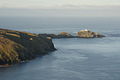
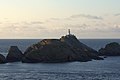
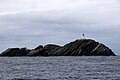
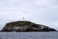
Category:Muckle Flugga
Zur Navigation springen
Zur Suche springen
| Objektposition | | Karte mit allen Koordinaten: OpenStreetMap |
|---|
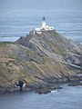
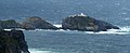
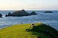
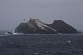
Insel in Shetland im äußersten Norden des Vereinigten Königreichs  | |||||
| Medium hochladen | |||||
| Ist ein(e) | |||||
|---|---|---|---|---|---|
| Ist Teil von |
| ||||
| Ort | Shetlandinseln, Schottland | ||||
| Liegt am oder im Gewässer | |||||
| Breite |
| ||||
| Länge |
| ||||
| Einwohnerzahl |
| ||||
| Fläche |
| ||||
 | |||||
Unterkategorien
Diese Kategorie enthält folgende Unterkategorie:
In Klammern die Anzahl der enthaltenen Kategorien (K), Seiten (S), Dateien (D)
M
Medien in der Kategorie „Muckle Flugga“
Folgende 98 Dateien sind in dieser Kategorie, von 98 insgesamt.
-
 Far side of the Flugga - geograph.org.uk - 941019.jpg 640 × 426; 58 KB
-
 Flugga sunset from Saxa Vord - geograph.org.uk - 858901.jpg 426 × 640; 59 KB
-
 Gannet passing The Rumblings - geograph.org.uk - 5797063.jpg 1.600 × 1.068; 725 KB
-
 Gannets on Clingra Stack - geograph.org.uk - 547837.jpg 640 × 415; 84 KB
-

-
 Herma Ness, Muckle Flugga lighthouse - geograph.org.uk - 2539106.jpg 480 × 640; 72 KB
-

-

-
 Lee of Saxavord and Muckle Flugga - geograph.org.uk - 5279517.jpg 1.024 × 681; 176 KB
-
 Little Flugga from Muckle Flugga - geograph.org.uk - 2431913.jpg 800 × 520; 120 KB
-

-
 Muckle Flugga - geograph.org.uk - 3116112.jpg 1.024 × 683; 239 KB
-
 Muckle Flugga - geograph.org.uk - 3929600.jpg 1.280 × 851; 225 KB
-
 Muckle Flugga - geograph.org.uk - 624645.jpg 426 × 640; 40 KB
-
 Muckle Flugga and associated skerries - geograph.org.uk - 2695515.jpg 2.471 × 1.000; 1,78 MB
-
 Muckle Flugga and Out Stack - geograph.org.uk - 2695653.jpg 3.621 × 1.969; 3,96 MB
-
 Muckle Flugga and Out Stack - geograph.org.uk - 3977016.jpg 2.048 × 1.536; 530 KB
-

-
 Muckle Flugga and passing boat - geograph.org.uk - 3010628.jpg 800 × 534; 119 KB
-
 Muckle Flugga and Taing of Loosswick, Hermaness - geograph.org.uk - 3531456.jpg 1.024 × 683; 164 KB
-
 Muckle Flugga and Taing of Loosswick, Hermaness - geograph.org.uk - 3531457.jpg 1.024 × 683; 219 KB
-
 Muckle Flugga and Taing of Loosswick, Hermaness - geograph.org.uk - 3531459.jpg 1.024 × 684; 201 KB
-
 Muckle Flugga and Taing of Loosswick, Hermaness - geograph.org.uk - 3531461.jpg 1.024 × 683; 181 KB
-
 Muckle Flugga and the Rumblings - geograph.org.uk - 874059.jpg 640 × 426; 35 KB
-
 Muckle Flugga from above Humla Stack, Hermaness - geograph.org.uk - 3868887.jpg 1.024 × 681; 185 KB
-
 Muckle Flugga from above Humla Stack, Hermaness - geograph.org.uk - 3868890.jpg 1.024 × 681; 135 KB
-
 Muckle Flugga from above Humla Stack, Hermaness - geograph.org.uk - 3868891.jpg 1.024 × 681; 186 KB
-
 Muckle Flugga from afar^ - geograph.org.uk - 5013400.jpg 2.547 × 1.882; 951 KB
-
 Muckle Flugga from Hermaness Hill - geograph.org.uk - 4992409.jpg 1.024 × 681; 134 KB
-
 Muckle Flugga from Hermaness Hill - geograph.org.uk - 6175372.jpg 1.600 × 1.065; 456 KB
-
 Muckle Flugga from Saxa Vord - geograph.org.uk - 1616163.jpg 640 × 427; 39 KB
-
 Muckle Flugga from Saxa Vord - geograph.org.uk - 2160079.jpg 800 × 534; 83 KB
-
 Muckle Flugga from Saxa Vord - geograph.org.uk - 5148834.jpg 1.024 × 682; 136 KB
-
 Muckle Flugga from Saxa Vord - geograph.org.uk - 919318.jpg 640 × 426; 53 KB
-
 Muckle Flugga from Taing of Loosswick, Hermaness - geograph.org.uk - 3530686.jpg 1.024 × 682; 101 KB
-
 Muckle Flugga from the air - geograph.org.uk - 1072076.jpg 428 × 640; 82 KB
-
 Muckle Flugga from the flanks of Sothers Field - geograph.org.uk - 4255464.jpg 1.024 × 681; 152 KB
-
 Muckle Flugga from the mooring - geograph.org.uk - 2431937.jpg 520 × 800; 126 KB
-
 Muckle Flugga from the Neap, Hermaness - geograph.org.uk - 3492642.jpg 1.024 × 683; 122 KB
-
 Muckle Flugga from the sea - geograph.org.uk - 5522319.jpg 1.024 × 682; 116 KB
-
 Muckle Flugga from the sea - geograph.org.uk - 5522325.jpg 1.024 × 682; 105 KB
-
 Muckle Flugga from the sea - geograph.org.uk - 5522329.jpg 1.024 × 682; 100 KB
-
 Muckle Flugga from the sea - geograph.org.uk - 5522347.jpg 1.024 × 682; 108 KB
-
 Muckle Flugga from the sea - geograph.org.uk - 5522384.jpg 1.024 × 683; 210 KB
-
 Muckle Flugga from the seaward side - geograph.org.uk - 941026.jpg 640 × 426; 49 KB
-

-
 Muckle Flugga sunset - geograph.org.uk - 858821.jpg 640 × 426; 59 KB
-
 Muckle Flugga wreathed in mist - geograph.org.uk - 919312.jpg 640 × 426; 48 KB
-
 MV Oberon passing through the Flugga sound - geograph.org.uk - 6175384.jpg 1.600 × 1.065; 630 KB
-
 North west tip of Hermaness, Unst - geograph.org.uk - 343002.jpg 640 × 447; 48 KB
-

-
 Ordnance Survey One-Inch Sheet 1 Shetland, Published 1961.jpg 8.274 × 9.927; 6,77 MB
-
 Out Stack.3.jpg 2.560 × 1.920; 1,19 MB
-
 Over Looss Wick to Muckle Flugga - geograph.org.uk - 4309272.jpg 1.024 × 698; 150 KB
-
 Ruskock, Muckle Flugga - geograph.org.uk - 1611427.jpg 640 × 426; 66 KB
-
 Setting sun beyond Muckle Flugga - geograph.org.uk - 858826.jpg 640 × 426; 57 KB
-
 Simmer Dim over Muckle Flugga - geograph.org.uk - 3004295.jpg 800 × 533; 80 KB
-
 Sun setting beyond Muckle Flugga - geograph.org.uk - 3004211.jpg 800 × 532; 124 KB
-

-
 Sunset beyond Herma Ness and Muckle Flugga - geograph.org.uk - 4946280.jpg 1.024 × 682; 65 KB
-

-

-

-

-
-

-

-
 Sunset beyond Muckle Flugga on the longest day - geograph.org.uk - 4037661.jpg 1.024 × 681; 111 KB
-

-
 Sunset beyond Muckle Flugga, from Saxa Vord - geograph.org.uk - 6191047.jpg 1.600 × 1.065; 395 KB
-
 Sunset beyond Muckle Flugga, from Saxa Vord - geograph.org.uk - 6191049.jpg 1.600 × 1.065; 407 KB
-
 Sunset beyond Muckle Flugga, from Saxa Vord - geograph.org.uk - 6191050.jpg 1.600 × 1.065; 308 KB
-
 Sunset Bonxie and Muckle Flugga - geograph.org.uk - 4946278.jpg 1.024 × 682; 66 KB
-
 Taing of Loosswick - geograph.org.uk - 206950.jpg 640 × 385; 157 KB
-
 Taking supplies to Muckle Flugga - geograph.org.uk - 2431935.jpg 533 × 800; 112 KB
-
-
 The Muckle Flugga reef - geograph.org.uk - 624640.jpg 640 × 426; 71 KB
-
 The Muckle Flugga reef from the sea - geograph.org.uk - 5522405.jpg 1.024 × 682; 64 KB
-

-
 The Muckle Flugga supply boat at Muckle Flugga - geograph.org.uk - 2431945.jpg 1.184 × 806; 254 KB
-

-
 The Rumblings and Vesta Skerry from the sea - geograph.org.uk - 5522332.jpg 1.024 × 683; 126 KB
-

-
 The top of the UK - geograph.org.uk - 694614.jpg 640 × 480; 33 KB
-

-
 Tipta Skerry - geograph.org.uk - 5790935.jpg 3.648 × 2.736; 3,35 MB
-
 Tipta Skerry from the sea - geograph.org.uk - 5522340.jpg 1.024 × 684; 125 KB
-
 Vesta Skerry and Muckle Flugga - geograph.org.uk - 941006.jpg 640 × 426; 44 KB
-
 View from Saxa Vord to Muckle Flugga - geograph.org.uk - 2160040.jpg 800 × 533; 152 KB
-
 View from Saxa Vord to Muckle Flugga - geograph.org.uk - 2160047.jpg 800 × 533; 113 KB
-
 View from Saxa Vord to Muckle Flugga - geograph.org.uk - 4175208.jpg 1.024 × 681; 136 KB
-
 View to Muckle Flugga across the Lee of Saxavord - geograph.org.uk - 3863002.jpg 1.024 × 680; 128 KB
-

-
 View to Muckle Flugga from Holm of Skaw - geograph.org.uk - 2013524.jpg 800 × 534; 181 KB
-
 View to Muckle Flugga from Saxa Vord - geograph.org.uk - 1616153.jpg 640 × 427; 43 KB
-
 View to Muckle Flugga from the Neap, Hermaness - geograph.org.uk - 3868806.jpg 1.024 × 681; 156 KB
-

-
 View towards Muckle Flugga - geograph.org.uk - 5922662.jpg 800 × 600; 488 KB


_Scotland.jpg)


