Category:Mullingar
Vai alla navigazione
Vai alla ricerca
town in County Westmeath, Ireland  | |||||
| Carica un file multimediale | |||||
| Istanza di | |||||
|---|---|---|---|---|---|
| Luogo | Westmeath, Leinster, Irlanda | ||||
| Popolazione |
| ||||
| Altezza sul mare |
| ||||
 | |||||
Sottocategorie
Questa categoria contiene le 16 sottocategorie indicate di seguito, su un totale di 16.
A
B
- Belvedere House and Gardens (79 F)
C
- Culleen More (4 F)
D
- Joe Dolan (4 F)
H
- Hevey Institute, Mullingar (5 F)
M
- Mullingar Cathedral (24 F)
- Mullingar railway station (16 F)
N
S
- Saunder's Bridge (4 F)
- Scanlan's Bridge (1 F)
- St. Loman's GAA (1 F)
- Streets in Mullingar (8 F)
W
Á
File nella categoria "Mullingar"
Questa categoria contiene 125 file, indicati di seguito, su un totale di 125.
-
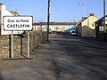 Approaching Castlefin from the south - geograph.org.uk - 689186.jpg 640 × 478; 56 KB
-
 Austin Friars 01.jpg 640 × 480; 106 KB
-
 Ballyarrell Mountain - geograph.org.uk - 689991.jpg 640 × 479; 66 KB
-
 Bilingual GA EN sign at Mullingar Train Station (2022).jpg 4 128 × 3 096; 6,35 MB
-
 Blue Irish letterbox.jpg 768 × 1 024; 538 KB
-
 Buffers - Unused - geograph.org.uk - 4667451.jpg 1 632 × 918; 457 KB
-
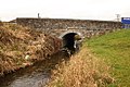
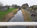
 Canal Bridge - geograph.org.uk - 5630003.jpg 640 × 480; 130 KB
-
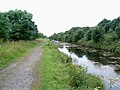
 Canal Path - geograph.org.uk - 5630021.jpg 640 × 480; 156 KB
-
 Canal à Mullingar.jpg 640 × 480; 155 KB
-
 Charles Howard-Bury's famed Ibex.jpg 3 024 × 4 032; 1,71 MB
-
 Cold December evening in Mullingar.JPG 3 104 × 1 746; 982 KB
-

-
 Defence Forces Triathlon (4897812499).jpg 1 200 × 800; 319 KB
-
 Dry Dock - geograph.org.uk - 5630009.jpg 640 × 480; 153 KB
-
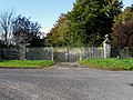 Entrance Gates - geograph.org.uk - 1017775.jpg 640 × 480; 133 KB
-
 Entrance Gateway - geograph.org.uk - 793845.jpg 640 × 426; 75 KB
-
 Farm Gate and Track - geograph.org.uk - 968943.jpg 640 × 426; 111 KB
-
 Fish Farm Ponds - geograph.org.uk - 786369.jpg 640 × 394; 91 KB
-
 Gleneely Hill - geograph.org.uk - 689409.jpg 640 × 479; 71 KB
-

-
 Hamish 2.JPG 640 × 480; 150 KB
-
 Harbour Bridge - geograph.org.uk - 5630016.jpg 640 × 480; 118 KB
-
 Jeaous Wall info board - panoramio.jpg 2 816 × 2 112; 1,11 MB
-
 Jezioro Owel.JPG 4 320 × 3 240; 5,82 MB
-
 Levrieres Mullingar.jpg 2 496 × 1 664; 900 KB
-
 Levriers Mullingar juillet 2008.jpg 2 816 × 2 112; 1,1 MB
-
 Locomotive scrapping, Mullingar - geograph.org.uk - 2856680.jpg 640 × 385; 79 KB
-
 Lough Lene bathing.JPG 400 × 300; 48 KB
-
 Low Bridge - geograph.org.uk - 786382.jpg 640 × 426; 99 KB
-
 Market Square bilingual signs Mullingar (2022).jpg 4 128 × 3 096; 3,59 MB
-

-

-
 Moulin à Pierre.jpg 480 × 640; 76 KB
-

-
 Mullingar - Cathedral of Christ the King - geograph.org.uk - 4276309.jpg 768 × 1 024; 144 KB
-

-
 Mullingar - Royal Canal at Scanlan's Bridge - geograph.org.uk - 4276307.jpg 1 024 × 768; 186 KB
-
 Mullingar - Royal Canal N of Saunder's Bridge - geograph.org.uk - 4276300.jpg 1 024 × 768; 191 KB
-
 Mullingar - Royal Canal SW of Scanlan's Bridge - geograph.org.uk - 4276308.jpg 1 024 × 768; 148 KB
-

-

-
 Mullingar 01 area.JPG 945 × 594; 82 KB
-
 Mullingar 02 area.JPG 945 × 591; 98 KB
-
 Mullingar Hockey Club.jpg 1 171 × 720; 64 KB
-
 Mullingar logo.JPG 250 × 300; 15 KB
-
 Mullingar Park Hotel 2022.jpg 4 608 × 3 456; 6,16 MB
-
 Mullingar Town Centre - geograph.org.uk - 5027677.jpg 4 160 × 2 340; 2,46 MB
-
 Mullingar Town Park (2022).jpg 4 128 × 3 096; 3,93 MB
-
 Mullingar Town Park, 2021-07-21, 01.jpg 4 032 × 3 024; 4,45 MB
-
 Mullingar Town Park, 2021-07-21, 02.jpg 4 032 × 3 024; 4,45 MB
-
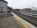 Mullingar train station (2022).jpg 4 128 × 3 096; 3,93 MB
-
 Mullingar train station bilingual sign (2022).jpg 3 096 × 4 128; 2,55 MB
-
 Mullingar Westmeath.JPG 260 × 295; 10 KB
-
 Mulready's Cross - geograph.org.uk - 1005779.jpg 640 × 480; 55 KB
-
 National Science Park, Mullingar.jpg 4 608 × 3 456; 5,53 MB
-
 New Roundabout - geograph.org.uk - 786383.jpg 640 × 426; 54 KB
-
 NIR scrap railcar, Mullingar - geograph.org.uk - 2858012.jpg 640 × 428; 107 KB
-
 Old Water Tower - geograph.org.uk - 4667435.jpg 918 × 1 632; 653 KB
-
 Passage sculpted by Brian O Loughlin - panoramio.jpg 2 816 × 2 112; 1,34 MB
-
 Plaque de la caserne Columb Mullingar.JPG 2 816 × 2 112; 1,46 MB
-
 Renovated bridge - geograph.org.uk - 707772.jpg 640 × 427; 96 KB
-
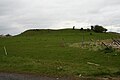 Ring Fort - geograph.org.uk - 776966.jpg 640 × 426; 51 KB
-
 Ringfort and Powerline - geograph.org.uk - 793839.jpg 640 × 426; 54 KB
-
 Road at Mullingar - geograph.org.uk - 992970.jpg 640 × 479; 53 KB
-
 Road Bridge - geograph.org.uk - 707757.jpg 640 × 427; 57 KB
-
 Road Junction - geograph.org.uk - 793834.jpg 640 × 426; 59 KB
-
 Roundabout and Factory - geograph.org.uk - 777005.jpg 640 × 401; 43 KB
-
 Royal canal - panoramio.jpg 4 912 × 3 264; 4,03 MB
-

-
-

-
 Signal Box now Disused - geograph.org.uk - 4666780.jpg 1 632 × 918; 305 KB
-
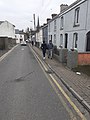 St. John's Terrace, Mullingar (2022).jpg 3 096 × 4 128; 3,79 MB
-
 St. Loman's GAA crest.jpg 546 × 546; 107 KB
-
 The disused arm of Mullingar Station - geograph.org.uk - 4276317.jpg 1 024 × 768; 182 KB
-
 The Green Bridge, The Royal Canal, Mullingar (2022).jpg 4 128 × 3 096; 3,95 MB
-

-
 The Royal Canal, Mullingar, County Westmeath, Ireland.jpg 2 448 × 3 264; 2,27 MB
-
 Turnpike Cross Roads - geograph.org.uk - 1029206.jpg 640 × 480; 91 KB
-
 Waste land near Mullingar, Co. Westmeath - geograph.org.uk - 1390044.jpg 640 × 459; 113 KB
-
 Westmeath Council Council Headquarters, Mullingar (2022).jpg 4 128 × 3 096; 3,45 MB
-
 Westmeath County Council bilingual GA EN sign in Mullingar (2022).jpg 3 096 × 4 128; 4,36 MB
-
 What S The Time Mr Wolf (66703579).jpeg 2 000 × 1 333; 362 KB
-
 Ballyarrell Townland - geograph.org.uk - 690001.jpg 640 × 479; 69 KB
-
 Ballybun Townland - geograph.org.uk - 690025.jpg 640 × 479; 81 KB
-
 Ballybun Townland - geograph.org.uk - 690027.jpg 640 × 275; 41 KB
-
 Ballygonigan Townland - geograph.org.uk - 690005.jpg 640 × 479; 69 KB
-
 Ballygonigan Townland - geograph.org.uk - 690037.jpg 640 × 479; 76 KB
-
 Blairstown Townland - geograph.org.uk - 689326.jpg 640 × 479; 59 KB
-
 Carranadone Townland - geograph.org.uk - 690042.jpg 640 × 271; 36 KB
-
 Carricknashane Townland - geograph.org.uk - 689331.jpg 640 × 479; 53 KB
-
 Castlefin - geograph.org.uk - 500350.jpg 640 × 479; 53 KB
-
 Church Island - geograph.org.uk - 620917.jpg 640 × 427; 88 KB
-
 Cloonarell Townland - geograph.org.uk - 690003.jpg 640 × 479; 63 KB
-
 Cormakilly Townland - geograph.org.uk - 690057.jpg 640 × 479; 54 KB
-
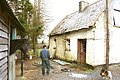 Derelict Gate House, Avaltygort - geograph.org.uk - 646786.jpg 640 × 427; 86 KB
-
 Dooghan Townland - geograph.org.uk - 689321.jpg 640 × 479; 59 KB
-
 Drumcannon townland - geograph.org.uk - 689400.jpg 640 × 479; 71 KB
-
 Drumcannon townland - geograph.org.uk - 689998.jpg 640 × 479; 75 KB
-
 Dungorman Townland - geograph.org.uk - 690051.jpg 640 × 372; 39 KB
-
 Hillhead Townland - geograph.org.uk - 689324.jpg 640 × 479; 70 KB
-
 Ignored signage - geograph.org.uk - 716637.jpg 640 × 427; 120 KB
-
 Liscooly Townland - geograph.org.uk - 689327.jpg 640 × 479; 58 KB
-
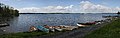 Lough Owel - geograph.org.uk - 601373.jpg 640 × 204; 40 KB
-
 Lough Owel - geograph.org.uk - 620747.jpg 640 × 427; 83 KB
-
 Maghereaboy Townland - geograph.org.uk - 689364.jpg 640 × 479; 68 KB
-
 Maghereaboy Townland - geograph.org.uk - 689368.jpg 640 × 479; 58 KB
-
 Meenlougher Townland - geograph.org.uk - 689995.jpg 640 × 479; 81 KB
-
 Meenlougher Townland - geograph.org.uk - 690006.jpg 640 × 479; 69 KB
-
 Mounthall Townland - geograph.org.uk - 689403.jpg 640 × 479; 73 KB
-
 N15 at Carricknashane - geograph.org.uk - 689357.jpg 640 × 479; 64 KB
-
 Near Mullanboy - geograph.org.uk - 690053.jpg 640 × 479; 79 KB
-
 Near Tievebrack - geograph.org.uk - 690009.jpg 640 × 479; 66 KB
-
 Zoney.jpg 1 366 × 1 000; 372 KB
-
 Road at Drummurphy - geograph.org.uk - 690047.jpg 640 × 479; 68 KB
-
 Road at Killygordon - geograph.org.uk - 689394.jpg 640 × 479; 46 KB
-
 Road at Rushy Hill - geograph.org.uk - 689405.jpg 640 × 478; 55 KB
-
 Road junction - geograph.org.uk - 708186.jpg 640 × 427; 68 KB
-
 Rushy Hill - geograph.org.uk - 407677.jpg 640 × 479; 95 KB
-
 Rushy Hill - geograph.org.uk - 407681.jpg 640 × 284; 31 KB
-
 Rushy Hill - geograph.org.uk - 689990.jpg 640 × 479; 76 KB
-
 Sessiaghallison Townland - geograph.org.uk - 689320.jpg 640 × 479; 73 KB
-
 Sportsfields at Knockdrin, Westmeath - geograph.org.uk - 437048.jpg 640 × 480; 83 KB
-
 Áras an Mhuilinn, An Muileann gCearr Mullingar (2022).jpg 4 128 × 3 096; 4,24 MB
-


.jpg)


.jpg)


.jpg)


.jpg)


.jpg)
.jpg)


.jpg)


.jpg)


.jpg)
.jpg)
.jpeg)


.jpg)