Category:Museumsmast (Umspannwerk Recklinghausen)
Jump to navigation
Jump to search
| Object location | | View all coordinates using: OpenStreetMap |
|---|
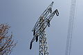
English: Old electricity pylon from ca. 1928, part of the Umspannwerk Recklinghausen museum's outside area. The pylon was shortened (shaft length/height) and translocated (previously part of the former Kruckel–Witten 110 kV power line some km southeast of the museum).
Media in category "Museumsmast (Umspannwerk Recklinghausen)"
The following 8 files are in this category, out of 8 total.
-
 Electricity pylon power outage.jpg 2,448 × 3,264; 1.25 MB
-
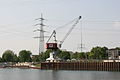
 Recklinghausen - Am Stadthafen - Emscherbrücke Umspannwerk 01 ies.jpg 3,888 × 2,592; 2.33 MB
-
 Recklinghausen - Am Stadthafen - Emscherbrücke Umspannwerk 03 ies.jpg 3,888 × 2,592; 1.69 MB
-
 Recklinghausen - Am Stadthafen - Stadthafen 28 ies.jpg 3,888 × 2,592; 1.7 MB
-
 Recklinghausen - Uferstraße - Umspannwerk 06 ies.jpg 2,592 × 3,888; 2.6 MB
-
 Recklinghausen - Uferstraße - Umspannwerk 11 ies.jpg 3,888 × 2,592; 2.4 MB
-
 Recklinghausen - Uferstraße - Umspannwerk 18 ies.jpg 3,888 × 2,592; 1.69 MB
-
 Umspannwerk Recklinghausen Dach 110 kV DE 2011.jpg 4,000 × 3,000; 2.98 MB


