Category:Mynydd Graig Goch
Jump to navigation
Jump to search

hill (609.75m) in Gwynedd  | |||||
| Upload media | |||||
| Instance of | |||||
|---|---|---|---|---|---|
| Location | Gwynedd, Wales | ||||
| Mountain range | |||||
| Topographic prominence |
| ||||
| Elevation above sea level |
| ||||
| Parent peak |
| ||||
 | |||||
Media in category "Mynydd Graig Goch"
The following 32 files are in this category, out of 32 total.
-
 A Simple Sheepfold - geograph.org.uk - 256478.jpg 640 × 480; 109 KB
-
 Boulder Littered Mountainside - geograph.org.uk - 256693.jpg 640 × 560; 109 KB
-
 Chapel near Golan - geograph.org.uk - 90530.jpg 640 × 480; 96 KB
-
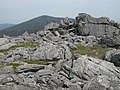 Crags on summit of Mynydd Graig Goch - geograph.org.uk - 196667.jpg 640 × 480; 138 KB
-
 Ditch - geograph.org.uk - 183358.jpg 640 × 480; 91 KB
-
 Dry Stone wall on Mynydd Graig Goch - geograph.org.uk - 196656.jpg 640 × 480; 131 KB
-

-
 Garnedd-goch - geograph.org.uk - 196686.jpg 640 × 480; 136 KB
-

-
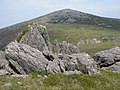
 Summit crags, Mynydd Graig Goch - geograph.org.uk - 196674.jpg 640 × 480; 145 KB
-
 Summit of Rhinog Fawr - geograph.org.uk - 1277009.jpg 640 × 480; 119 KB
-
 The Nantlle Ridge, as seen from Y Fron, with a dry-stone wall in the foreground.jpg 4,608 × 2,592; 3.06 MB
-

-
 Top of the western spur off Rhinog Fawr - geograph.org.uk - 1276909.jpg 640 × 480; 116 KB
-

-

-

-
 Bryn Eithin farm - geograph.org.uk - 233878.jpg 640 × 480; 80 KB
-
 Cottage at Cwm Bran - geograph.org.uk - 526097.jpg 640 × 480; 53 KB
-
 Farmland at Llwyngwnadl Isaf - geograph.org.uk - 183362.jpg 640 × 480; 63 KB
-
 Farmland near Mynydd Graig Goch - geograph.org.uk - 141280.jpg 640 × 480; 88 KB
-

-

-

-
 Looking towards Mynydd Graig Goch - geograph.org.uk - 141254.jpg 640 × 480; 75 KB
-
 Looking towards Pant Glas - geograph.org.uk - 248157.jpg 640 × 480; 68 KB
-
 Misty Moorland - geograph.org.uk - 233871.jpg 640 × 480; 59 KB
-

-

-
 Pont Ynys Pwntan across Afon Dwyryd - geograph.org.uk - 352085.jpg 640 × 407; 53 KB
-
 The Remnants of a Lake - geograph.org.uk - 252884.jpg 640 × 418; 57 KB
-


