Category:National Waterways Museum, Gloucester
Jump to navigation
Jump to search
| Object location | | View all coordinates using: OpenStreetMap |
|---|
museum charting the 200-year history of the Gloucester docks and the Gloucester & Sharpness Canal, United Kingdom  | |||||
| Upload media | |||||
| Instance of | |||||
|---|---|---|---|---|---|
| Location | Gloucester, Gloucestershire, South West England, England | ||||
| Street address |
| ||||
| official website | |||||
 | |||||
Subcategories
This category has the following 4 subcategories, out of 4 total.
Media in category "National Waterways Museum, Gloucester"
The following 159 files are in this category, out of 159 total.
-
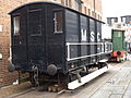 20 Ton Brake Wagon, Built at Swindon in 1948 (16346792344).jpg 4,288 × 3,216; 3.41 MB
-
 20 Ton Brake Wagon, Built at Swindon in 1948 (16968222921).jpg 4,288 × 3,216; 3.56 MB
-
 Built by Gloucester Railway & Wagon Company (16782896009).jpg 4,288 × 3,216; 3.55 MB
-
 Built by Gloucester Railway & Wagon Company (16782907499).jpg 4,288 × 3,216; 3.51 MB
-
 Built by Gloucester Railway & Wagon Company (16967820732).jpg 4,288 × 3,216; 3.85 MB
-
 Built by Gloucester Railway & Wagon Company (16967859902).jpg 4,288 × 3,216; 3.76 MB
-
 Built by Gloucester Railway & Wagon Company (16969195145).jpg 4,288 × 3,216; 3.55 MB
-

-
 Dry Dock National Waterways Museum, Gloucester.jpg 2,000 × 3,008; 2.01 MB
-
 Gloucester Docks - geograph.org.uk - 28045.jpg 640 × 481; 102 KB
-
 Gloucester Docks - geograph.org.uk - 694144.jpg 640 × 480; 86 KB
-
 Gloucester Docks - National Waterways Museum (geograph 6691344).jpg 3,558 × 4,603; 5.66 MB
-

-
 Gloucester Docks at Night (4211296698).jpg 2,080 × 1,520; 2.44 MB
-
 Gloucester Docks Tall Ships day 08.JPG 3,456 × 2,304; 1.76 MB
-

-

-

-
 Gloucester Waterways Museum - geograph.org.uk - 2923881.jpg 640 × 480; 78 KB
-
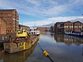
 Gloucester Waterways Museum - Gloucester Docks - boat - S.N.D. No. 4.jpg 4,288 × 3,216; 3.39 MB
-

-

-

-

-

-

-
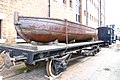
 Iron Boat on a Railway Truck National Waterways Museum, Gloucester (1).jpg 3,008 × 2,000; 1.91 MB
-
 Iron Boat on a Railway Truck National Waterways Museum, Gloucester.jpg 3,008 × 2,000; 1.96 MB
-
 Llanthony warehouse - geograph.org.uk - 1469213.jpg 640 × 480; 110 KB
-
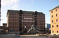
 Llanthony Warehouse, Gloucester Docks.jpg 3,388 × 2,304; 4.29 MB
-

-

-
 National Waterways Museum - geograph.org.uk - 1128269.jpg 480 × 640; 74 KB
-
 National Waterways Museum - geograph.org.uk - 1469227.jpg 640 × 480; 115 KB
-
 National Waterways Museum April 2019.jpg 4,096 × 3,072; 1.39 MB
-

-

-
 National Waterways Museum, Gloucester - geograph.org.uk - 105074.jpg 640 × 427; 83 KB
-
 National Waterways Museum, Gloucester - geograph.org.uk - 2430170.jpg 2,056 × 3,088; 1.13 MB
-
 National Waterways Museum, Gloucester - geograph.org.uk - 621282.jpg 640 × 436; 69 KB
-
 National Waterways Museum, Gloucester 20190210 102206 (47570899672).jpg 4,032 × 3,024; 718 KB
-
 National Waterways Museum, Gloucester 20190210 102210 (46708170625).jpg 4,032 × 3,024; 979 KB
-
 National Waterways Museum, Gloucester 20190210 102217 (40657285243).jpg 4,032 × 3,024; 931 KB
-
 National Waterways Museum, Gloucester 20190210 102222 (47570897242).jpg 4,032 × 3,024; 1.4 MB
-
 National Waterways Museum, Gloucester 20190210 102605 (46899404164).jpg 4,032 × 3,024; 880 KB
-
 National Waterways Museum, Gloucester 20190210 102613 (46899401044).jpg 3,024 × 4,032; 1,015 KB
-
 National Waterways Museum, Gloucester 20190210 102621 (46899407514).jpg 4,032 × 3,024; 780 KB
-
 National Waterways Museum, Gloucester 20190210 102848 (46899408604).jpg 4,032 × 3,024; 1.09 MB
-
 National Waterways Museum, Gloucester 20190210 102929 (33746385958).jpg 4,032 × 3,024; 1.39 MB
-
 National Waterways Museum, Gloucester 20190210 102936 (47623678661).jpg 3,024 × 4,032; 1.66 MB
-
 National Waterways Museum, Gloucester 20190210 102941 (46899394304).jpg 4,032 × 3,024; 1.34 MB
-
 National Waterways Museum, Gloucester 20190210 103055 (46708161125).jpg 4,032 × 3,024; 1.42 MB
-
 National Waterways Museum, Gloucester 20190210 103100 (46708157055).jpg 3,024 × 4,032; 1.43 MB
-
 National Waterways Museum, Gloucester 20190210 103202 (46899384374).jpg 3,024 × 4,032; 1.93 MB
-
 National Waterways Museum, Gloucester 20190210 103240 (40657259003).jpg 4,032 × 3,024; 1.19 MB
-
 National Waterways Museum, Gloucester 20190210 103250 (32681025727).jpg 3,024 × 4,032; 808 KB
-
 National Waterways Museum, Gloucester 20190210 103327 (32681030447).jpg 4,032 × 3,024; 926 KB
-
 National Waterways Museum, Gloucester 20190210 103424 (40657266143).jpg 4,032 × 3,024; 1.08 MB
-
 National Waterways Museum, Gloucester 20190210 103540 (32681023827).jpg 4,032 × 3,024; 1.52 MB
-
 National Waterways Museum, Gloucester 20190210 103545 (46899373034).jpg 4,032 × 3,024; 1.07 MB
-
 National Waterways Museum, Gloucester 20190210 103553 (33746354818).jpg 4,032 × 3,024; 1.6 MB
-
 National Waterways Museum, Gloucester 20190210 103558 (47570858222).jpg 4,032 × 3,024; 1.5 MB
-
 National Waterways Museum, Gloucester 20190210 103609 (47623650281).jpg 4,032 × 3,024; 523 KB
-
 National Waterways Museum, Gloucester 20190210 103715 (47623652711).jpg 3,024 × 4,032; 1.37 MB
-
 National Waterways Museum, Gloucester 20190210 103722 (32681018427).jpg 4,032 × 3,024; 2.15 MB
-
 National Waterways Museum, Gloucester 20190210 103751 (40657241293).jpg 4,032 × 3,024; 1.35 MB
-
 National Waterways Museum, Gloucester 20190210 103754 (46899354434).jpg 4,032 × 3,024; 2.1 MB
-
 National Waterways Museum, Gloucester 20190210 103831 (46708115665).jpg 4,032 × 3,024; 1.5 MB
-
 National Waterways Museum, Gloucester 20190210 104009 (47570847252).jpg 4,032 × 3,024; 837 KB
-
 National Waterways Museum, Gloucester 20190210 104018 (46899339734).jpg 4,032 × 3,024; 2.7 MB
-
 National Waterways Museum, Gloucester 20190210 104134 (47623611201).jpg 4,032 × 3,024; 1.44 MB
-
 National Waterways Museum, Gloucester 20190210 104138 (46708107045).jpg 4,032 × 3,024; 1.36 MB
-
 National Waterways Museum, Gloucester 20190210 104207 (40657223693).jpg 3,024 × 4,032; 1.38 MB
-
 National Waterways Museum, Gloucester 20190210 104213 (33746334488).jpg 4,032 × 3,024; 1.52 MB
-
 National Waterways Museum, Gloucester 20190210 104225 (47623605711).jpg 4,032 × 3,024; 2.61 MB
-
 National Waterways Museum, Gloucester 20190210 104233 (40657213813).jpg 4,032 × 3,024; 1.51 MB
-
 National Waterways Museum, Gloucester 20190210 104306 (46899318154).jpg 3,024 × 4,032; 820 KB
-
 National Waterways Museum, Gloucester 20190210 104450 (33746325838).jpg 4,032 × 3,024; 493 KB
-
 National Waterways Museum, Gloucester 20190210 104549 (46899316884).jpg 3,024 × 4,032; 812 KB
-
 National Waterways Museum, Gloucester 20190210 104554 (32680981707).jpg 3,024 × 4,032; 930 KB
-
 National Waterways Museum, Gloucester 20190210 104608 (46899314944).jpg 3,024 × 4,032; 1.55 MB
-
 National Waterways Museum, Gloucester 20190210 104619 (46708091665).jpg 4,032 × 3,024; 783 KB
-
 National Waterways Museum, Gloucester 20190210 104713 (40657210213).jpg 4,032 × 3,024; 1.46 MB
-
 National Waterways Museum, Gloucester 20190210 104804 (46708081925).jpg 3,024 × 4,032; 1.37 MB
-
 National Waterways Museum, Gloucester 20190210 104940 (46708085915).jpg 4,032 × 3,024; 1.94 MB
-
 National Waterways Museum, Gloucester 20190210 104952 (40657200763).jpg 4,032 × 3,024; 1.32 MB
-
 National Waterways Museum, Gloucester 20190210 105049 (47623586051).jpg 4,032 × 3,024; 1.8 MB
-
 National Waterways Museum, Gloucester 20190210 105049(0) (40657197743).jpg 4,032 × 3,024; 1.8 MB
-
 National Waterways Museum, Gloucester 20190210 105059 (47570751712).jpg 4,032 × 3,024; 1.85 MB
-
 National Waterways Museum, Gloucester 20190210 105105 (46899309034).jpg 3,024 × 4,032; 1.35 MB
-
 National Waterways Museum, Gloucester 20190210 105111 (47570808722).jpg 4,032 × 3,024; 831 KB
-
 National Waterways Museum, Gloucester 20190210 105126 (46899300994).jpg 4,032 × 3,024; 1.77 MB
-
 National Waterways Museum, Gloucester 20190210 105220 (47623571401).jpg 4,032 × 3,024; 1.45 MB
-
 National Waterways Museum, Gloucester 20190210 105230 (46899298344).jpg 4,032 × 3,024; 1.57 MB
-
 National Waterways Museum, Gloucester 20190210 105242 (46899298574).jpg 4,032 × 3,024; 1.18 MB
-
 National Waterways Museum, Gloucester 20190210 105335 (33746303948).jpg 4,032 × 3,024; 1.43 MB
-
 National Waterways Museum, Gloucester 20190210 105506 (33746300848).jpg 4,032 × 3,024; 1.43 MB
-
 National Waterways Museum, Gloucester 20190210 105520 (32680946937).jpg 3,024 × 4,032; 1.28 MB
-
 National Waterways Museum, Gloucester 20190210 105608 (33746297348).jpg 3,024 × 4,032; 1.62 MB
-
 National Waterways Museum, Gloucester 20190210 105615 (47623566561).jpg 4,032 × 3,024; 1.57 MB
-
 National Waterways Museum, Gloucester 20190210 105620 (33746291998).jpg 4,032 × 3,024; 1.45 MB
-
 National Waterways Museum, Gloucester 20190210 105638 (33746298768).jpg 4,032 × 3,024; 1.57 MB
-
 National Waterways Museum, Gloucester 20190210 105921 (46899280884).jpg 4,032 × 3,024; 792 KB
-
 National Waterways Museum, Gloucester 20190210 105937 (32680930867).jpg 4,032 × 3,024; 433 KB
-
 National Waterways Museum, Gloucester 20190210 110102 (46708005875).jpg 4,032 × 3,024; 514 KB
-
 National Waterways Museum, Gloucester 20190210 110119 (46708049575).jpg 4,032 × 3,024; 657 KB
-
 National Waterways Museum, Gloucester 20190210 110130 (47623550651).jpg 3,024 × 4,032; 496 KB
-
 National Waterways Museum, Gloucester 20190210 110140 (47623550171).jpg 4,032 × 3,024; 639 KB
-
 National Waterways Museum, Gloucester 20190210 110606 (46708048165).jpg 4,032 × 3,024; 1.66 MB
-
 National Waterways Museum, Gloucester 20190210 110647 (47623551131).jpg 2,160 × 2,160; 591 KB
-
 National Waterways Museum, Gloucester 20190210 110717 (46899277694).jpg 4,032 × 3,024; 836 KB
-
 National Waterways Museum, Gloucester 20190210 110726 (47570788662).jpg 4,032 × 3,024; 507 KB
-
 National Waterways Museum, Gloucester 20190210 110823 (33746280858).jpg 3,024 × 4,032; 1.33 MB
-
 National Waterways Museum, Gloucester 20190210 110847 (33746277898).jpg 4,032 × 3,024; 784 KB
-
 National Waterways Museum, Gloucester 20190210 110904 (47570787792).jpg 4,032 × 3,024; 2.13 MB
-
 National Waterways Museum, Gloucester 20190210 110919 (32680912237).jpg 3,024 × 4,032; 1.02 MB
-
 National Waterways Museum, Gloucester 20190210 110927 (40657167623).jpg 4,032 × 3,024; 1.4 MB
-
 National Waterways Museum, Gloucester 20190210 111059 (46708037835).jpg 4,032 × 3,024; 1.59 MB
-
 National Waterways Museum, Gloucester 20190210 111853 (40657170783).jpg 4,032 × 3,024; 1.51 MB
-
 National Waterways Museum, Gloucester 20190210 112035 (32680908277).jpg 4,032 × 3,024; 1.11 MB
-
 National Waterways Museum, Gloucester 20190210 112039 (46708031745).jpg 4,032 × 3,024; 979 KB
-
 National Waterways Museum, Gloucester 20190210 112108 (46899258744).jpg 4,032 × 3,024; 1.34 MB
-
 National Waterways Museum, Gloucester 20190210 112113 (46899257934).jpg 4,032 × 3,024; 1.47 MB
-
 National Waterways Museum, Gloucester 20190210 112120 (33746265818).jpg 3,024 × 4,032; 993 KB
-
 National Waterways Museum, Gloucester 20190210 112220 (40657150303).jpg 4,032 × 3,024; 1.29 MB
-
 National Waterways Museum, Gloucester 20190210 112224 (33746263628).jpg 4,032 × 3,024; 730 KB
-
 National Waterways Museum, Gloucester 20190210 112331 (40657149103).jpg 4,032 × 3,024; 629 KB
-
 National Waterways Museum, Gloucester 20190210 112339 (46899249994).jpg 3,024 × 4,032; 669 KB
-
 National Waterways Museum, Gloucester 20190210 112343 (46708023265).jpg 3,024 × 4,032; 673 KB
-
 National Waterways Museum, Gloucester 20190210 112517 (46708019275).jpg 4,032 × 3,024; 713 KB
-
 National Waterways Museum, Gloucester 20190210 153434 (47570765282).jpg 4,032 × 3,024; 921 KB
-
 National Waterways Museum, Gloucester 20190210 153437 (46708015865).jpg 4,032 × 3,024; 823 KB
-
 National Waterways Museum, Gloucester 20190210 153738 (47623532991).jpg 4,032 × 3,024; 825 KB
-
 National Waterways Museum, Gloucester 20190210 153758 (47623533091).jpg 4,032 × 3,024; 1.52 MB
-
 National Waterways Museum, Gloucester 20190210 153807 (46899237264).jpg 4,032 × 3,024; 1 MB
-
-

-

-

-
 National Waterways Museum.jpg 1,755 × 1,446; 773 KB
-
 NWMuseum.JPG 1,536 × 2,048; 788 KB
-
 Outside the National Waterways Museum, Gloucester - geograph.org.uk - 2001780.jpg 1,440 × 1,080; 769 KB
-
 Postbox outside the Museum - geograph.org.uk - 1065407.jpg 640 × 480; 86 KB
-
 Replica Warehouse National Waterways Museum, Gloucester.jpg 3,008 × 2,000; 1.82 MB
-
 SND 4 Dredger National Waterways Museum, Gloucester.jpg 3,008 × 2,000; 1.77 MB
-

-
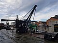
 Steam crane, National Waterways Museum - geograph.org.uk - 880333.jpg 640 × 480; 104 KB
-

-
 Steam Pumping Engine National Waterways Museum, Gloucester.jpg 3,008 × 2,000; 1.56 MB
-
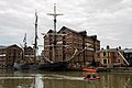 Tall ships at Gloucester Docks-14980837940.jpg 1,620 × 1,080; 2.03 MB
-
 That sinking feeling^ - geograph.org.uk - 205879.jpg 640 × 435; 86 KB
-
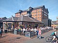 The Lord High Constable of England Wetherspoon pub.jpg 4,096 × 3,072; 2.46 MB
-
 The National Waterways Museum in Gloucester Docks - geograph.org.uk - 1999179.jpg 1,500 × 1,000; 179 KB
-

-

-
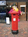 Victorian pillar box , Penfold design - geograph.org.uk - 1013514.jpg 480 × 640; 132 KB
-
 Waterway Museum - geograph.org.uk - 2443951.jpg 3,008 × 2,000; 2.63 MB
-
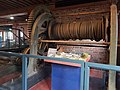
 Winch and other Canalia National Waterways Museum, Gloucester.jpg 3,008 × 2,000; 1.57 MB
-
 Working Narrowboats National Waterways Museum, Gloucester.jpg 3,008 × 2,000; 1.96 MB
.jpg)
.jpg)
.jpg)
.jpg)
.jpg)
.jpg)
.jpg)


.jpg)

.jpg)


.jpg)


.jpg)
.jpg)
.jpg)
.jpg)
.jpg)
.jpg)
.jpg)
.jpg)
.jpg)
.jpg)
.jpg)
.jpg)
.jpg)
.jpg)
.jpg)
.jpg)
.jpg)
.jpg)
.jpg)
.jpg)
.jpg)
.jpg)
.jpg)
.jpg)
.jpg)
.jpg)
.jpg)
.jpg)
.jpg)
.jpg)
.jpg)
.jpg)
.jpg)
.jpg)
.jpg)
.jpg)
.jpg)
.jpg)
.jpg)
.jpg)
.jpg)
.jpg)
.jpg)
.jpg)
.jpg)
.jpg)
.jpg)
_(40657197743).jpg)
.jpg)
.jpg)
.jpg)
.jpg)
.jpg)
.jpg)
.jpg)
.jpg)
.jpg)
.jpg)
.jpg)
.jpg)
.jpg)
.jpg)
.jpg)
.jpg)
.jpg)
.jpg)
.jpg)
.jpg)
.jpg)
.jpg)
.jpg)
.jpg)
.jpg)
.jpg)
.jpg)
.jpg)
.jpg)
.jpg)
.jpg)
.jpg)
.jpg)
.jpg)
.jpg)
.jpg)
.jpg)
.jpg)
.jpg)
.jpg)
.jpg)
.jpg)
.jpg)
.jpg)
.jpg)
.jpg)
.jpg)


