Category:Natural arches in England
Jump to navigation
Jump to search
Subcategories
This category has the following 9 subcategories, out of 9 total.
D
E
- Elephant Rock, Hartlepool (2 F)
- Enys Dodnan (15 F)
G
- God's Bridge, County Durham (6 F)
L
- London Bridge (natural arch) (14 F)
N
P
- Pulpit Rock, Isle of Portland (65 F)
S
- Stair Hole (80 F)
Media in category "Natural arches in England"
The following 41 files are in this category, out of 41 total.
-
 A walk at Seaford (6941964338).jpg 2,525 × 3,773; 7.75 MB
-
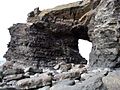
 Arch - geograph.org.uk - 207481.jpg 640 × 427; 84 KB
-
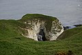
 Arch in High Stacks, Flamborough Head - geograph.org.uk - 3532516.jpg 1,024 × 768; 113 KB
-
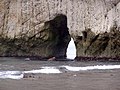
 Arch, Selwicks Bay - geograph.org.uk - 507457.jpg 640 × 480; 134 KB
-
 Bat's Head and Bat's Hole - geograph.org.uk - 503253.jpg 640 × 429; 85 KB
-
 Bat's Hole natural arch - geograph.org.uk - 300484.jpg 640 × 480; 103 KB
-
 Bats Hole - geograph.org.uk - 697117.jpg 640 × 480; 104 KB
-
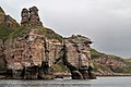
 Bell Rock, Torquay.jpg 5,658 × 2,916; 16.52 MB
-
 Botany Bay Arch 1965 - geograph.org.uk - 2636197.jpg 1,243 × 1,600; 417 KB
-
 Botany Bay Arch Gallois 1965.jpg 2,405 × 2,198; 2.08 MB
-
 Carter Lane, Flamborough - geograph.org.uk - 173235.jpg 480 × 640; 179 KB
-
 Carter Lane, Flamborough - geograph.org.uk - 835329.jpg 480 × 640; 121 KB
-
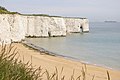
 Chalk cliffs - geograph.org.uk - 505630.jpg 640 × 480; 113 KB
-
 Dawlish Warren , Langstone Rock - geograph.org.uk - 1237118.jpg 640 × 512; 72 KB
-
 Dawlish Warren , Langstone Rock - geograph.org.uk - 1237146.jpg 640 × 512; 75 KB
-
 Easegill Force waterfall - geograph.org.uk - 1414288.jpg 425 × 640; 394 KB
-
 Green Stacks Pinnacle, Flamborough Head - geograph.org.uk - 766406.jpg 640 × 471; 207 KB
-
 Gurney-036-98304.jpg 1,328 × 1,950; 292 KB
-
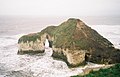
 High Stacks Flamborough Head.jpg 640 × 480; 100 KB
-
 High Stacks, Flamborough - geograph.org.uk - 538295.jpg 640 × 480; 70 KB
-
 High Stacks, Flamborough Head - geograph.org.uk - 498580.jpg 640 × 409; 65 KB
-
 Kindle Scar, Flamborough - geograph.org.uk - 835811.jpg 640 × 415; 72 KB
-
 Kingsgate Bay - geograph.org.uk - 248356.jpg 640 × 426; 123 KB
-
 Natural arch near Spit Point - geograph.org.uk - 1238195.jpg 640 × 461; 76 KB
-

-
 Natural arch, coast near Cataclews Point - geograph.org.uk - 1285553.jpg 640 × 432; 119 KB
-
 Natural arch, Seaham Beach - geograph.org.uk - 1527745.jpg 640 × 480; 110 KB
-
 Natural arch, Stantaway Hill - geograph.org.uk - 725859.jpg 640 × 480; 160 KB
-
 Natural arch, Stantaway Hill - geograph.org.uk - 725867.jpg 640 × 480; 135 KB
-
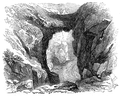 Natural Bridge near St. Columb (OAW).png 744 × 593; 726 KB
-
 Natural stone arch - geograph.org.uk - 1414291.jpg 640 × 480; 406 KB
-
 Needles Eye natural arch on the Berwickshire Coast (geograph 5898138).jpg 1,024 × 683; 636 KB
-
 Newcombe Hope, Flamborough - geograph.org.uk - 835292.jpg 480 × 640; 123 KB
-
 Rockfall at the Long Quarry Sea Arch.jpg 5,152 × 3,864; 8.13 MB
-
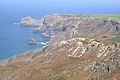
 The Strangles Beach - geograph.org.uk - 9889.jpg 640 × 480; 67 KB
-
 The View from High Cliff - geograph.org.uk - 1490703.jpg 640 × 426; 89 KB
-
 Thornwick Bay Yorkshire England.jpg 1,064 × 837; 134 KB
-
 Thornwick Bay, Yorkshire, England-LCCN2002708333.jpg 3,655 × 2,748; 2.63 MB
-
 Thornwick Bay, Yorkshire, England-LCCN2002708333.tif 3,655 × 2,748; 28.74 MB
-
 Thornwick looking out to sea - geograph.org.uk - 499565.jpg 640 × 480; 85 KB
-
 Wringapeak - geograph.org.uk - 73911.jpg 640 × 480; 58 KB
.jpg)


.png)

.jpg)


